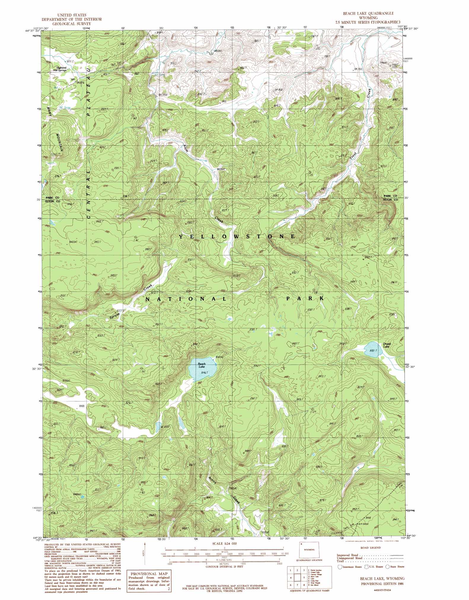
Beach Lake Topo Map Wyoming
To zoom in, hover over the map of Beach Lake
USGS Topo Quad 44110e5 - 1:24,000 scale
| Topo Map Name: | Beach Lake |
| USGS Topo Quad ID: | 44110e5 |
| Print Size: | ca. 21 1/4" wide x 27" high |
| Southeast Coordinates: | 44.5° N latitude / 110.5° W longitude |
| Map Center Coordinates: | 44.5625° N latitude / 110.5625° W longitude |
| U.S. State: | WY |
| Filename: | o44110e5.jpg |
| Download Map JPG Image: | Beach Lake topo map 1:24,000 scale |
| Map Type: | Topographic |
| Topo Series: | 7.5´ |
| Map Scale: | 1:24,000 |
| Source of Map Images: | United States Geological Survey (USGS) |
| Alternate Map Versions: |
Beach Lake WY 1986, updated 1986 Download PDF Buy paper map Beach Lake WY 2012 Download PDF Buy paper map Beach Lake WY 2015 Download PDF Buy paper map |
1:24,000 Topo Quads surrounding Beach Lake
Mount Holmes |
Obsidian Cliff |
Cook Peak |
Mount Washburn |
Amethyst Mountain |
Madison Junction |
Norris Junction |
Crystal Falls |
Canyon Village |
White Lake |
Lower Geyser Basin |
Mary Lake |
Beach Lake |
Lake |
Lake Butte |
Old Faithful |
Craig Pass |
West Thumb |
Dot Island |
Frank Island |
Shoshone Geyser Basin |
Lewis Falls |
Mount Sheridan |
Heart Lake |
Alder Lake |
> Back to 44110e1 at 1:100,000 scale
> Back to 44110a1 at 1:250,000 scale
> Back to U.S. Topo Maps home
Beach Lake topo map: Gazetteer
Beach Lake: Lakes
Beach Lake elevation 2484m 8149′Dryad Lake elevation 2532m 8307′
Beach Lake: Springs
Highland Hot Springs elevation 2495m 8185′Beach Lake digital topo map on disk
Buy this Beach Lake topo map showing relief, roads, GPS coordinates and other geographical features, as a high-resolution digital map file on DVD: