Little Juniper Spring Topo Map Oregon
To zoom in, hover over the map of Little Juniper Spring
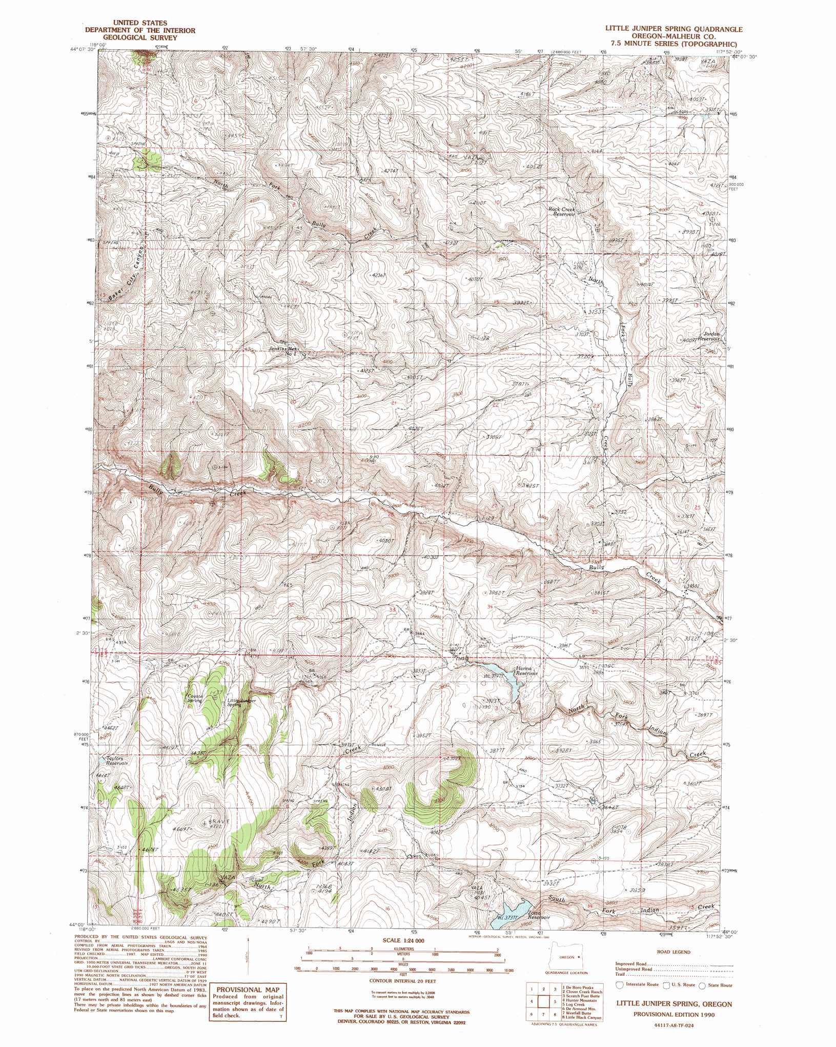
USGS Topo Quad 44117a8 - 1:24,000 scale
| Topo Map Name: | Little Juniper Spring |
| USGS Topo Quad ID: | 44117a8 |
| Print Size: | ca. 21 1/4" wide x 27" high |
| Southeast Coordinates: | 44° N latitude / 117.875° W longitude |
| Map Center Coordinates: | 44.0625° N latitude / 117.9375° W longitude |
| U.S. State: | OR |
| Filename: | o44117a8.jpg |
| Download Map JPG Image: | Little Juniper Spring topo map 1:24,000 scale |
| Map Type: | Topographic |
| Topo Series: | 7.5´ |
| Map Scale: | 1:24,000 |
| Source of Map Images: | United States Geological Survey (USGS) |
| Alternate Map Versions: |
Little Juniper Spring OR 1990, updated 1990 Download PDF Buy paper map Little Juniper Spring OR 2011 Download PDF Buy paper map Little Juniper Spring OR 2014 Download PDF Buy paper map |
1:24,000 Topo Quads surrounding Little Juniper Spring
Rastus Mountain |
Eldorado Pass |
Ironside |
Cow Valley West |
Cow Valley East |
Clevenger Butte |
De Bord Peaks |
Clover Creek Ranch |
Scratch Post Mountain |
Juniper Mountain |
Castle Rock |
Hunter Mtn |
Little Juniper Spring |
Log Creek |
Buckbrush Creek |
Beulah |
De Armond Mountain |
Westfall Butte |
Little Black Canyon |
Westfall |
Petes Mountain |
Stemler Ridge |
Jonesboro |
South Mountain |
Namorf |
> Back to 44117a1 at 1:100,000 scale
> Back to 44116a1 at 1:250,000 scale
> Back to U.S. Topo Maps home
Little Juniper Spring topo map: Gazetteer
Little Juniper Spring: Dams
North Fork Indian Creek Dam elevation 1164m 3818′Vaughn Dam elevation 1133m 3717′
Little Juniper Spring: Reservoirs
Hanna Reservoir elevation 1164m 3818′Jenkins Reservoir Number One elevation 1256m 4120′
Jordan Reservoir elevation 1173m 3848′
Rock Creek Reservoir elevation 1153m 3782′
Taylors Reservoir elevation 1376m 4514′
Zotto Reservoir elevation 1133m 3717′
Little Juniper Spring: Springs
Coyote Spring elevation 1321m 4333′Little Juniper Spring elevation 1297m 4255′
Little Juniper Spring: Streams
Rock Creek elevation 1134m 3720′Little Juniper Spring digital topo map on disk
Buy this Little Juniper Spring topo map showing relief, roads, GPS coordinates and other geographical features, as a high-resolution digital map file on DVD: