Wingville Topo Map Oregon
To zoom in, hover over the map of Wingville
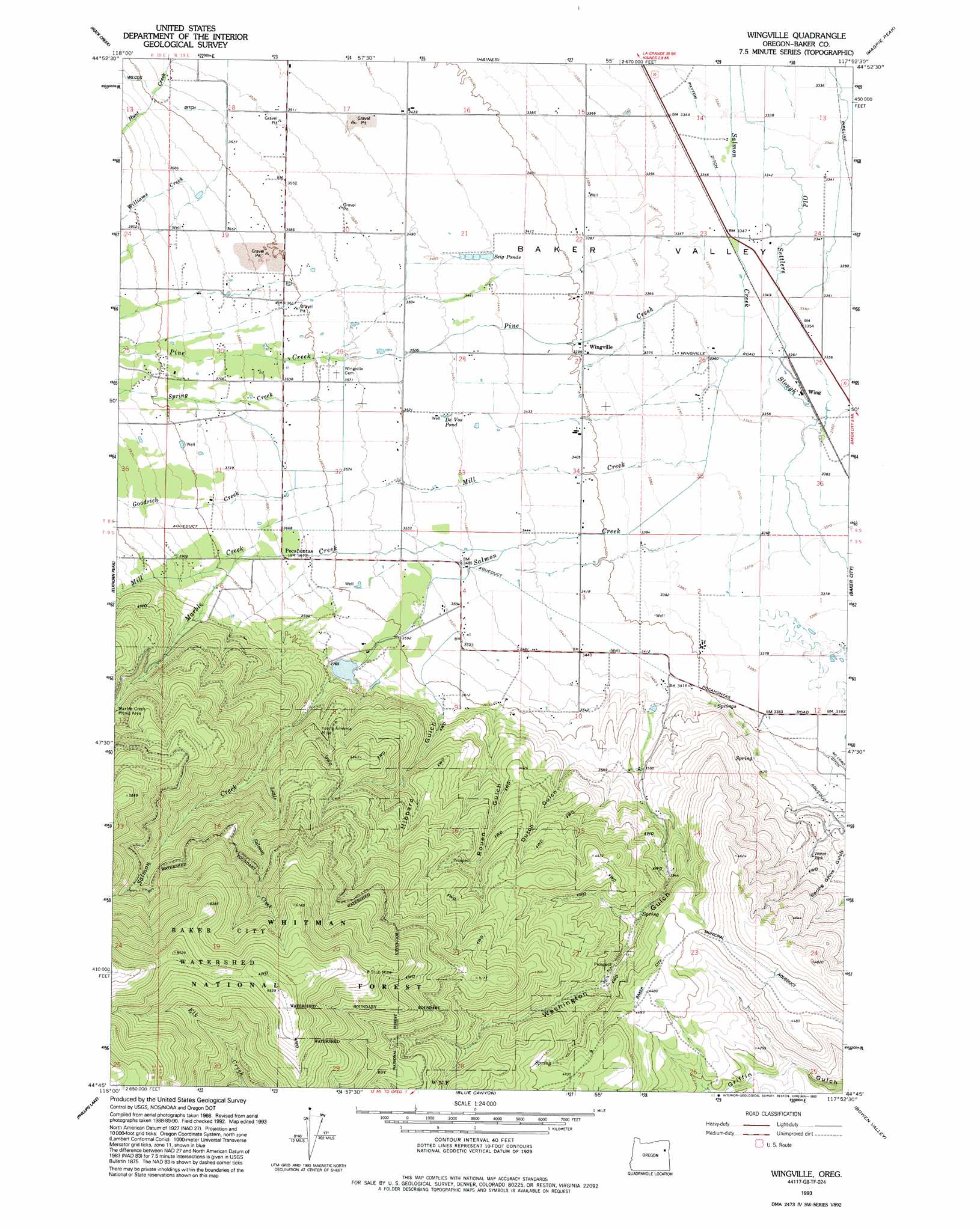
USGS Topo Quad 44117g8 - 1:24,000 scale
| Topo Map Name: | Wingville |
| USGS Topo Quad ID: | 44117g8 |
| Print Size: | ca. 21 1/4" wide x 27" high |
| Southeast Coordinates: | 44.75° N latitude / 117.875° W longitude |
| Map Center Coordinates: | 44.8125° N latitude / 117.9375° W longitude |
| U.S. State: | OR |
| Filename: | o44117g8.jpg |
| Download Map JPG Image: | Wingville topo map 1:24,000 scale |
| Map Type: | Topographic |
| Topo Series: | 7.5´ |
| Map Scale: | 1:24,000 |
| Source of Map Images: | United States Geological Survey (USGS) |
| Alternate Map Versions: |
Wingville OR 1967, updated 1972 Download PDF Buy paper map Wingville OR 1967, updated 1985 Download PDF Buy paper map Wingville OR 1993, updated 1993 Download PDF Buy paper map Wingville OR 2011 Download PDF Buy paper map Wingville OR 2014 Download PDF Buy paper map |
| FStopo: | US Forest Service topo Wingville is available: Download FStopo PDF Download FStopo TIF |
1:24,000 Topo Quads surrounding Wingville
Anthony Butte |
Tucker Flat |
North Powder |
Telocaset |
Medical Springs |
Anthony Lakes |
Rock Creek |
Haines |
Magpie Peak |
Keating Nw |
Bourne |
Elkhorn Peak |
Wingville |
Baker |
Virtue Flat |
Sumpter |
Phillips Lake |
Blue Canyon |
Bowen Valley |
Encina |
Unity Reservoir |
Beaverdam Creek |
Brannan Gulch |
Dooley Mountain |
French Gulch |
> Back to 44117e1 at 1:100,000 scale
> Back to 44116a1 at 1:250,000 scale
> Back to U.S. Topo Maps home
Wingville topo map: Gazetteer
Wingville: Canals
Baker Municipal Aqueduct elevation 1367m 4484′Payton Ditch elevation 1020m 3346′
Phillips Ditch elevation 1123m 3684′
Wingville: Lakes
De Vos Pond elevation 1064m 3490′Seig Ponds elevation 1050m 3444′
Wingville: Mines
Stub Mine elevation 1836m 6023′Young America Mine elevation 1294m 4245′
Wingville: Parks
Ebell Picnic Area elevation 1136m 3727′Wingville: Populated Places
Pocahontas (historical) elevation 1120m 3674′Wingville elevation 1036m 3398′
Wingville: Post Offices
Pocahontas Post Office (historical) elevation 1120m 3674′Wingville Post Office (historical) elevation 1036m 3398′
Wingville: Reservoirs
Butler Reservoir elevation 1057m 3467′Wingville: Streams
Goodrich Creek elevation 1024m 3359′Little Salmon Creek elevation 1284m 4212′
Marble Creek elevation 1053m 3454′
Mill Creek elevation 1027m 3369′
Pine Creek elevation 1022m 3353′
Spring Creek elevation 1028m 3372′
Williams Creek elevation 1097m 3599′
Wingville: Valleys
Dutch Gulch elevation 1144m 3753′Hibbard Gulch elevation 1128m 3700′
Rouen Gulch elevation 1106m 3628′
Wingville digital topo map on disk
Buy this Wingville topo map showing relief, roads, GPS coordinates and other geographical features, as a high-resolution digital map file on DVD: