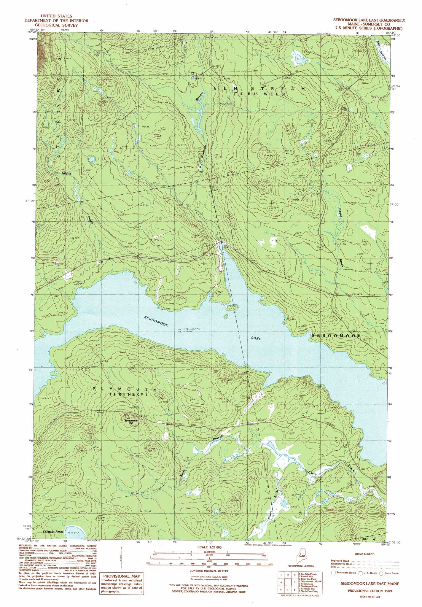
Seboomook Lake East Topo Map Maine
To zoom in, hover over the map of Seboomook Lake East
USGS Topo Quad 45069h7 - 1:24,000 scale
| Topo Map Name: | Seboomook Lake East |
| USGS Topo Quad ID: | 45069h7 |
| Print Size: | ca. 21 1/4" wide x 27" high |
| Southeast Coordinates: | 45.875° N latitude / 69.75° W longitude |
| Map Center Coordinates: | 45.9375° N latitude / 69.8125° W longitude |
| U.S. State: | ME |
| Filename: | o45069h7.jpg |
| Download Map JPG Image: | Seboomook Lake East topo map 1:24,000 scale |
| Map Type: | Topographic |
| Topo Series: | 7.5´ |
| Map Scale: | 1:24,000 |
| Source of Map Images: | United States Geological Survey (USGS) |
| Alternate Map Versions: |
Seboomook Lake East ME 1977, updated 1981 Download PDF Buy paper map Seboomook Lake East ME 1989, updated 1989 Download PDF Buy paper map Seboomook Lake East ME 2011 Download PDF Buy paper map Seboomook Lake East ME 2014 Download PDF Buy paper map |
1:24,000 Topo Quads surrounding Seboomook Lake East
Hinckley Hill |
Saint John Pond Depot |
Spruce Brook |
Caucomgomoc Lake West |
Caucomgomoc Lake East |
Norris Brook |
Saint John Ponds |
Russell Mountain |
Bean Pot Pond |
Ragmuff Stream |
Foley Pond |
Seboomook Lake West |
Seboomook Lake East |
Seboomook |
Penobscot Farm |
Canada Falls Lake |
Tomhegan Pond |
Socatean Bay |
North East Carry |
Lobster Mountain |
Churchill Stream |
Brassua Lake West |
Brassua Lake East |
Mount Kineo |
Spencer Bay |
> Back to 45069e1 at 1:100,000 scale
> Back to 45068a1 at 1:250,000 scale
> Back to U.S. Topo Maps home
Seboomook Lake East topo map: Gazetteer
Seboomook Lake East: Lakes
Socatean Pond elevation 416m 1364′Seboomook Lake East: Streams
Logan Brook elevation 329m 1079′North Branch Carry Brook elevation 337m 1105′
Nulhedus Stream elevation 327m 1072′
South Branch Carry Brook elevation 337m 1105′
Seboomook Lake East: Summits
Sevenmile Hill elevation 431m 1414′Seboomook Lake East digital topo map on disk
Buy this Seboomook Lake East topo map showing relief, roads, GPS coordinates and other geographical features, as a high-resolution digital map file on DVD:
Maine, New Hampshire, Rhode Island & Eastern Massachusetts
Buy digital topo maps: Maine, New Hampshire, Rhode Island & Eastern Massachusetts