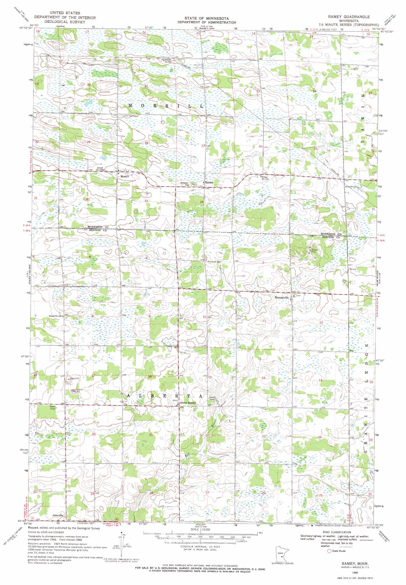
Ramey Topo Map Minnesota
To zoom in, hover over the map of Ramey
USGS Topo Quad 45093g8 - 1:24,000 scale
| Topo Map Name: | Ramey |
| USGS Topo Quad ID: | 45093g8 |
| Print Size: | ca. 21 1/4" wide x 27" high |
| Southeast Coordinates: | 45.75° N latitude / 93.875° W longitude |
| Map Center Coordinates: | 45.8125° N latitude / 93.9375° W longitude |
| U.S. State: | MN |
| Filename: | o45093g8.jpg |
| Download Map JPG Image: | Ramey topo map 1:24,000 scale |
| Map Type: | Topographic |
| Topo Series: | 7.5´ |
| Map Scale: | 1:24,000 |
| Source of Map Images: | United States Geological Survey (USGS) |
| Alternate Map Versions: |
Ramey MN 1968, updated 1970 Download PDF Buy paper map Ramey MN 2010 Download PDF Buy paper map Ramey MN 2013 Download PDF Buy paper map Ramey MN 2016 Download PDF Buy paper map |
1:24,000 Topo Quads surrounding Ramey
Freedhem |
Lastrup |
Hillman |
Hillman Se |
Onamia |
Pierz Lake |
Pierz |
Ramey Nw |
Ramey Ne |
Page |
Rice |
Little Rock |
Ramey |
Rum River |
Milaca |
Little Rock Lake |
Mayhew |
Foley |
Ronneby |
Foreston |
Saint Cloud |
Cable |
Duelm |
Santiago |
Princeton Sw |
> Back to 45093e1 at 1:100,000 scale
> Back to 45092a1 at 1:250,000 scale
> Back to U.S. Topo Maps home
Ramey topo map: Gazetteer
Ramey: Airports
F Dillenburg Airport elevation 393m 1289′Ramey: Dams
Cross Lake Dam elevation 391m 1282′Ramey: Populated Places
Brennyville elevation 375m 1230′Jakeville elevation 366m 1200′
Morrill elevation 399m 1309′
North Benton elevation 376m 1233′
Ramey elevation 392m 1286′
Ramey: Post Offices
Morrill Post Office (historical) elevation 399m 1309′Ramey Post Office (historical) elevation 392m 1286′
Ramey: Reservoirs
Cross Lake elevation 391m 1282′Ramey digital topo map on disk
Buy this Ramey topo map showing relief, roads, GPS coordinates and other geographical features, as a high-resolution digital map file on DVD: