Freedhem Topo Map Minnesota
To zoom in, hover over the map of Freedhem
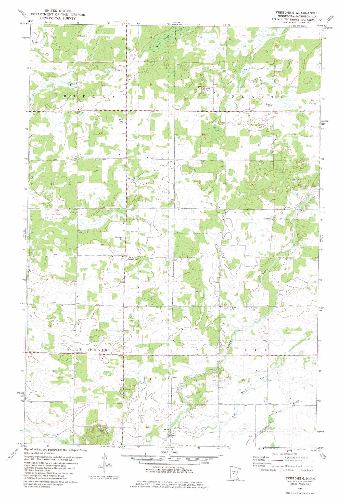
USGS Topo Quad 46094a2 - 1:24,000 scale
| Topo Map Name: | Freedhem |
| USGS Topo Quad ID: | 46094a2 |
| Print Size: | ca. 21 1/4" wide x 27" high |
| Southeast Coordinates: | 46° N latitude / 94.125° W longitude |
| Map Center Coordinates: | 46.0625° N latitude / 94.1875° W longitude |
| U.S. State: | MN |
| Filename: | o46094a2.jpg |
| Download Map JPG Image: | Freedhem topo map 1:24,000 scale |
| Map Type: | Topographic |
| Topo Series: | 7.5´ |
| Map Scale: | 1:24,000 |
| Source of Map Images: | United States Geological Survey (USGS) |
| Alternate Map Versions: |
Freedhem MN 1981, updated 1982 Download PDF Buy paper map Freedhem MN 2010 Download PDF Buy paper map Freedhem MN 2013 Download PDF Buy paper map Freedhem MN 2016 Download PDF Buy paper map |
1:24,000 Topo Quads surrounding Freedhem
Pillager |
Baxter |
Brainerd |
South Long Lake |
Grave Lake |
Belle Prairie Nw |
Fort Ripley |
Lastrup Nw |
Shephard |
Platte Lake |
Randall |
Belle Prairie |
Freedhem |
Lastrup |
Hillman |
Little Falls West |
Little Falls East |
Pierz Lake |
Pierz |
Ramey Nw |
Bowlus |
Royalton |
Rice |
Little Rock |
Ramey |
> Back to 46094a1 at 1:100,000 scale
> Back to 46094a1 at 1:250,000 scale
> Back to U.S. Topo Maps home
Freedhem topo map: Gazetteer
Freedhem: Lakes
Thirtythree Lake elevation 374m 1227′Freedhem: Populated Places
Freedhem elevation 384m 1259′Freedhem: Post Offices
Freedhem Post Office (historical) elevation 384m 1259′Freedhem: Streams
Big Mink Creek elevation 345m 1131′Freedhem digital topo map on disk
Buy this Freedhem topo map showing relief, roads, GPS coordinates and other geographical features, as a high-resolution digital map file on DVD: