Hickson Ranch Topo Map Montana
To zoom in, hover over the map of Hickson Ranch
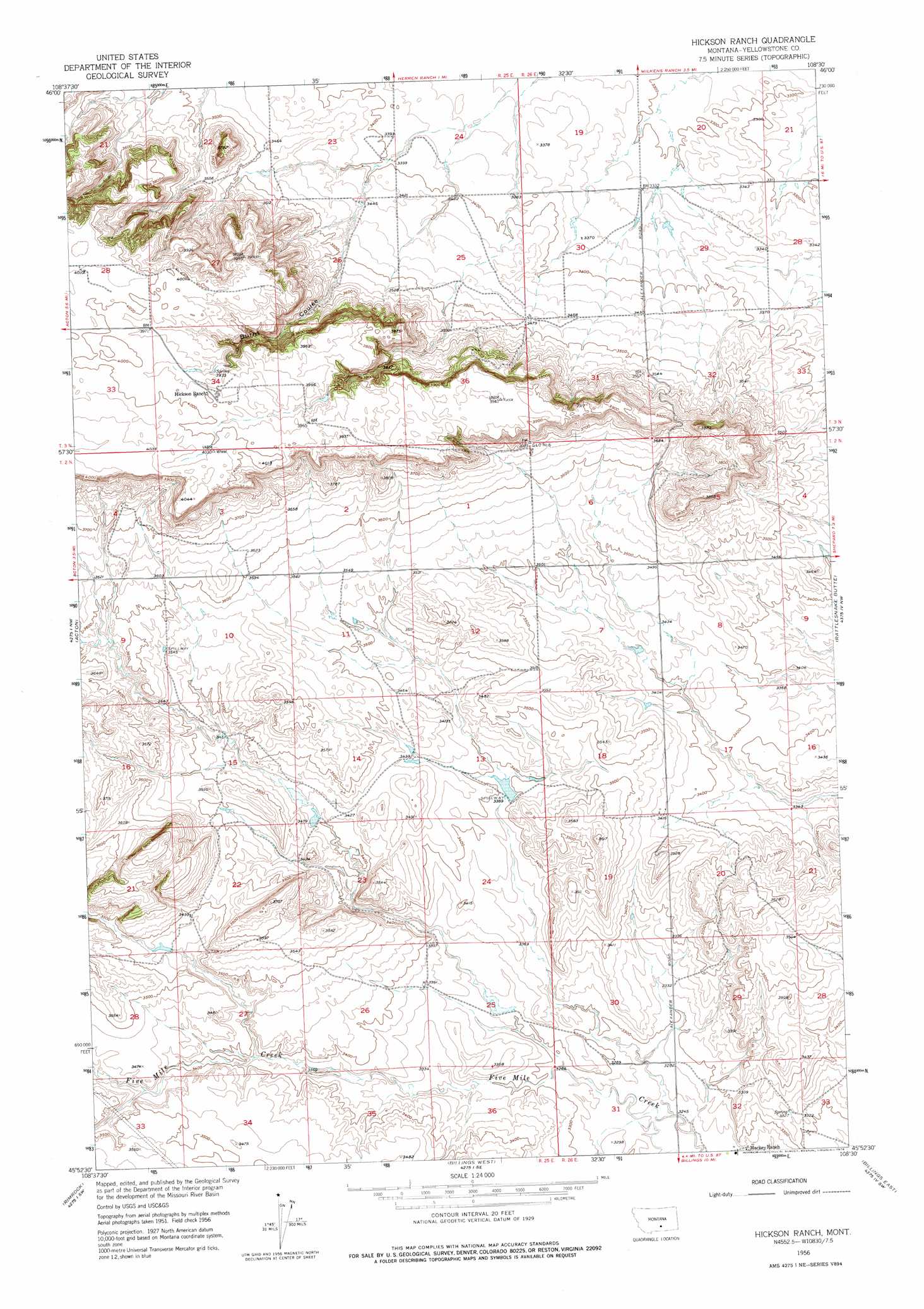
USGS Topo Quad 45108h5 - 1:24,000 scale
| Topo Map Name: | Hickson Ranch |
| USGS Topo Quad ID: | 45108h5 |
| Print Size: | ca. 21 1/4" wide x 27" high |
| Southeast Coordinates: | 45.875° N latitude / 108.5° W longitude |
| Map Center Coordinates: | 45.9375° N latitude / 108.5625° W longitude |
| U.S. State: | MT |
| Filename: | o45108h5.jpg |
| Download Map JPG Image: | Hickson Ranch topo map 1:24,000 scale |
| Map Type: | Topographic |
| Topo Series: | 7.5´ |
| Map Scale: | 1:24,000 |
| Source of Map Images: | United States Geological Survey (USGS) |
| Alternate Map Versions: |
Hickson Ranch MT 1956, updated 1957 Download PDF Buy paper map Hickson Ranch MT 1956, updated 1976 Download PDF Buy paper map Hickson Ranch MT 2011 Download PDF Buy paper map Hickson Ranch MT 2014 Download PDF Buy paper map |
1:24,000 Topo Quads surrounding Hickson Ranch
Broadview Ne |
Hay Basin North |
Hay Basin Ne |
Park Coulee |
Dunn Mountain South |
Broadview East |
Hay Basin South |
North Fork Crooked Creek West |
North Fork Crooked Creek East |
Cotton Creek |
Comanche |
Acton |
Hickson Ranch |
Rattlesnake Butte |
Huntley |
Two Pine School |
Rimrock |
Billings West |
Billings East |
Cottonwood Creek |
Laurel |
Mossmain |
Yegen |
Soda Springs Nw |
Badbaby Coulee |
> Back to 45108e1 at 1:100,000 scale
> Back to 45108a1 at 1:250,000 scale
> Back to U.S. Topo Maps home
Hickson Ranch topo map: Gazetteer
Hickson Ranch: Dams
Dover D Dam Number 1 elevation 1012m 3320′R Burton Number 1 Dam elevation 1035m 3395′
Hickson Ranch: Valleys
Burnt Coulee elevation 1077m 3533′Hickson Ranch: Wells
02N25E22C___01 Well elevation 1062m 3484′02N26E18D___01 Well elevation 1054m 3458′
02N26E21CDAD01 Well elevation 1080m 3543′
Hickson Ranch digital topo map on disk
Buy this Hickson Ranch topo map showing relief, roads, GPS coordinates and other geographical features, as a high-resolution digital map file on DVD: