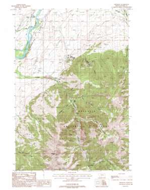
Emigrant Topo Map Montana
To zoom in, hover over the map of Emigrant
USGS Topo Quad 45110c6 - 1:24,000 scale
| Topo Map Name: | Emigrant |
| USGS Topo Quad ID: | 45110c6 |
| Print Size: | ca. 21 1/4" wide x 27" high |
| Southeast Coordinates: | 45.25° N latitude / 110.625° W longitude |
| Map Center Coordinates: | 45.3125° N latitude / 110.6875° W longitude |
| U.S. State: | MT |
| Filename: | o45110c6.jpg |
| Download Map JPG Image: | Emigrant topo map 1:24,000 scale |
| Map Type: | Topographic |
| Topo Series: | 7.5´ |
| Map Scale: | 1:24,000 |
| Source of Map Images: | United States Geological Survey (USGS) |
| Alternate Map Versions: |
Emigrant MT 1988, updated 1988 Download PDF Buy paper map Emigrant MT 1988, updated 1988 Download PDF Buy paper map Emigrant MT 2000, updated 2005 Download PDF Buy paper map Emigrant MT 2011 Download PDF Buy paper map Emigrant MT 2014 Download PDF Buy paper map |
| FStopo: | US Forest Service topo Emigrant is available: Download FStopo PDF Download FStopo TIF |
1:24,000 Topo Quads surrounding Emigrant
> Back to 45110a1 at 1:100,000 scale
> Back to 45110a1 at 1:250,000 scale
> Back to U.S. Topo Maps home
Emigrant topo map: Gazetteer
Emigrant: Airports
Chico Airport elevation 1609m 5278′Emigrant: Canals
Mill Creek Flat Ditch elevation 1566m 5137′Upland Ditch elevation 1558m 5111′
Emigrant: Mines
Alaska Mine elevation 1782m 5846′Allison Mine elevation 2361m 7746′
Comanche Mine elevation 3014m 9888′
Ku Klux Mine elevation 1986m 6515′
McAdow Mine elevation 2997m 9832′
NW Section 5 Mine elevation 2597m 8520′
Saint Julian Mine elevation 2704m 8871′
Saint Julian Mine elevation 2651m 8697′
Section 6 Placer Mine elevation 2318m 7604′
Emigrant: Populated Places
Chico elevation 1652m 5419′Chico Hot Springs elevation 1607m 5272′
Emigrant elevation 1490m 4888′
Golden Age Village Trailer Park elevation 1490m 4888′
White City elevation 1803m 5915′
Emigrant: Post Offices
Chico Post Office (historical) elevation 1652m 5419′Emigrant Post Office elevation 1490m 4888′
Emigrant: Springs
05S08E34ACB_01 Spring elevation 1501m 4924′06S08E12ACB_01 Spring elevation 1818m 5964′
06S09E01CDC_01 Spring elevation 1624m 5328′
06S09E01CDC_02 Spring elevation 1644m 5393′
Emigrant: Streams
Balm of Gilead Creek elevation 1778m 5833′Blacktail Creek elevation 1767m 5797′
East Fork Emigrant Creek elevation 2214m 7263′
Fridley Creek elevation 1881m 6171′
Emigrant: Summits
Chico Peak elevation 3096m 10157′Emigrant Peak elevation 3327m 10915′
Emigrant: Valleys
Conlin Gulch elevation 1724m 5656′Emigrant Gulch elevation 1671m 5482′
Moze Gulch elevation 1747m 5731′
Emigrant: Wells
07S09E06ADD_01 Well elevation 2385m 7824′07S09E06DDA_01 Well elevation 2376m 7795′
Emigrant digital topo map on disk
Buy this Emigrant topo map showing relief, roads, GPS coordinates and other geographical features, as a high-resolution digital map file on DVD:


