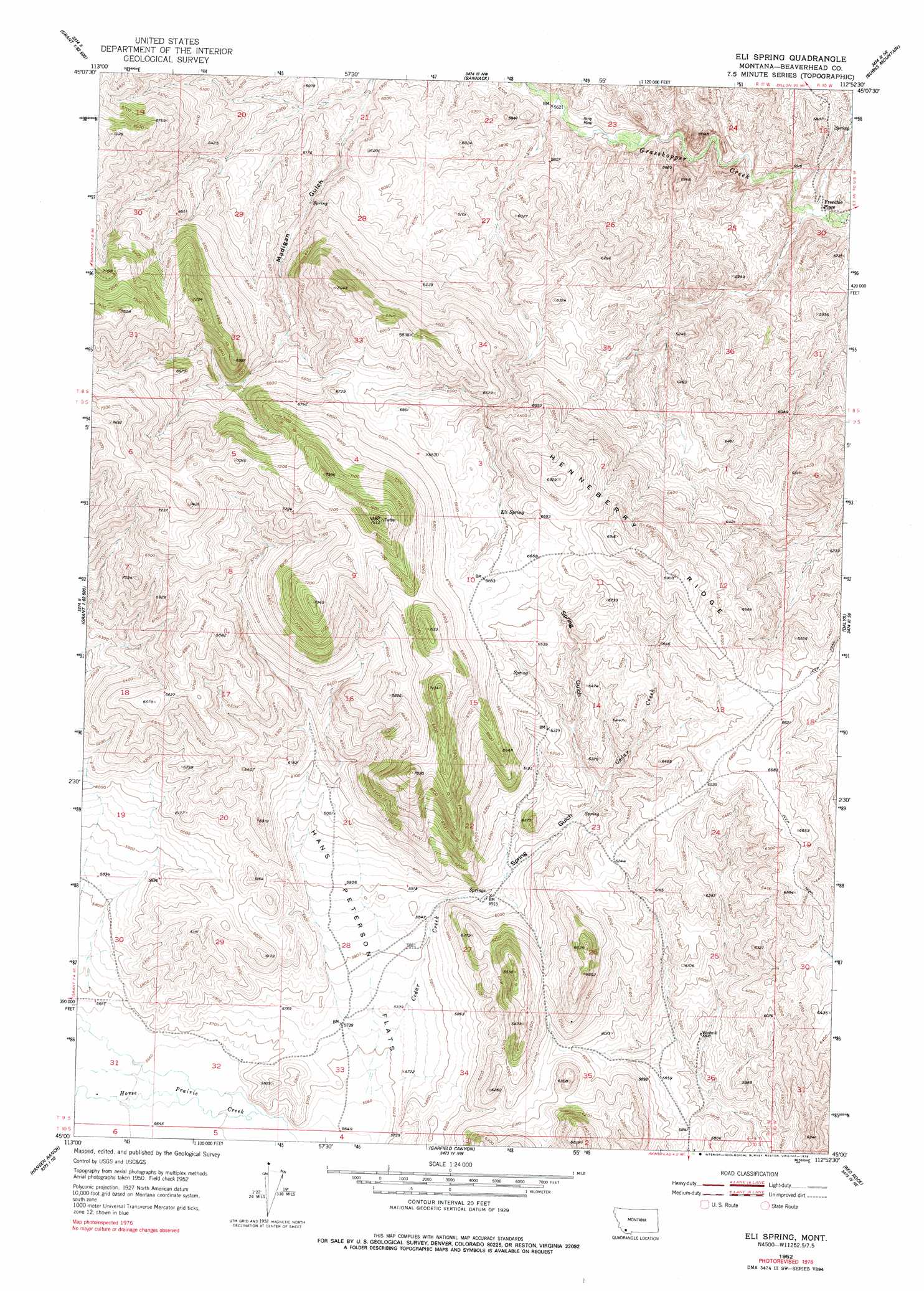
Eli Spring Topo Map Montana
To zoom in, hover over the map of Eli Spring
USGS Topo Quad 45112a8 - 1:24,000 scale
| Topo Map Name: | Eli Spring |
| USGS Topo Quad ID: | 45112a8 |
| Print Size: | ca. 21 1/4" wide x 27" high |
| Southeast Coordinates: | 45° N latitude / 112.875° W longitude |
| Map Center Coordinates: | 45.0625° N latitude / 112.9375° W longitude |
| U.S. State: | MT |
| Filename: | o45112a8.jpg |
| Download Map JPG Image: | Eli Spring topo map 1:24,000 scale |
| Map Type: | Topographic |
| Topo Series: | 7.5´ |
| Map Scale: | 1:24,000 |
| Source of Map Images: | United States Geological Survey (USGS) |
| Alternate Map Versions: |
Eli Spring MT 1952, updated 1954 Download PDF Buy paper map Eli Spring MT 1952, updated 1958 Download PDF Buy paper map Eli Spring MT 1952, updated 1979 Download PDF Buy paper map Eli Spring MT 2011 Download PDF Buy paper map Eli Spring MT 2014 Download PDF Buy paper map |
1:24,000 Topo Quads surrounding Eli Spring
Tash Peak |
Polaris |
Ermont |
Argenta |
Bond |
Brays Canyon |
Mill Point |
Bannack |
Burns Mountain |
Dillon West |
Bachelor Mountain |
Grant |
Eli Spring |
Dalys |
Gallagher Mountain |
Jeff Davis Peak |
Hansen Ranch |
Garfield Canyon |
Red Rock |
Monument Hill |
Deadman Pass |
Medicine Lodge Peak |
Deer Canyon |
Kidd |
Briggs Ranch |
> Back to 45112a1 at 1:100,000 scale
> Back to 45112a1 at 1:250,000 scale
> Back to U.S. Topo Maps home
Eli Spring topo map: Gazetteer
Eli Spring: Flats
Hans Peterson Flats elevation 1778m 5833′Eli Spring: Mines
Grasshopper Strip Mine elevation 1720m 5643′Eli Spring: Populated Places
Frenchie Place elevation 1694m 5557′Eli Spring: Ranges
Rocky Hills elevation 2108m 6916′Eli Spring: Ridges
Henneberry Ridge elevation 2105m 6906′Eli Spring: Springs
09S11W02AADD01 Spring elevation 1882m 6174′09S11W27ABBD01 Spring elevation 1801m 5908′
Eli Spring elevation 1993m 6538′
Eli Spring: Streams
Cedar Creek elevation 1731m 5679′Eli Spring: Valleys
Spring Gulch elevation 1785m 5856′Eli Spring digital topo map on disk
Buy this Eli Spring topo map showing relief, roads, GPS coordinates and other geographical features, as a high-resolution digital map file on DVD: