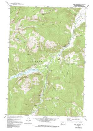
Stine Mountain Topo Map Montana
To zoom in, hover over the map of Stine Mountain
USGS Topo Quad 45113f1 - 1:24,000 scale
| Topo Map Name: | Stine Mountain |
| USGS Topo Quad ID: | 45113f1 |
| Print Size: | ca. 21 1/4" wide x 27" high |
| Southeast Coordinates: | 45.625° N latitude / 113° W longitude |
| Map Center Coordinates: | 45.6875° N latitude / 113.0625° W longitude |
| U.S. State: | MT |
| Filename: | o45113f1.jpg |
| Download Map JPG Image: | Stine Mountain topo map 1:24,000 scale |
| Map Type: | Topographic |
| Topo Series: | 7.5´ |
| Map Scale: | 1:24,000 |
| Source of Map Images: | United States Geological Survey (USGS) |
| Alternate Map Versions: |
Stine Mountain MT 1978, updated 1994 Download PDF Buy paper map Stine Mountain MT 2011 Download PDF Buy paper map Stine Mountain MT 2014 Download PDF Buy paper map |
| FStopo: | US Forest Service topo Stine Mountain is available: Download FStopo PDF Download FStopo TIF |
1:24,000 Topo Quads surrounding Stine Mountain
> Back to 45113e1 at 1:100,000 scale
> Back to 45112a1 at 1:250,000 scale
> Back to U.S. Topo Maps home
Stine Mountain topo map: Gazetteer
Stine Mountain: Canals
Wise River Ditch elevation 1812m 5944′Stine Mountain: Lakes
Grouse Lakes elevation 2566m 8418′Stine Mountain: Mines
Atlas Mine elevation 2150m 7053′Stine Mountain: Pillars
Eagle Rock elevation 2002m 6568′Stine Mountain: Post Offices
Ponsonby Post Office (historical) elevation 1869m 6131′Stine Mountain: Streams
Adson Creek elevation 1819m 5967′Boulder Creek elevation 1969m 6459′
Butler Creek elevation 1839m 6033′
Clifford Creek elevation 1973m 6473′
Deno Creek elevation 2003m 6571′
Evans Creek elevation 1921m 6302′
Fourth of July Creek elevation 1950m 6397′
Grouse Creek elevation 1916m 6286′
Lews Creek elevation 1926m 6318′
Moose Creek elevation 1981m 6499′
Pettengill Creek elevation 2100m 6889′
Sheep Creek elevation 1879m 6164′
Stine Creek elevation 1842m 6043′
Stine Mountain: Summits
Needle Rock elevation 2020m 6627′Stine Mountain elevation 2896m 9501′
Sugarloaf Hill elevation 2005m 6578′
Stine Mountain: Trails
Stine Creek Trail elevation 2346m 7696′Stine Mountain: Valleys
Ross Gulch elevation 1900m 6233′Stine Mountain digital topo map on disk
Buy this Stine Mountain topo map showing relief, roads, GPS coordinates and other geographical features, as a high-resolution digital map file on DVD:


