Grangeville West Topo Map Idaho
To zoom in, hover over the map of Grangeville West
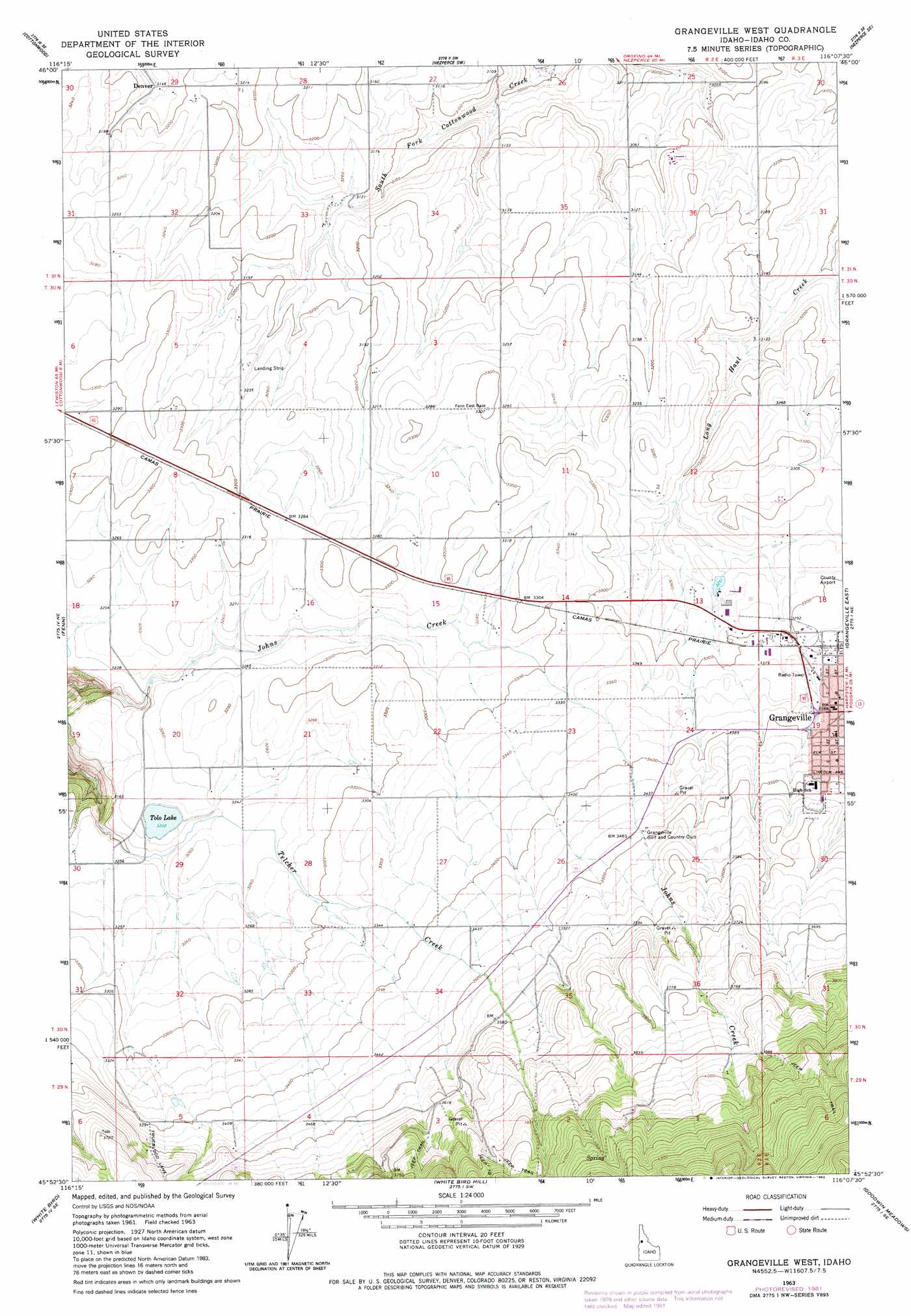
USGS Topo Quad 45116h2 - 1:24,000 scale
| Topo Map Name: | Grangeville West |
| USGS Topo Quad ID: | 45116h2 |
| Print Size: | ca. 21 1/4" wide x 27" high |
| Southeast Coordinates: | 45.875° N latitude / 116.125° W longitude |
| Map Center Coordinates: | 45.9375° N latitude / 116.1875° W longitude |
| U.S. State: | ID |
| Filename: | o45116h2.jpg |
| Download Map JPG Image: | Grangeville West topo map 1:24,000 scale |
| Map Type: | Topographic |
| Topo Series: | 7.5´ |
| Map Scale: | 1:24,000 |
| Source of Map Images: | United States Geological Survey (USGS) |
| Alternate Map Versions: |
Grangeville West ID 1963, updated 1964 Download PDF Buy paper map Grangeville West ID 1963, updated 1982 Download PDF Buy paper map Grangeville West ID 1995, updated 1999 Download PDF Buy paper map Grangeville West ID 2010 Download PDF Buy paper map Grangeville West ID 2013 Download PDF Buy paper map |
| FStopo: | US Forest Service topo Grangeville West is available: Download FStopo PDF Download FStopo TIF |
1:24,000 Topo Quads surrounding Grangeville West
Craigmont |
Cottonwood Ne |
Nezperce |
Kamiah |
Kooskia |
Keuterville |
Cottonwood |
Nezperce Sw |
Nezperce Se |
Stites |
Moughmer Point |
Fenn |
Grangeville West |
Grangeville East |
Harpster |
Joseph |
White Bird |
White Bird Hill |
Goodwin Meadows |
Hungry Ridge |
Grave Point |
Slate Creek |
Mckinzie Creek |
Dairy Mountain |
Sawyer Ridge |
> Back to 45116e1 at 1:100,000 scale
> Back to 45116a1 at 1:250,000 scale
> Back to U.S. Topo Maps home
Grangeville West topo map: Gazetteer
Grangeville West: Dams
Johns Creek Dam elevation 1280m 4199′Grangeville West: Lakes
Tolo Lake elevation 986m 3234′Grangeville West: Populated Places
Denver elevation 959m 3146′Grangeville West: Valleys
Harrison Johnson Draw elevation 987m 3238′Grangeville West digital topo map on disk
Buy this Grangeville West topo map showing relief, roads, GPS coordinates and other geographical features, as a high-resolution digital map file on DVD: