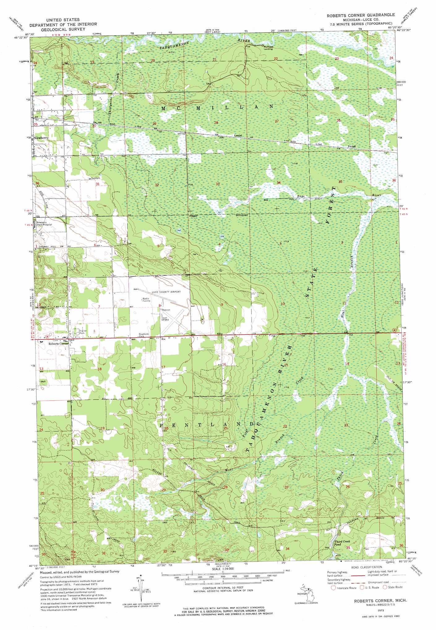
Roberts Corner Topo Map Michigan
To zoom in, hover over the map of Roberts Corner
USGS Topo Quad 46085c4 - 1:24,000 scale
| Topo Map Name: | Roberts Corner |
| USGS Topo Quad ID: | 46085c4 |
| Print Size: | ca. 21 1/4" wide x 27" high |
| Southeast Coordinates: | 46.25° N latitude / 85.375° W longitude |
| Map Center Coordinates: | 46.3125° N latitude / 85.4375° W longitude |
| U.S. State: | MI |
| Filename: | o46085c4.jpg |
| Download Map JPG Image: | Roberts Corner topo map 1:24,000 scale |
| Map Type: | Topographic |
| Topo Series: | 7.5´ |
| Map Scale: | 1:24,000 |
| Source of Map Images: | United States Geological Survey (USGS) |
| Alternate Map Versions: |
Roberts Corner MI 1973, updated 1977 Download PDF Buy paper map Roberts Corner MI 2011 Download PDF Buy paper map Roberts Corner MI 2014 Download PDF Buy paper map Roberts Corner MI 2017 Download PDF Buy paper map |
1:24,000 Topo Quads surrounding Roberts Corner
Muskallonge Lake Sw |
Muskallonge Lake Se |
Betsy Lake Sw |
Betsy Lake South |
Timberlost |
Buckeye Lake |
Auger Lake |
Roy Lake |
Gimlet Creek |
Big Beaver Creek |
Mcmillan |
Newberry |
Roberts Corner |
Soo Junction |
Hulbert |
Curtis East |
Millecoquins |
Gilchrist |
Garnet |
Rexton |
Gould City |
Engadine |
Naubinway |
Hog Island Point |
Epoufette |
> Back to 46085a1 at 1:100,000 scale
> Back to 46084a1 at 1:250,000 scale
> Back to U.S. Topo Maps home
Roberts Corner topo map: Gazetteer
Roberts Corner: Airports
Luce County Hale Airport elevation 261m 856′Roberts Corner: Canals
Big Ditch elevation 216m 708′Roberts Corner: Lakes
Third Creek Pond elevation 244m 800′Roberts Corner: Populated Places
Great Northern Trailer Court elevation 265m 869′Lencel elevation 221m 725′
McPhees Landing elevation 216m 708′
Roberts Corner elevation 265m 869′
Roberts Corner: Streams
First Creek elevation 216m 708′Third Creek elevation 218m 715′
Thirtynine Creek elevation 216m 708′
West Branch Sage River elevation 216m 708′
Roberts Corner digital topo map on disk
Buy this Roberts Corner topo map showing relief, roads, GPS coordinates and other geographical features, as a high-resolution digital map file on DVD: