Trenary Topo Map Michigan
To zoom in, hover over the map of Trenary
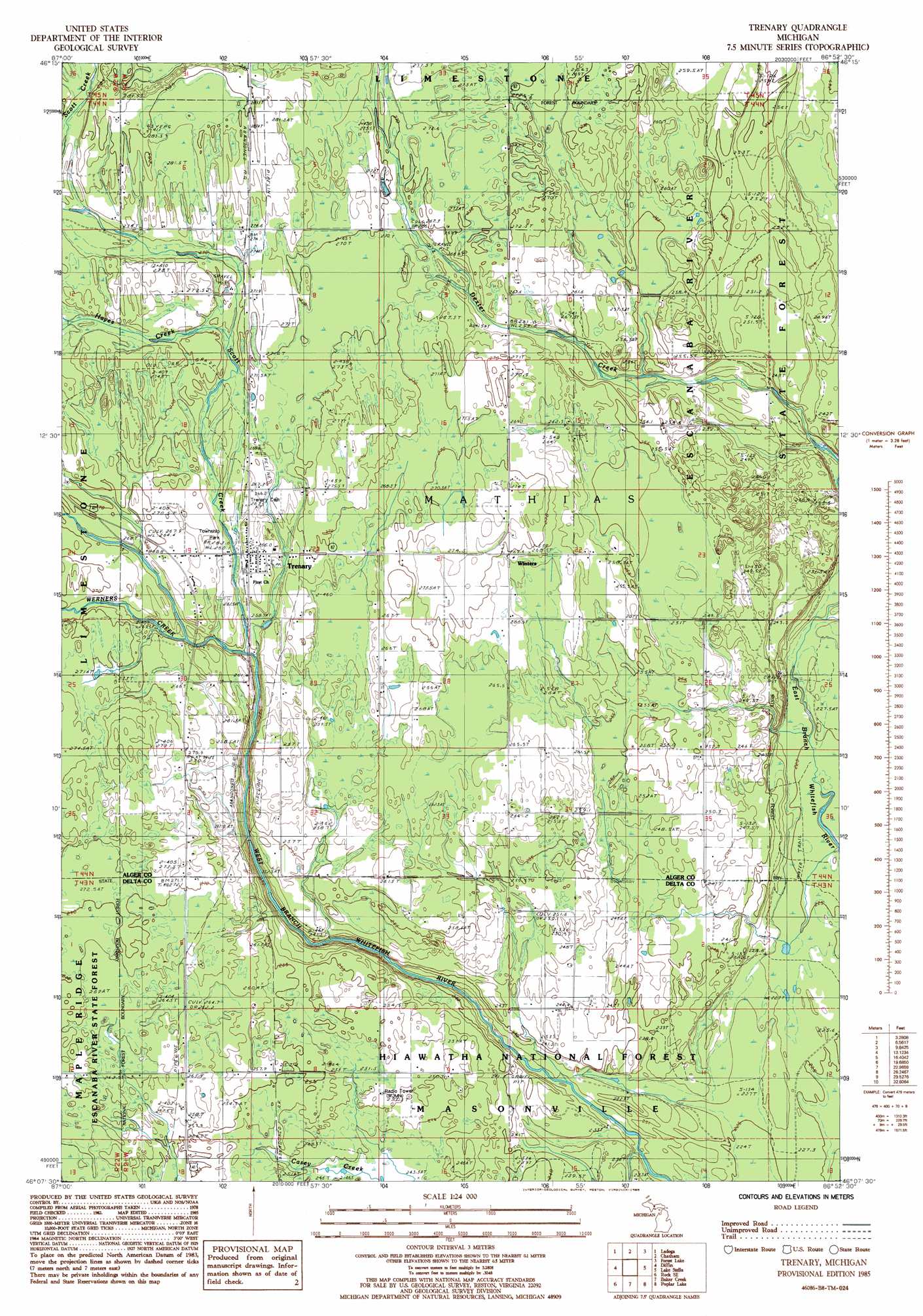
USGS Topo Quad 46086b8 - 1:24,000 scale
| Topo Map Name: | Trenary |
| USGS Topo Quad ID: | 46086b8 |
| Print Size: | ca. 21 1/4" wide x 27" high |
| Southeast Coordinates: | 46.125° N latitude / 86.875° W longitude |
| Map Center Coordinates: | 46.1875° N latitude / 86.9375° W longitude |
| U.S. State: | MI |
| Filename: | o46086b8.jpg |
| Download Map JPG Image: | Trenary topo map 1:24,000 scale |
| Map Type: | Topographic |
| Topo Series: | 7.5´ |
| Map Scale: | 1:24,000 |
| Source of Map Images: | United States Geological Survey (USGS) |
| Alternate Map Versions: |
Trenary MI 1985, updated 1985 Download PDF Buy paper map Trenary MI 2011 Download PDF Buy paper map Trenary MI 2014 Download PDF Buy paper map Trenary MI 2017 Download PDF Buy paper map |
| FStopo: | US Forest Service topo Trenary is available: Download FStopo PDF Download FStopo TIF |
1:24,000 Topo Quads surrounding Trenary
Skandia |
Sand River |
Rock River |
Au Train |
Munsing |
Carlshend |
Ladoga |
Chatham |
Forest Lake |
Powell Lake |
Mcfarland |
Diffin |
Trenary |
Lake Stella |
The Lake |
Rock |
Rock Se |
Baker Creek |
Poplar Lake |
Waco Lake |
Cornell |
Perkins |
Rapid River |
Ensign |
Saint Jacques |
> Back to 46086a1 at 1:100,000 scale
> Back to 46086a1 at 1:250,000 scale
> Back to U.S. Topo Maps home
Trenary topo map: Gazetteer
Trenary: Parks
Mathias Township Park elevation 267m 875′Trenary: Populated Places
Trenary elevation 265m 869′Trenary: Post Offices
Trenary Post Office elevation 267m 875′Winters Post Office (historical) elevation 269m 882′
Trenary: Streams
Dexter Creek elevation 228m 748′Dry Creek elevation 234m 767′
Hayes Creek elevation 267m 875′
Scott Creek elevation 250m 820′
Spring Creek elevation 222m 728′
Weber Creek elevation 252m 826′
Werners Creek elevation 258m 846′
Trenary digital topo map on disk
Buy this Trenary topo map showing relief, roads, GPS coordinates and other geographical features, as a high-resolution digital map file on DVD: