Lake Lida Topo Map Minnesota
To zoom in, hover over the map of Lake Lida
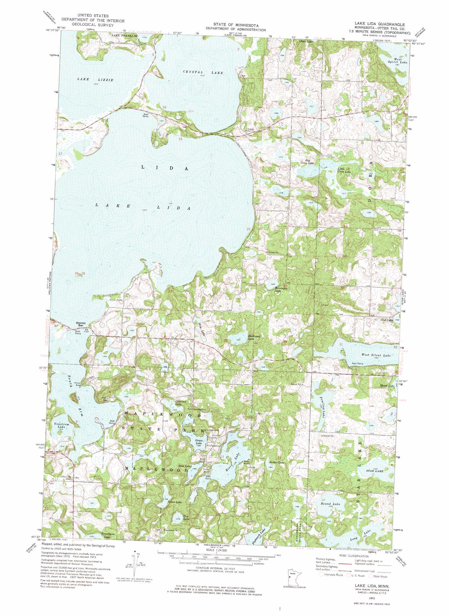
USGS Topo Quad 46095e8 - 1:24,000 scale
| Topo Map Name: | Lake Lida |
| USGS Topo Quad ID: | 46095e8 |
| Print Size: | ca. 21 1/4" wide x 27" high |
| Southeast Coordinates: | 46.5° N latitude / 95.875° W longitude |
| Map Center Coordinates: | 46.5625° N latitude / 95.9375° W longitude |
| U.S. State: | MN |
| Filename: | o46095e8.jpg |
| Download Map JPG Image: | Lake Lida topo map 1:24,000 scale |
| Map Type: | Topographic |
| Topo Series: | 7.5´ |
| Map Scale: | 1:24,000 |
| Source of Map Images: | United States Geological Survey (USGS) |
| Alternate Map Versions: |
Lake Lida MN 1973, updated 1975 Download PDF Buy paper map Lake Lida MN 2010 Download PDF Buy paper map Lake Lida MN 2013 Download PDF Buy paper map Lake Lida MN 2016 Download PDF Buy paper map |
1:24,000 Topo Quads surrounding Lake Lida
Lake Park Sw |
Big Cormorant Lake |
Audubon |
Detroit Lakes |
Rochert |
Rollag |
Cormorant |
Lake Franklin |
Vergas |
Frazee |
Lake Olaf |
Pelican Rapids |
Lake Lida |
Star Lake |
Dent |
Elizabeth |
Erhard |
Heilberger Lake |
Phelps |
Walker Lake |
Carlisle |
Fergus Falls |
Wall Lake |
Underwood |
Battle Lake |
> Back to 46095e1 at 1:100,000 scale
> Back to 46094a1 at 1:250,000 scale
> Back to U.S. Topo Maps home
Lake Lida topo map: Gazetteer
Lake Lida: Bars
Stoney Bar elevation 401m 1315′Lake Lida: Lakes
Andrew Lake elevation 410m 1345′Bass Lake elevation 415m 1361′
Beaver Lake elevation 404m 1325′
Beers Lake elevation 420m 1377′
Beiningen Lake elevation 434m 1423′
Big Crow Lake elevation 401m 1315′
Cataract Lake elevation 418m 1371′
Club Lake elevation 411m 1348′
Cow Lake elevation 420m 1377′
Crystal Lake elevation 400m 1312′
Deadwood Lake elevation 427m 1400′
Femling Lake elevation 413m 1354′
Fladmark Lake elevation 425m 1394′
Fritz Lake elevation 416m 1364′
Grass Lake elevation 417m 1368′
Grass Lake elevation 417m 1368′
James Lake elevation 415m 1361′
Lake Field elevation 410m 1345′
Lake Lida elevation 400m 1312′
Lake Lizzie elevation 400m 1312′
Little Crow Lake elevation 401m 1315′
Long Lake elevation 416m 1364′
Round Lake elevation 419m 1374′
Slim Lake elevation 425m 1394′
South Arm Lake Lida elevation 400m 1312′
Venstrom Lake elevation 400m 1312′
West Silent Lake elevation 410m 1345′
West Spirit Lake elevation 415m 1361′
Lake Lida: Parks
Maplewood State Park elevation 435m 1427′Lake Lida: Post Offices
Arthur Post Office (historical) elevation 428m 1404′Bessie Post Office (historical) elevation 424m 1391′
Lida Post Office (historical) elevation 421m 1381′
Lake Lida digital topo map on disk
Buy this Lake Lida topo map showing relief, roads, GPS coordinates and other geographical features, as a high-resolution digital map file on DVD: