Park Rapids Sw Topo Map Minnesota
To zoom in, hover over the map of Park Rapids Sw
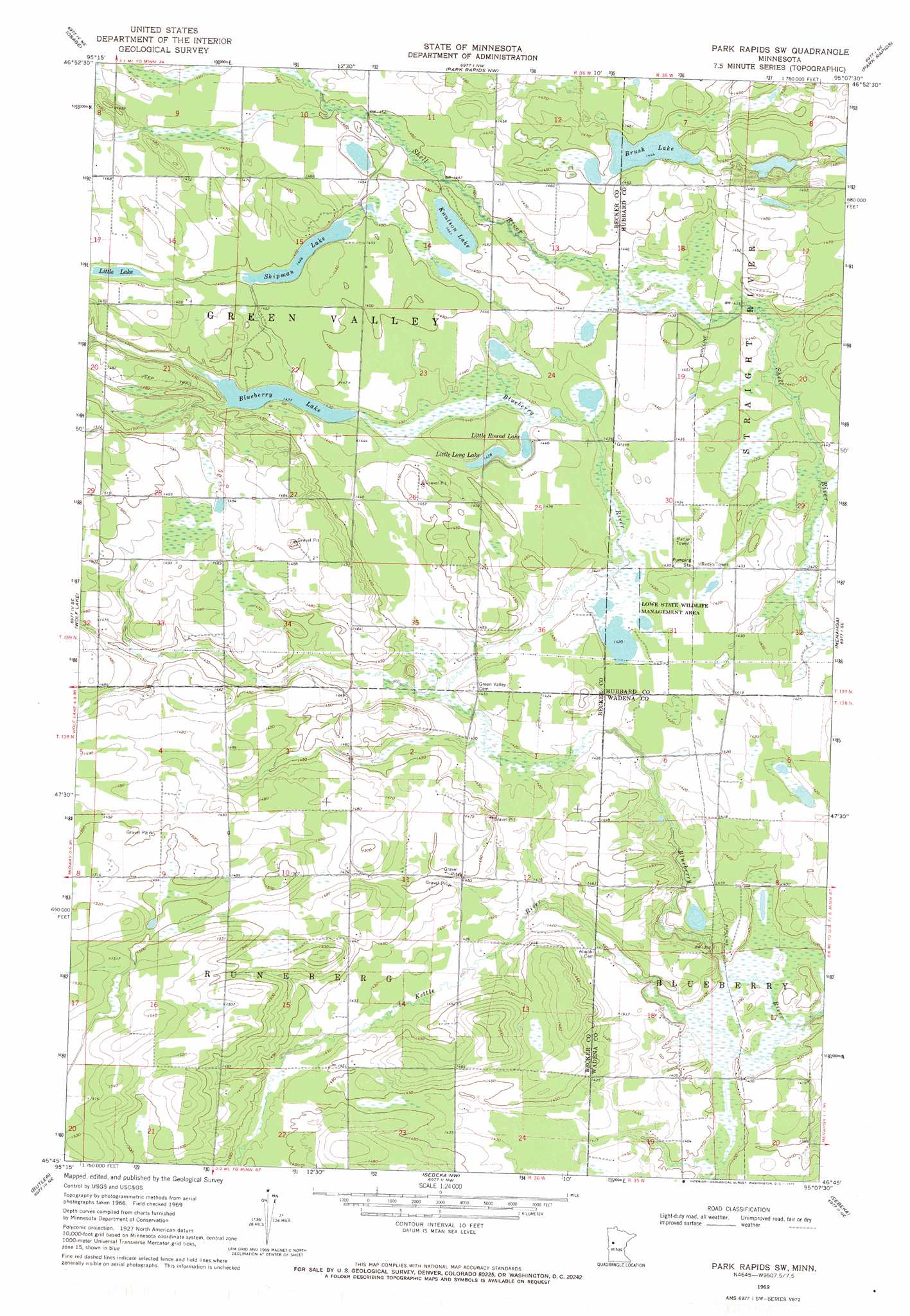
USGS Topo Quad 46095g2 - 1:24,000 scale
| Topo Map Name: | Park Rapids Sw |
| USGS Topo Quad ID: | 46095g2 |
| Print Size: | ca. 21 1/4" wide x 27" high |
| Southeast Coordinates: | 46.75° N latitude / 95.125° W longitude |
| Map Center Coordinates: | 46.8125° N latitude / 95.1875° W longitude |
| U.S. State: | MN |
| Filename: | o46095g2.jpg |
| Download Map JPG Image: | Park Rapids Sw topo map 1:24,000 scale |
| Map Type: | Topographic |
| Topo Series: | 7.5´ |
| Map Scale: | 1:24,000 |
| Source of Map Images: | United States Geological Survey (USGS) |
| Alternate Map Versions: |
Park Rapids SW MN 1969, updated 1971 Download PDF Buy paper map Park Rapids SW MN 2010 Download PDF Buy paper map Park Rapids SW MN 2013 Download PDF Buy paper map Park Rapids SW MN 2016 Download PDF Buy paper map |
1:24,000 Topo Quads surrounding Park Rapids Sw
Big Rush Lake |
Big Basswood Lake |
Two Inlets |
Skunk Lake |
Mantrap Lake |
Ponsford |
Osage |
Park Rapids Nw |
Park Rapids |
Dorset |
Evergreen |
Wolf Lake |
Park Rapids Sw |
Menahga |
Huntersville |
New York Mills Nw |
Butler |
Sebeka Nw |
Sebeka |
Nimrod |
New York Mills West |
New York Mills East |
Sebeka Sw |
Blue Grass |
Nimrod Sw |
> Back to 46095e1 at 1:100,000 scale
> Back to 46094a1 at 1:250,000 scale
> Back to U.S. Topo Maps home
Park Rapids Sw topo map: Gazetteer
Park Rapids Sw: Lakes
Blueberry Lake elevation 434m 1423′Brush Lake elevation 440m 1443′
Knutson Lake elevation 440m 1443′
Little Lake elevation 445m 1459′
Little Long Lake elevation 434m 1423′
Little Round Lake elevation 434m 1423′
Shipman Lake elevation 440m 1443′
Park Rapids Sw: Parks
Lowe State Wildlife Management Area elevation 435m 1427′Park Rapids Sw: Streams
Kettle River elevation 422m 1384′Park Rapids Sw digital topo map on disk
Buy this Park Rapids Sw topo map showing relief, roads, GPS coordinates and other geographical features, as a high-resolution digital map file on DVD: