Queens Point Topo Map Montana
To zoom in, hover over the map of Queens Point
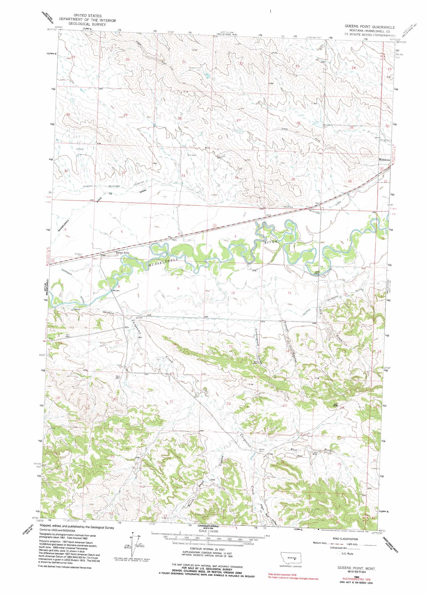
USGS Topo Quad 46107e8 - 1:24,000 scale
| Topo Map Name: | Queens Point |
| USGS Topo Quad ID: | 46107e8 |
| Print Size: | ca. 21 1/4" wide x 27" high |
| Southeast Coordinates: | 46.5° N latitude / 107.875° W longitude |
| Map Center Coordinates: | 46.5625° N latitude / 107.9375° W longitude |
| U.S. State: | MT |
| Filename: | o46107e8.jpg |
| Download Map JPG Image: | Queens Point topo map 1:24,000 scale |
| Map Type: | Topographic |
| Topo Series: | 7.5´ |
| Map Scale: | 1:24,000 |
| Source of Map Images: | United States Geological Survey (USGS) |
| Alternate Map Versions: |
Queens Point MT 1962, updated 1965 Download PDF Buy paper map Queens Point MT 1962, updated 1991 Download PDF Buy paper map Queens Point MT 2011 Download PDF Buy paper map Queens Point MT 2014 Download PDF Buy paper map |
1:24,000 Topo Quads surrounding Queens Point
Kelley |
Mud Spring |
Maxwell Ranch |
Mosby Se |
Kincheloe Ranch |
Musselshell Nw |
Akers Ranch |
Melstone Nw |
Melstone Ne |
Grebe Ranch |
Delphia |
Musselshell |
Queens Point |
Melstone |
Guthridge Ranch |
Chimney Butte |
Corey Flat |
Chandler Spring |
Weed Creek West |
Weed Creek East |
Cherry Spring |
Steamboat Butte |
Pine View |
Mailbox Hill |
Mexican Buttes |
> Back to 46107e1 at 1:100,000 scale
> Back to 46106a1 at 1:250,000 scale
> Back to U.S. Topo Maps home
Queens Point topo map: Gazetteer
Queens Point: Canals
Chandler Ditch elevation 897m 2942′Queens Point: Dams
Melstone Dam elevation 904m 2965′Queens Point: Mines
Keene Mine elevation 930m 3051′Queens Point: Populated Places
Absher (historical) elevation 897m 2942′Queens Point elevation 897m 2942′
Queens Point: Post Offices
Absher Post Office (historical) elevation 897m 2942′Baldwin Post Office (historical) elevation 891m 2923′
Carpenter Creek Post Office (historical) elevation 905m 2969′
Queens Point: Streams
Carpenter Creek elevation 897m 2942′Dry Creek elevation 878m 2880′
East Fork Carpenter Creek elevation 926m 3038′
Queens Point: Valleys
Angus Bell Coulee elevation 939m 3080′Burnt Shed Coulee elevation 925m 3034′
Cunningham Coulee elevation 908m 2979′
Finnan Coulee elevation 889m 2916′
Queens Point: Wells
09N30E13CCAC01 Well elevation 943m 3093′09N30E14BDDD01 Well elevation 917m 3008′
09N30E20AABA01 Well elevation 924m 3031′
09N30E30DBAD01 Well elevation 992m 3254′
Queens Point digital topo map on disk
Buy this Queens Point topo map showing relief, roads, GPS coordinates and other geographical features, as a high-resolution digital map file on DVD:
Eastern Montana & Western North Dakota
Buy digital topo maps: Eastern Montana & Western North Dakota