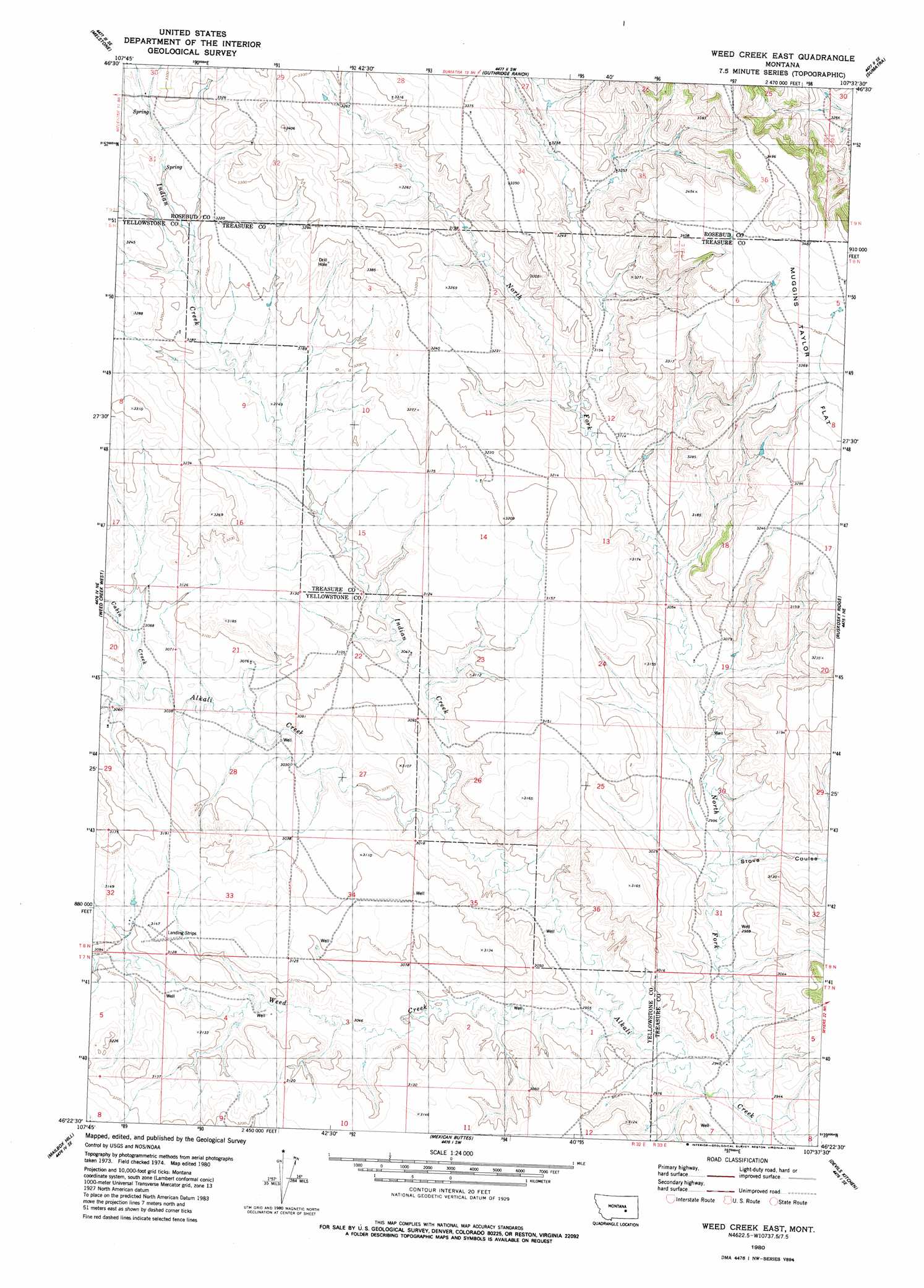
Weed Creek East Topo Map Montana
To zoom in, hover over the map of Weed Creek East
USGS Topo Quad 46107d6 - 1:24,000 scale
| Topo Map Name: | Weed Creek East |
| USGS Topo Quad ID: | 46107d6 |
| Print Size: | ca. 21 1/4" wide x 27" high |
| Southeast Coordinates: | 46.375° N latitude / 107.625° W longitude |
| Map Center Coordinates: | 46.4375° N latitude / 107.6875° W longitude |
| U.S. State: | MT |
| Filename: | o46107d6.jpg |
| Download Map JPG Image: | Weed Creek East topo map 1:24,000 scale |
| Map Type: | Topographic |
| Topo Series: | 7.5´ |
| Map Scale: | 1:24,000 |
| Source of Map Images: | United States Geological Survey (USGS) |
| Alternate Map Versions: |
Weed Creek East MT 1980, updated 1980 Download PDF Buy paper map Weed Creek East MT 2011 Download PDF Buy paper map Weed Creek East MT 2014 Download PDF Buy paper map |
1:24,000 Topo Quads surrounding Weed Creek East
Melstone Nw |
Melstone Ne |
Grebe Ranch |
Hecker Ranch |
Yablonski Ranch |
Queens Point |
Melstone |
Guthridge Ranch |
Sumatra |
Ingomar West |
Chandler Spring |
Weed Creek West |
Weed Creek East |
Ruskosky Ridge |
Mckonkey Creek |
Pine View |
Mailbox Hill |
Mexican Buttes |
Devils Kitchen |
Rancher Cemetery |
Bull Mountain Nw |
Mud Butte |
Coal Bank Creek |
Custer |
Bighorn |
> Back to 46107a1 at 1:100,000 scale
> Back to 46106a1 at 1:250,000 scale
> Back to U.S. Topo Maps home
Weed Creek East topo map: Gazetteer
Weed Creek East: Streams
Cabin Creek elevation 930m 3051′Indian Creek elevation 910m 2985′
Injun Creek elevation 890m 2919′
Weed Creek elevation 897m 2942′
Weed Creek East: Valleys
Stove Coulee elevation 907m 2975′Weed Creek East: Wells
07N33E06DBD_01 Well elevation 895m 2936′08N33E05BDBD01 Well elevation 1048m 3438′
08N33E19BCDD01 Well elevation 923m 3028′
Weed Creek East digital topo map on disk
Buy this Weed Creek East topo map showing relief, roads, GPS coordinates and other geographical features, as a high-resolution digital map file on DVD:
Eastern Montana & Western North Dakota
Buy digital topo maps: Eastern Montana & Western North Dakota