Steamboat Butte Topo Map Montana
To zoom in, hover over the map of Steamboat Butte
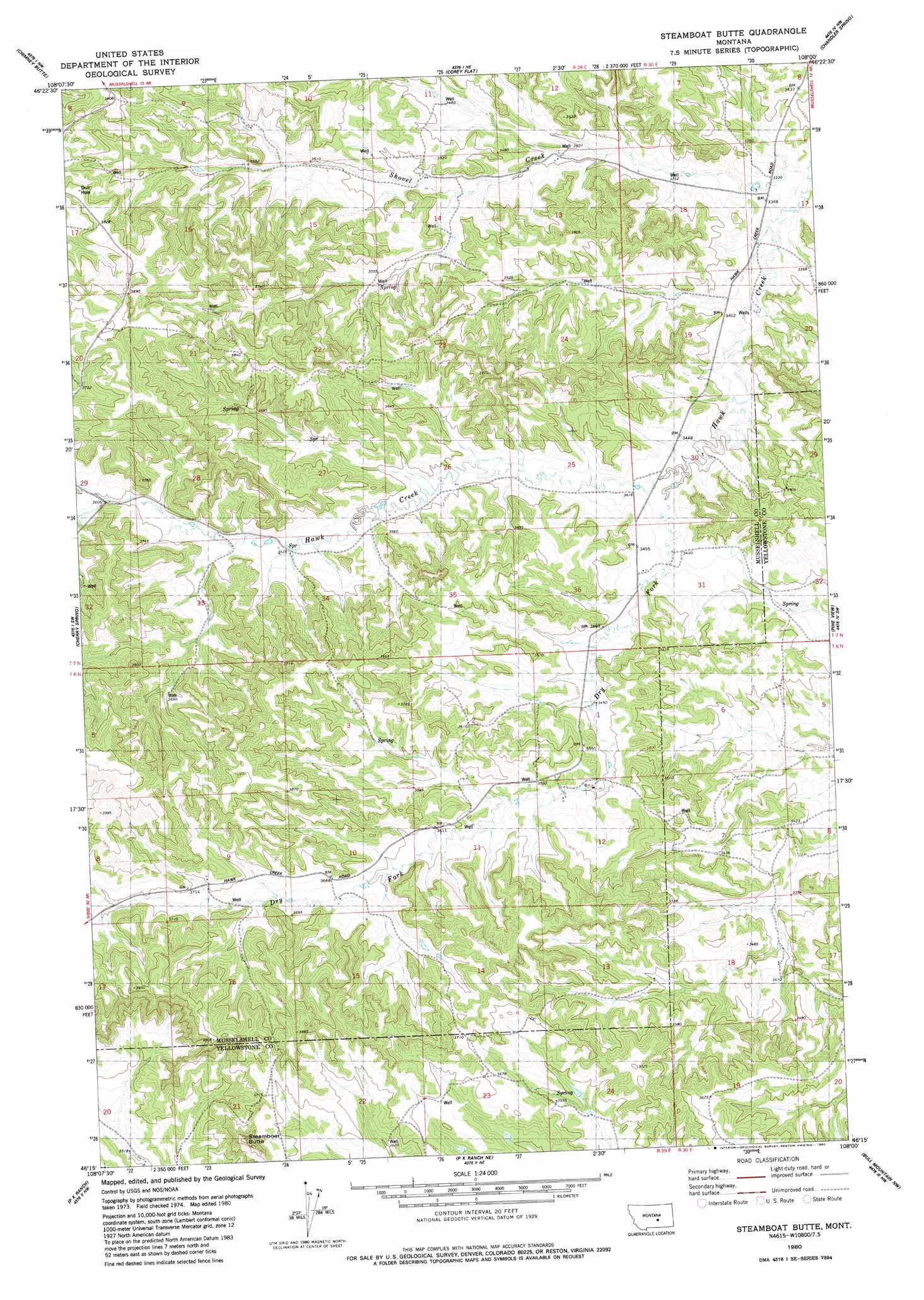
USGS Topo Quad 46108c1 - 1:24,000 scale
| Topo Map Name: | Steamboat Butte |
| USGS Topo Quad ID: | 46108c1 |
| Print Size: | ca. 21 1/4" wide x 27" high |
| Southeast Coordinates: | 46.25° N latitude / 108° W longitude |
| Map Center Coordinates: | 46.3125° N latitude / 108.0625° W longitude |
| U.S. State: | MT |
| Filename: | o46108c1.jpg |
| Download Map JPG Image: | Steamboat Butte topo map 1:24,000 scale |
| Map Type: | Topographic |
| Topo Series: | 7.5´ |
| Map Scale: | 1:24,000 |
| Source of Map Images: | United States Geological Survey (USGS) |
| Alternate Map Versions: |
Steamboat Butte MT 1980, updated 1980 Download PDF Buy paper map Steamboat Butte MT 2011 Download PDF Buy paper map Steamboat Butte MT 2014 Download PDF Buy paper map |
1:24,000 Topo Quads surrounding Steamboat Butte
Big Wall East |
Delphia |
Musselshell |
Queens Point |
Melstone |
Gage Ne |
Chimney Butte |
Corey Flat |
Chandler Spring |
Weed Creek West |
Dunn Mountain North |
Cherry Spring |
Steamboat Butte |
Pine View |
Mailbox Hill |
Dunn Mountain South |
P K Ranch |
P K Ranch Ne |
Bull Mountain Nw |
Mud Butte |
Cotton Creek |
P K Ranch Sw |
P K Ranch Se |
Big Marys Island |
Bull Mountain |
> Back to 46108a1 at 1:100,000 scale
> Back to 46108a1 at 1:250,000 scale
> Back to U.S. Topo Maps home
Steamboat Butte topo map: Gazetteer
Steamboat Butte: Dams
Stephen Number 1 Dam elevation 1102m 3615′Steamboat Butte: Streams
Dry Fork Hawk Creek elevation 1038m 3405′Shovel Creek elevation 1012m 3320′
Steamboat Butte: Summits
Steamboat Butte elevation 1181m 3874′Steamboat Butte: Wells
06N29E04BBCB01 Well elevation 1124m 3687′06N29E05AADB01 Well elevation 1127m 3697′
06N29E11BDAD01 Well elevation 1088m 3569′
07N29E21CCCC01 Well elevation 1155m 3789′
Steamboat Butte digital topo map on disk
Buy this Steamboat Butte topo map showing relief, roads, GPS coordinates and other geographical features, as a high-resolution digital map file on DVD: