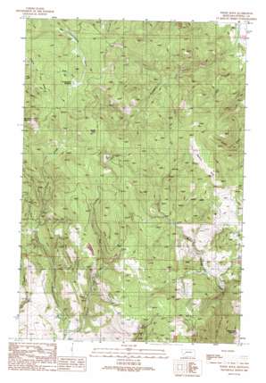
Windy Rock Topo Map Montana
To zoom in, hover over the map of Windy Rock
USGS Topo Quad 46112f7 - 1:24,000 scale
| Topo Map Name: | Windy Rock |
| USGS Topo Quad ID: | 46112f7 |
| Print Size: | ca. 21 1/4" wide x 27" high |
| Southeast Coordinates: | 46.625° N latitude / 112.75° W longitude |
| Map Center Coordinates: | 46.6875° N latitude / 112.8125° W longitude |
| U.S. State: | MT |
| Filename: | o46112f7.jpg |
| Download Map JPG Image: | Windy Rock topo map 1:24,000 scale |
| Map Type: | Topographic |
| Topo Series: | 7.5´ |
| Map Scale: | 1:24,000 |
| Source of Map Images: | United States Geological Survey (USGS) |
| Alternate Map Versions: |
Windy Rock MT 1989, updated 1989 Download PDF Buy paper map Windy Rock MT 2011 Download PDF Buy paper map Windy Rock MT 2014 Download PDF Buy paper map |
1:24,000 Topo Quads surrounding Windy Rock
> Back to 46112e1 at 1:100,000 scale
> Back to 46112a1 at 1:250,000 scale
> Back to U.S. Topo Maps home
Windy Rock topo map: Gazetteer
Windy Rock: Flats
Cottonwood Meadow elevation 2032m 6666′Mannix Park elevation 2050m 6725′
Windy Rock: Mines
Anderson Mine elevation 1648m 5406′NE NW Section 7 Mine elevation 1557m 5108′
Relyea Mine elevation 1860m 6102′
Relyea Mine elevation 1855m 6085′
Relyea Mine elevation 1854m 6082′
Silver La Donna Mine elevation 1660m 5446′
Windy Rock: Populated Places
Sharkeyville (historical) elevation 1626m 5334′Windy Rock: Streams
East Fork Brock Creek elevation 1481m 4858′West Fork Cottonwood Creek elevation 2035m 6676′
West Fork Wet Cottonwood Creek elevation 2035m 6676′
Windy Rock: Summits
Old Baldy Mountain elevation 2267m 7437′White Rocks Mountain elevation 2015m 6610′
Windy Rock elevation 2144m 7034′
Windy Rock: Wells
09N10W14CDCD01 Well elevation 1940m 6364′09N10W16AADB01 Well elevation 1684m 5524′
Windy Rock digital topo map on disk
Buy this Windy Rock topo map showing relief, roads, GPS coordinates and other geographical features, as a high-resolution digital map file on DVD:


