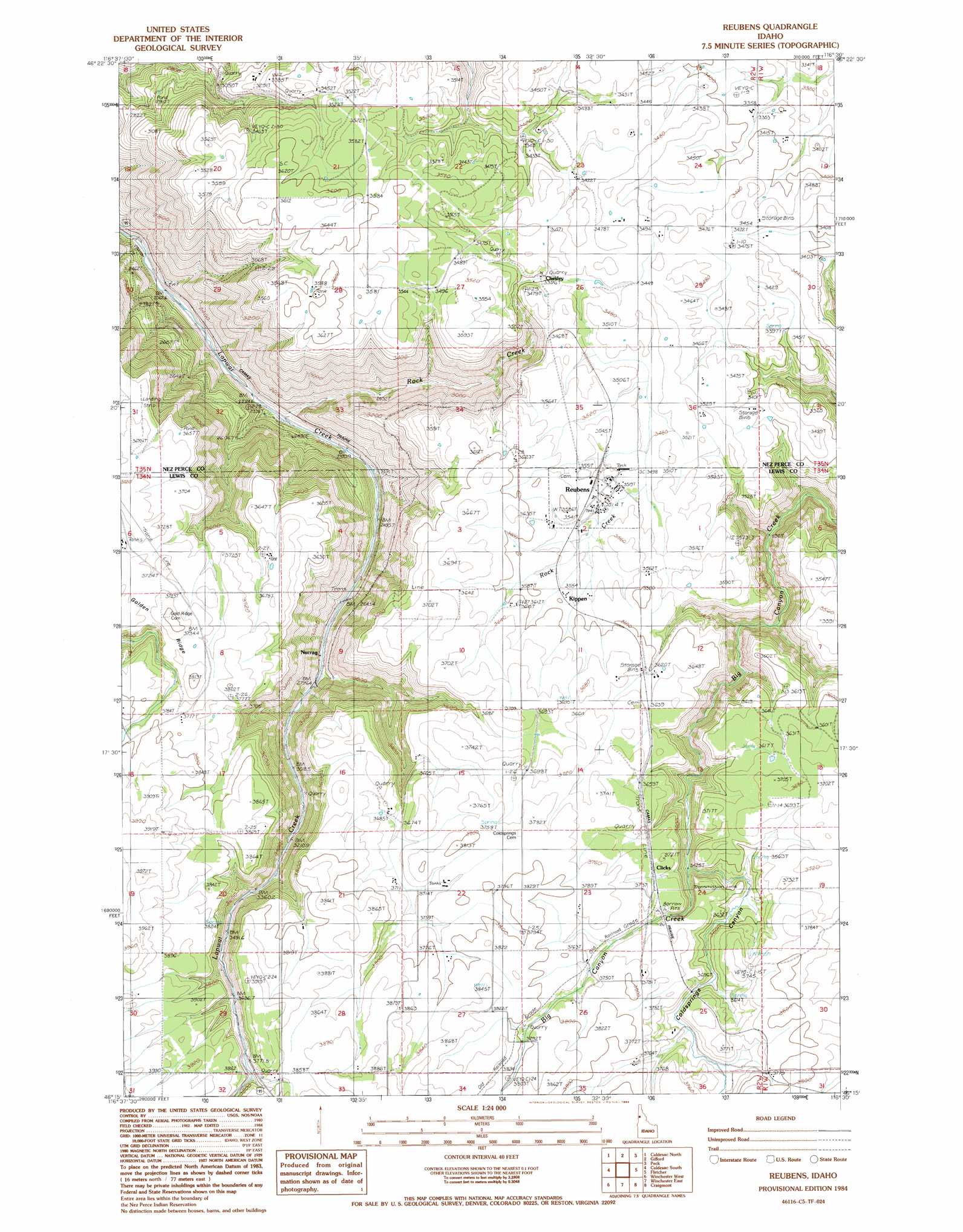
Reubens Topo Map Idaho
To zoom in, hover over the map of Reubens
USGS Topo Quad 46116c5 - 1:24,000 scale
| Topo Map Name: | Reubens |
| USGS Topo Quad ID: | 46116c5 |
| Print Size: | ca. 21 1/4" wide x 27" high |
| Southeast Coordinates: | 46.25° N latitude / 116.5° W longitude |
| Map Center Coordinates: | 46.3125° N latitude / 116.5625° W longitude |
| U.S. State: | ID |
| Filename: | o46116c5.jpg |
| Download Map JPG Image: | Reubens topo map 1:24,000 scale |
| Map Type: | Topographic |
| Topo Series: | 7.5´ |
| Map Scale: | 1:24,000 |
| Source of Map Images: | United States Geological Survey (USGS) |
| Alternate Map Versions: |
Reubens ID 1984, updated 1984 Download PDF Buy paper map Reubens ID 2010 Download PDF Buy paper map Reubens ID 2013 Download PDF Buy paper map |
1:24,000 Topo Quads surrounding Reubens
Green Knob |
Juliaetta |
Lenore |
Southwick |
Ahsahka |
Lapwai |
Culdesac North |
Gifford |
Peck |
Orofino West |
Sweetwater |
Culdesac South |
Reubens |
Fletcher |
Mohler |
Waha |
Winchester West |
Winchester East |
Craigmont |
Cottonwood Ne |
Frye Point |
Hoover Point |
Westlake |
Keuterville |
Cottonwood |
> Back to 46116a1 at 1:100,000 scale
> Back to 46116a1 at 1:250,000 scale
> Back to U.S. Topo Maps home
Reubens topo map: Gazetteer
Reubens: Populated Places
Chesley elevation 1036m 3398′Clicks elevation 1128m 3700′
Craig Junction elevation 1132m 3713′
Kippen elevation 1088m 3569′
Reubens elevation 1075m 3526′
Woodside (historical) elevation 1156m 3792′
Reubens: Ridges
Golden Ridge elevation 1158m 3799′Reubens: Streams
Coldspring Creek elevation 1045m 3428′Reubens: Valleys
Coldsprings Canyon elevation 1045m 3428′Reubens digital topo map on disk
Buy this Reubens topo map showing relief, roads, GPS coordinates and other geographical features, as a high-resolution digital map file on DVD: