Fletcher Topo Map Idaho
To zoom in, hover over the map of Fletcher
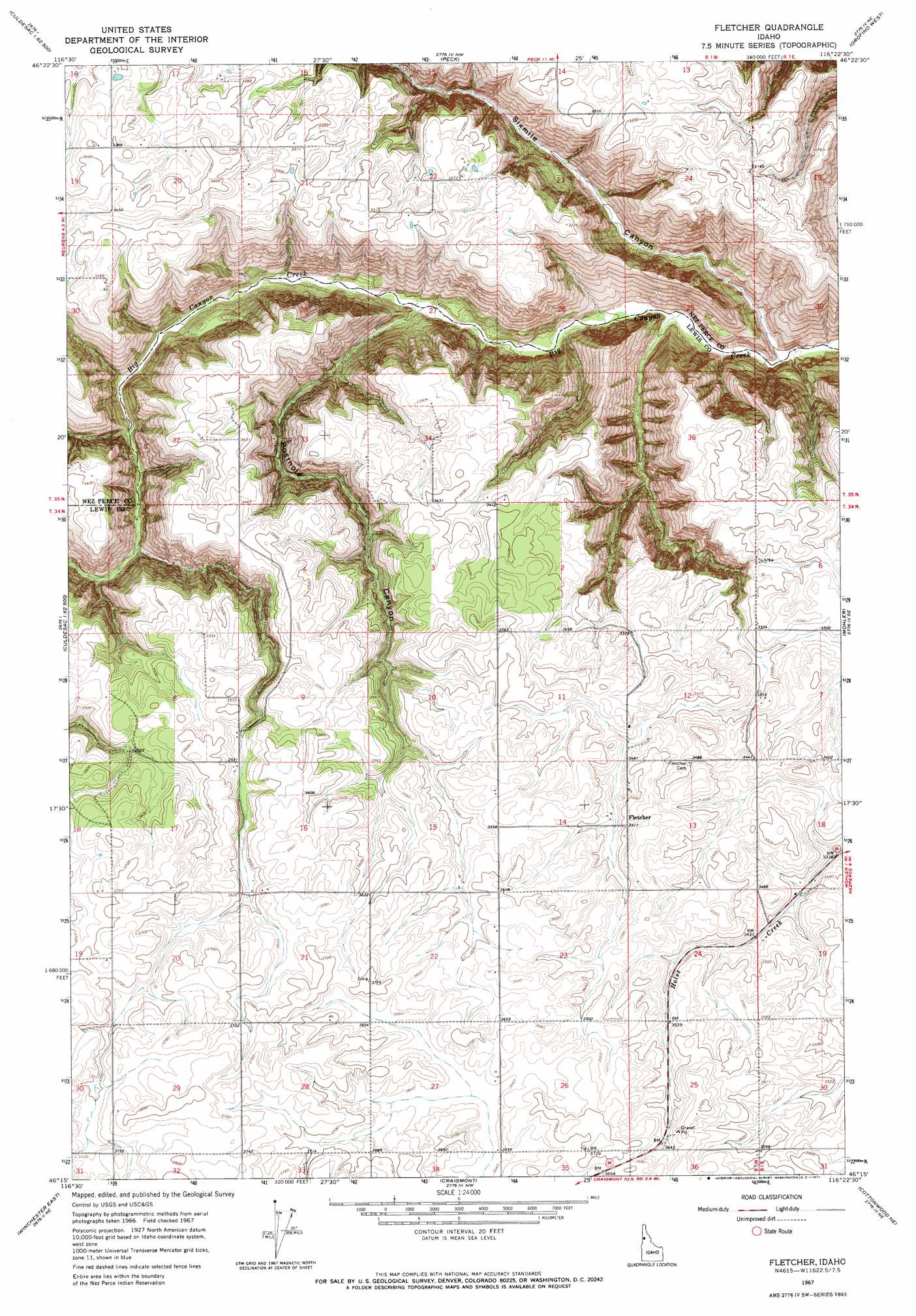
USGS Topo Quad 46116c4 - 1:24,000 scale
| Topo Map Name: | Fletcher |
| USGS Topo Quad ID: | 46116c4 |
| Print Size: | ca. 21 1/4" wide x 27" high |
| Southeast Coordinates: | 46.25° N latitude / 116.375° W longitude |
| Map Center Coordinates: | 46.3125° N latitude / 116.4375° W longitude |
| U.S. State: | ID |
| Filename: | o46116c4.jpg |
| Download Map JPG Image: | Fletcher topo map 1:24,000 scale |
| Map Type: | Topographic |
| Topo Series: | 7.5´ |
| Map Scale: | 1:24,000 |
| Source of Map Images: | United States Geological Survey (USGS) |
| Alternate Map Versions: |
Fletcher ID 1967, updated 1971 Download PDF Buy paper map Fletcher ID 2010 Download PDF Buy paper map Fletcher ID 2013 Download PDF Buy paper map |
1:24,000 Topo Quads surrounding Fletcher
Juliaetta |
Lenore |
Southwick |
Ahsahka |
Dent |
Culdesac North |
Gifford |
Peck |
Orofino West |
Orofino East |
Culdesac South |
Reubens |
Fletcher |
Mohler |
Sixmile Creek |
Winchester West |
Winchester East |
Craigmont |
Cottonwood Ne |
Nezperce |
Hoover Point |
Westlake |
Keuterville |
Cottonwood |
Nezperce Sw |
> Back to 46116a1 at 1:100,000 scale
> Back to 46116a1 at 1:250,000 scale
> Back to U.S. Topo Maps home
Fletcher topo map: Gazetteer
Fletcher: Populated Places
Fletcher elevation 1070m 3510′Fletcher: Valleys
Posthole Canyon elevation 695m 2280′Sixmile Canyon elevation 609m 1998′
Fletcher digital topo map on disk
Buy this Fletcher topo map showing relief, roads, GPS coordinates and other geographical features, as a high-resolution digital map file on DVD: