Frenchman Hills Lake Topo Map Washington
To zoom in, hover over the map of Frenchman Hills Lake
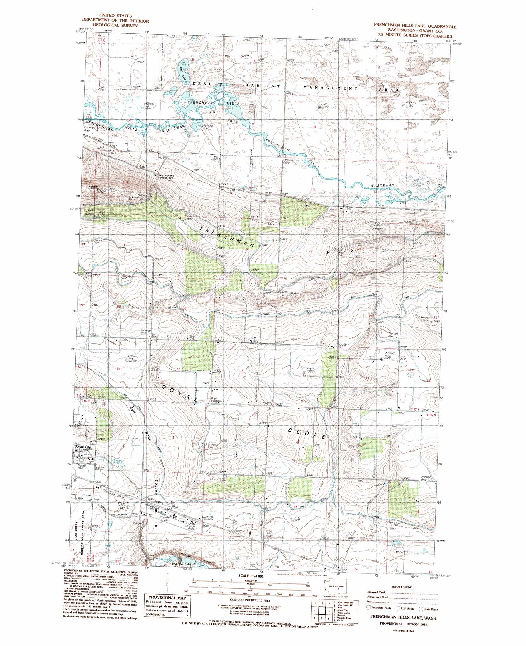
USGS Topo Quad 46119h5 - 1:24,000 scale
| Topo Map Name: | Frenchman Hills Lake |
| USGS Topo Quad ID: | 46119h5 |
| Print Size: | ca. 21 1/4" wide x 27" high |
| Southeast Coordinates: | 46.875° N latitude / 119.5° W longitude |
| Map Center Coordinates: | 46.9375° N latitude / 119.5625° W longitude |
| U.S. State: | WA |
| Filename: | o46119h5.jpg |
| Download Map JPG Image: | Frenchman Hills Lake topo map 1:24,000 scale |
| Map Type: | Topographic |
| Topo Series: | 7.5´ |
| Map Scale: | 1:24,000 |
| Source of Map Images: | United States Geological Survey (USGS) |
| Alternate Map Versions: |
Frenchman Hills Lake WA 1986, updated 1986 Download PDF Buy paper map Frenchman Hills Lake WA 2011 Download PDF Buy paper map Frenchman Hills Lake WA 2014 Download PDF Buy paper map |
1:24,000 Topo Quads surrounding Frenchman Hills Lake
Quincy |
Winchester |
Winchester Ne |
Moses Lake Nw |
Moses Lake North |
George |
Winchester Sw |
Winchester Se |
Mae |
Moses Lake South |
Beverly Ne |
Royal City |
Frenchman Hills Lake |
Royal Camp |
O'Sullivan Dam |
Beverly Se |
Smyrna |
Wahatis Peak |
Corfu |
Taunton |
Priest Rapids Ne |
Vernita Bridge |
Coyote Rapids |
Locke Island |
Hanford Ne |
> Back to 46119e1 at 1:100,000 scale
> Back to 46118a1 at 1:250,000 scale
> Back to U.S. Topo Maps home
Frenchman Hills Lake topo map: Gazetteer
Frenchman Hills Lake: Airports
Christensen Field elevation 351m 1151′Frenchman Hills Lake: Lakes
Frenchman Hills Lake elevation 342m 1122′Sand Lake elevation 341m 1118′
Frenchman Hills Lake: Parks
Desert Habitat Management Area elevation 345m 1131′Frenchman Hills Lake: Valleys
Natural Corral elevation 208m 682′Frenchman Hills Lake digital topo map on disk
Buy this Frenchman Hills Lake topo map showing relief, roads, GPS coordinates and other geographical features, as a high-resolution digital map file on DVD: