George Topo Map Washington
To zoom in, hover over the map of George
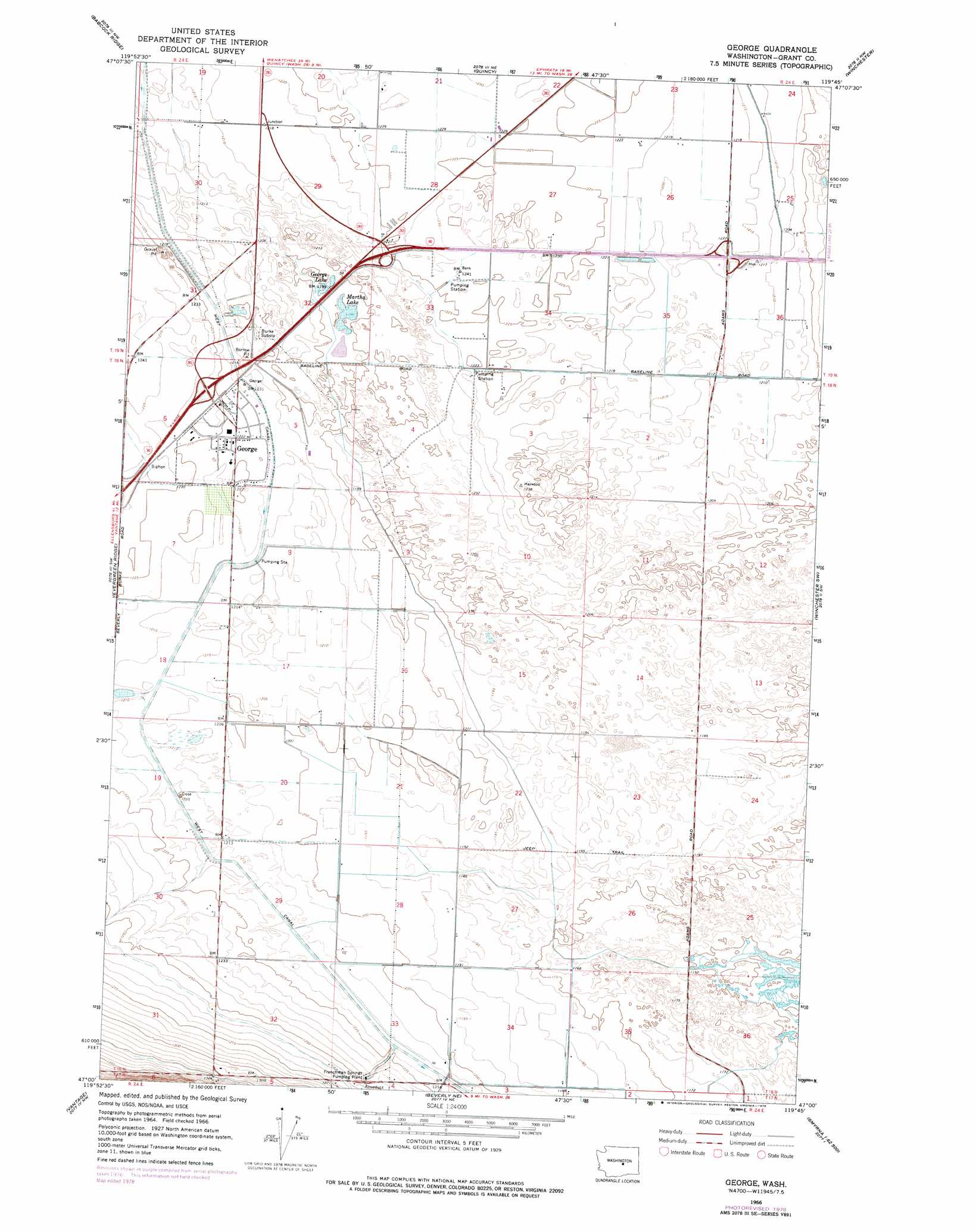
USGS Topo Quad 47119a7 - 1:24,000 scale
| Topo Map Name: | George |
| USGS Topo Quad ID: | 47119a7 |
| Print Size: | ca. 21 1/4" wide x 27" high |
| Southeast Coordinates: | 47° N latitude / 119.75° W longitude |
| Map Center Coordinates: | 47.0625° N latitude / 119.8125° W longitude |
| U.S. State: | WA |
| Filename: | o47119a7.jpg |
| Download Map JPG Image: | George topo map 1:24,000 scale |
| Map Type: | Topographic |
| Topo Series: | 7.5´ |
| Map Scale: | 1:24,000 |
| Source of Map Images: | United States Geological Survey (USGS) |
| Alternate Map Versions: |
George WA 1966, updated 1968 Download PDF Buy paper map George WA 1966, updated 1978 Download PDF Buy paper map George WA 2011 Download PDF Buy paper map George WA 2014 Download PDF Buy paper map |
1:24,000 Topo Quads surrounding George
Rock Island Dam |
Appledale |
Monument Hill |
Ephrata Sw |
Ephrata |
West Bar |
Babcock Ridge |
Quincy |
Winchester |
Winchester Ne |
Cape Horn Se |
Evergreen Ridge |
George |
Winchester Sw |
Winchester Se |
Ginkgo |
Vantage |
Beverly Ne |
Royal City |
Frenchman Hills Lake |
Doris |
Beverly |
Beverly Se |
Smyrna |
Wahatis Peak |
> Back to 47119a1 at 1:100,000 scale
> Back to 47118a1 at 1:250,000 scale
> Back to U.S. Topo Maps home
George topo map: Gazetteer
George: Lakes
George Lake elevation 367m 1204′Martha Lake elevation 365m 1197′
George: Populated Places
George elevation 374m 1227′George digital topo map on disk
Buy this George topo map showing relief, roads, GPS coordinates and other geographical features, as a high-resolution digital map file on DVD: