Logy Creek Ne Topo Map Washington
To zoom in, hover over the map of Logy Creek Ne
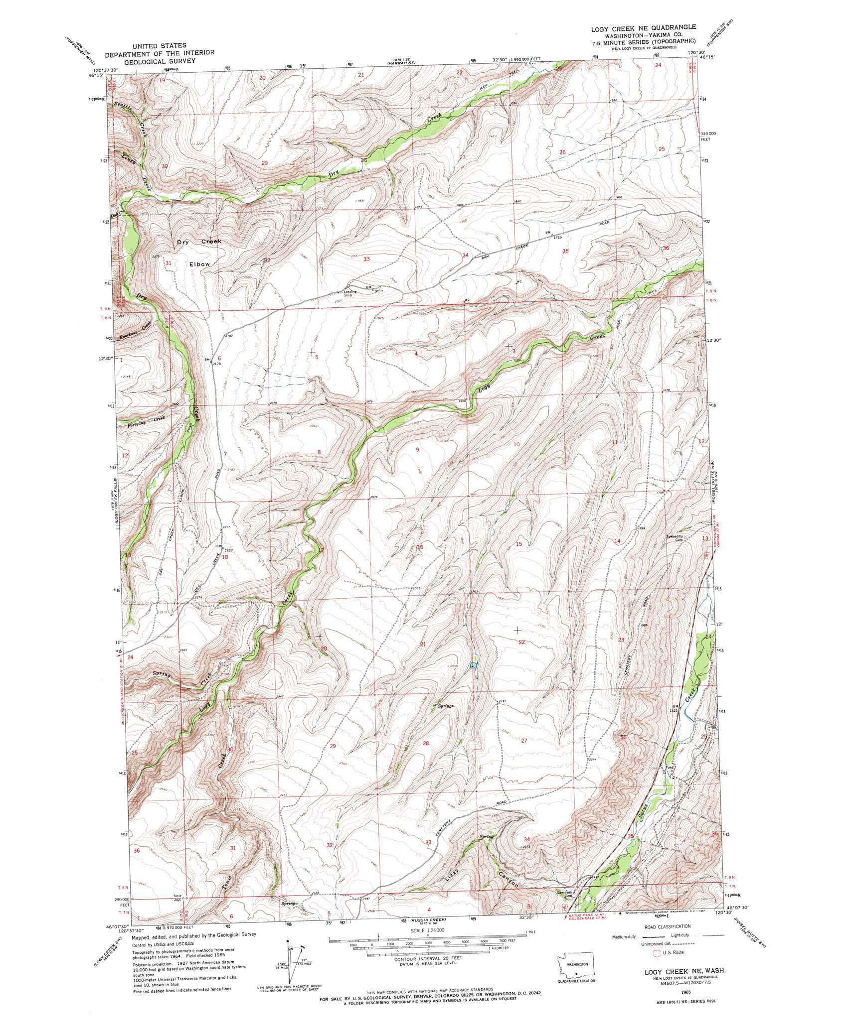
USGS Topo Quad 46120b5 - 1:24,000 scale
| Topo Map Name: | Logy Creek Ne |
| USGS Topo Quad ID: | 46120b5 |
| Print Size: | ca. 21 1/4" wide x 27" high |
| Southeast Coordinates: | 46.125° N latitude / 120.5° W longitude |
| Map Center Coordinates: | 46.1875° N latitude / 120.5625° W longitude |
| U.S. State: | WA |
| Filename: | o46120b5.jpg |
| Download Map JPG Image: | Logy Creek Ne topo map 1:24,000 scale |
| Map Type: | Topographic |
| Topo Series: | 7.5´ |
| Map Scale: | 1:24,000 |
| Source of Map Images: | United States Geological Survey (USGS) |
| Alternate Map Versions: |
Logy Creek NE WA 1965, updated 1967 Download PDF Buy paper map Logy Creek NE WA 2011 Download PDF Buy paper map Logy Creek NE WA 2013 Download PDF Buy paper map |
1:24,000 Topo Quads surrounding Logy Creek Ne
Medicine Valley |
White Swan |
Harrah |
Wapato |
Toppenish |
Fort Simcoe |
Toppenish Mountain |
Harrah Se |
Toppenish Sw |
Hembre Mountain |
Camas Patch |
Logy Creek Falls |
Logy Creek Ne |
Poisel Butte Nw |
Poisel Butte |
Stagman Butte |
Logy Creek Sw |
Kusshi Creek |
Poisel Butte Sw |
Poisel Butte Se |
Indian Rock |
Status Pass |
Lone Pine Butte |
Bickleton Nw |
Bickleton |
> Back to 46120a1 at 1:100,000 scale
> Back to 46120a1 at 1:250,000 scale
> Back to U.S. Topo Maps home
Logy Creek Ne topo map: Gazetteer
Logy Creek Ne: Bends
Dry Creek Elbow elevation 677m 2221′Logy Creek Ne: Streams
Fortyday Creek elevation 547m 1794′Knockout Creek elevation 528m 1732′
Lousy Creek elevation 489m 1604′
Oak Creek elevation 504m 1653′
Seattle Creek elevation 510m 1673′
Spring Creek elevation 549m 1801′
Tenie Creek elevation 557m 1827′
Logy Creek Ne: Valleys
Lizzy Canyon elevation 452m 1482′Logy Creek Ne digital topo map on disk
Buy this Logy Creek Ne topo map showing relief, roads, GPS coordinates and other geographical features, as a high-resolution digital map file on DVD: