Harrah Se Topo Map Washington
To zoom in, hover over the map of Harrah Se
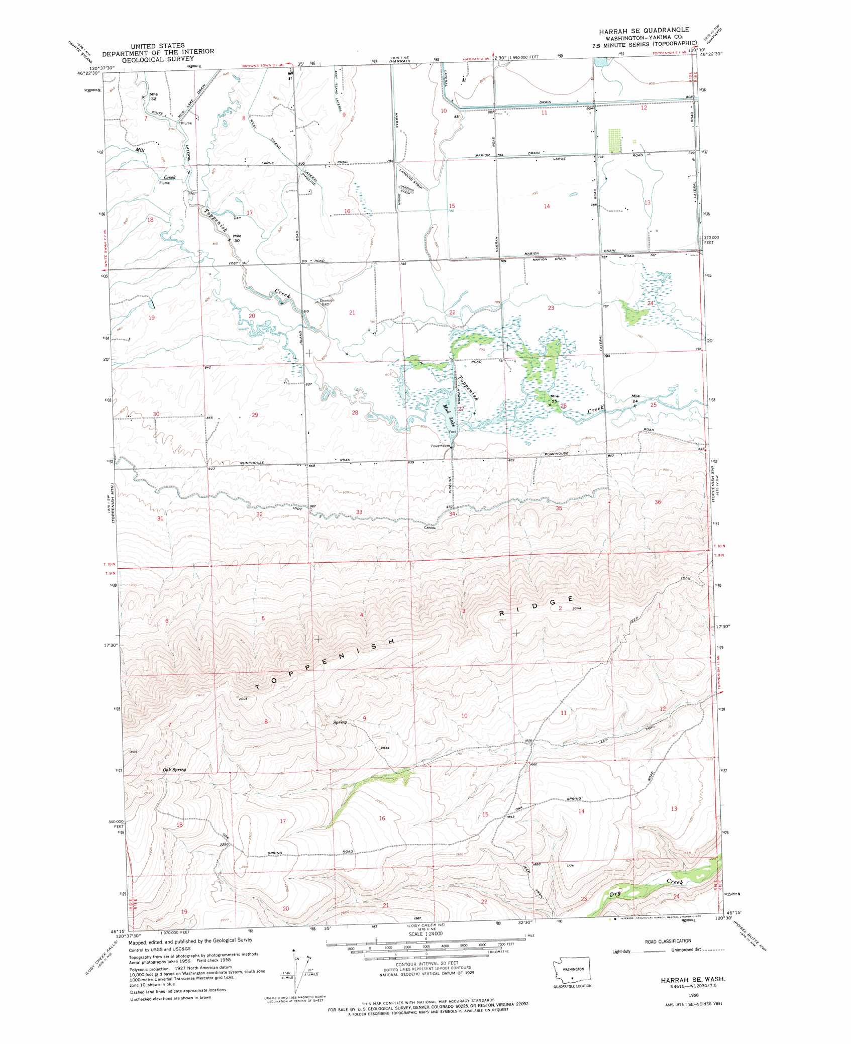
USGS Topo Quad 46120c5 - 1:24,000 scale
| Topo Map Name: | Harrah Se |
| USGS Topo Quad ID: | 46120c5 |
| Print Size: | ca. 21 1/4" wide x 27" high |
| Southeast Coordinates: | 46.25° N latitude / 120.5° W longitude |
| Map Center Coordinates: | 46.3125° N latitude / 120.5625° W longitude |
| U.S. State: | WA |
| Filename: | o46120c5.jpg |
| Download Map JPG Image: | Harrah Se topo map 1:24,000 scale |
| Map Type: | Topographic |
| Topo Series: | 7.5´ |
| Map Scale: | 1:24,000 |
| Source of Map Images: | United States Geological Survey (USGS) |
| Alternate Map Versions: |
Harrah SE WA 1958, updated 1960 Download PDF Buy paper map Harrah SE WA 1958, updated 1975 Download PDF Buy paper map Harrah SE WA 2011 Download PDF Buy paper map Harrah SE WA 2014 Download PDF Buy paper map |
1:24,000 Topo Quads surrounding Harrah Se
Tampico |
Wiley City |
Yakima West |
Yakima East |
Elephant Mountain |
Medicine Valley |
White Swan |
Harrah |
Wapato |
Toppenish |
Fort Simcoe |
Toppenish Mountain |
Harrah Se |
Toppenish Sw |
Hembre Mountain |
Camas Patch |
Logy Creek Falls |
Logy Creek Ne |
Poisel Butte Nw |
Poisel Butte |
Stagman Butte |
Logy Creek Sw |
Kusshi Creek |
Poisel Butte Sw |
Poisel Butte Se |
> Back to 46120a1 at 1:100,000 scale
> Back to 46120a1 at 1:250,000 scale
> Back to U.S. Topo Maps home
Harrah Se topo map: Gazetteer
Harrah Se: Canals
Lateral 4 elevation 246m 807′Low Line Pump Canal elevation 270m 885′
West Island Lateral elevation 260m 853′
Harrah Se: Dams
Wyna Dam elevation 249m 816′Harrah Se: Lakes
Mud Lake elevation 243m 797′Harrah Se: Springs
Oak Spring elevation 808m 2650′Harrah Se: Streams
Mill Creek elevation 248m 813′Harrah Se digital topo map on disk
Buy this Harrah Se topo map showing relief, roads, GPS coordinates and other geographical features, as a high-resolution digital map file on DVD: