White Swan Topo Map Washington
To zoom in, hover over the map of White Swan
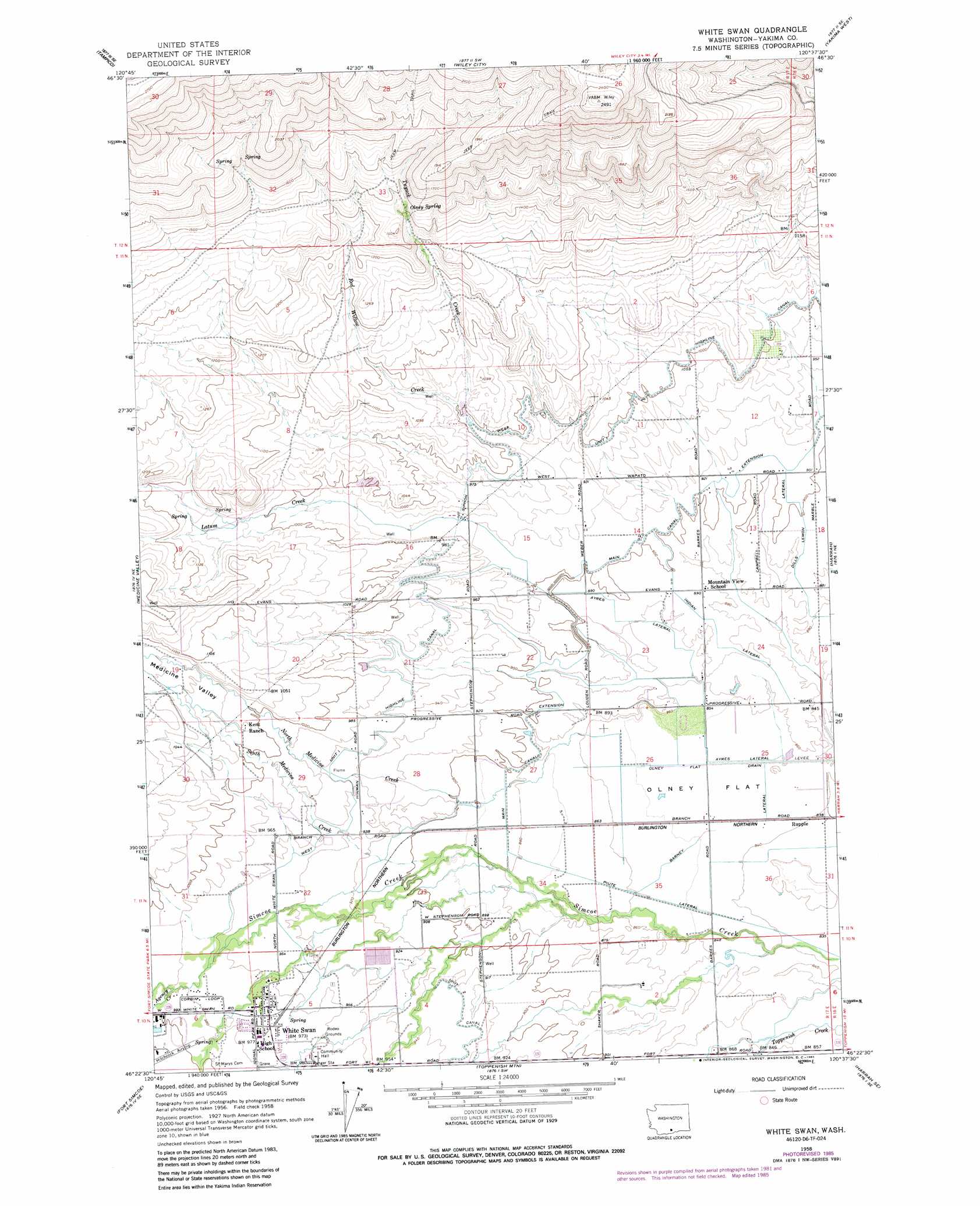
USGS Topo Quad 46120d6 - 1:24,000 scale
| Topo Map Name: | White Swan |
| USGS Topo Quad ID: | 46120d6 |
| Print Size: | ca. 21 1/4" wide x 27" high |
| Southeast Coordinates: | 46.375° N latitude / 120.625° W longitude |
| Map Center Coordinates: | 46.4375° N latitude / 120.6875° W longitude |
| U.S. State: | WA |
| Filename: | o46120d6.jpg |
| Download Map JPG Image: | White Swan topo map 1:24,000 scale |
| Map Type: | Topographic |
| Topo Series: | 7.5´ |
| Map Scale: | 1:24,000 |
| Source of Map Images: | United States Geological Survey (USGS) |
| Alternate Map Versions: |
White Swan WA 1958, updated 1960 Download PDF Buy paper map White Swan WA 1958, updated 1968 Download PDF Buy paper map White Swan WA 1958, updated 1985 Download PDF Buy paper map White Swan WA 2011 Download PDF Buy paper map White Swan WA 2013 Download PDF Buy paper map |
1:24,000 Topo Quads surrounding White Swan
Weddle Canyon |
Tieton |
Naches |
Selah |
Pomona |
Pine Mountain |
Tampico |
Wiley City |
Yakima West |
Yakima East |
Yesmowit Canyon |
Medicine Valley |
White Swan |
Harrah |
Wapato |
Willy Dick Canyon |
Fort Simcoe |
Toppenish Mountain |
Harrah Se |
Toppenish Sw |
Mckays Butte |
Camas Patch |
Logy Creek Falls |
Logy Creek Ne |
Poisel Butte Nw |
> Back to 46120a1 at 1:100,000 scale
> Back to 46120a1 at 1:250,000 scale
> Back to U.S. Topo Maps home
White Swan topo map: Gazetteer
White Swan: Airports
Harrah Airport elevation 259m 849′Hitchcock Airstrip elevation 308m 1010′
White Swan: Canals
Ayres Lateral elevation 269m 882′Barney Pacific Lateral elevation 259m 849′
Indian Lateral elevation 273m 895′
Main Canal Extension elevation 277m 908′
West Unit One Highline Canal elevation 301m 987′
White Swan: Flats
Olney Flat elevation 260m 853′White Swan: Populated Places
Rupple elevation 257m 843′White Swan elevation 295m 967′
White Swan: Springs
Olney Spring elevation 436m 1430′White Swan: Streams
Agency Creek elevation 299m 980′Latum Creek elevation 296m 971′
North Medicine Creek elevation 263m 862′
Red Willow Creek elevation 306m 1003′
South Medicine Creek elevation 272m 892′
Tuyuck Creek elevation 305m 1000′
White Swan: Valleys
Medicine Valley elevation 263m 862′Yakima Valley elevation 263m 862′
White Swan digital topo map on disk
Buy this White Swan topo map showing relief, roads, GPS coordinates and other geographical features, as a high-resolution digital map file on DVD: