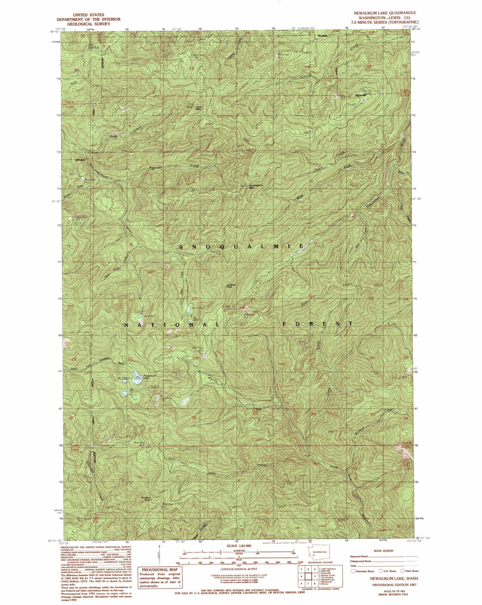
Newaukum Lake Topo Map Washington
To zoom in, hover over the map of Newaukum Lake
USGS Topo Quad 46122f4 - 1:24,000 scale
| Topo Map Name: | Newaukum Lake |
| USGS Topo Quad ID: | 46122f4 |
| Print Size: | ca. 21 1/4" wide x 27" high |
| Southeast Coordinates: | 46.625° N latitude / 122.375° W longitude |
| Map Center Coordinates: | 46.6875° N latitude / 122.4375° W longitude |
| U.S. State: | WA |
| Filename: | o46122f4.jpg |
| Download Map JPG Image: | Newaukum Lake topo map 1:24,000 scale |
| Map Type: | Topographic |
| Topo Series: | 7.5´ |
| Map Scale: | 1:24,000 |
| Source of Map Images: | United States Geological Survey (USGS) |
| Alternate Map Versions: |
Newaukum Lake WA 1987, updated 1987 Download PDF Buy paper map Newaukum Lake WA 1987, updated 1993 Download PDF Buy paper map Newaukum Lake WA 1998, updated 2003 Download PDF Buy paper map Newaukum Lake WA 2011 Download PDF Buy paper map Newaukum Lake WA 2013 Download PDF Buy paper map |
| FStopo: | US Forest Service topo Newaukum Lake is available: Download FStopo PDF Download FStopo TIF |
1:24,000 Topo Quads surrounding Newaukum Lake
Tenalquot Prarie |
Mckenna |
Harts Lake |
Tanwax Lake |
Lake Kapowsin |
Vail |
Lake Lawrence |
Bald Hill |
Eatonville |
Elbe |
Onalaska Nw |
Bernier Creek |
Newaukum Lake |
The Rockies |
Mineral |
Onalaska |
Mayfield Lake |
Mossyrock |
Morton |
Glenoma |
Eden Valley |
Hatchet Mountain |
Coyote Mountain |
Winters Mountain |
Vanson Peak |
> Back to 46122e1 at 1:100,000 scale
> Back to 46122a1 at 1:250,000 scale
> Back to U.S. Topo Maps home
Newaukum Lake topo map: Gazetteer
Newaukum Lake: Lakes
Newaukum Lake elevation 909m 2982′Newaukum Lake: Streams
Bigwater Creek elevation 442m 1450′Deer Creek elevation 582m 1909′
Drop Creek elevation 390m 1279′
Hard Creek elevation 467m 1532′
Jesse Creek elevation 424m 1391′
Little Creek elevation 448m 1469′
Mine Creek elevation 486m 1594′
Range Creek elevation 411m 1348′
Rockies Creek elevation 434m 1423′
Thorn Creek elevation 433m 1420′
Three Forks Creek elevation 510m 1673′
Ware Creek elevation 442m 1450′
West Fork Deschutes River elevation 423m 1387′
Winnie Creek elevation 429m 1407′
Newaukum Lake: Summits
Bald Mountain elevation 1103m 3618′Huckleberry Mountain elevation 1150m 3772′
Lookout Peak elevation 1039m 3408′
Rooster Rock elevation 1068m 3503′
Newaukum Lake digital topo map on disk
Buy this Newaukum Lake topo map showing relief, roads, GPS coordinates and other geographical features, as a high-resolution digital map file on DVD: