Muggun Creek Topo Map Michigan
To zoom in, hover over the map of Muggun Creek
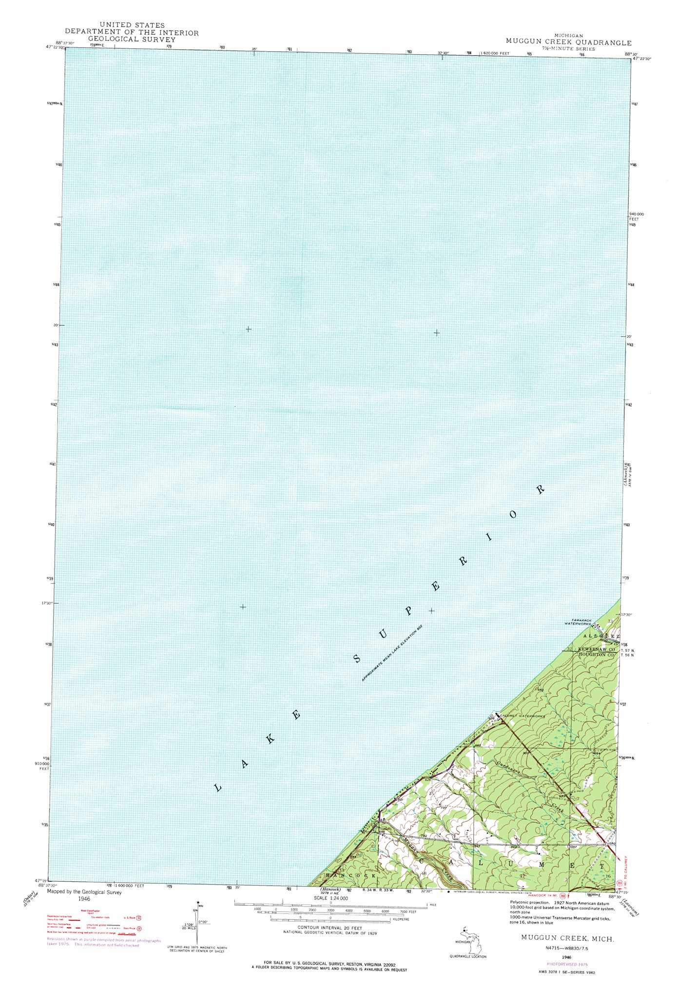
USGS Topo Quad 47088c5 - 1:24,000 scale
| Topo Map Name: | Muggun Creek |
| USGS Topo Quad ID: | 47088c5 |
| Print Size: | ca. 21 1/4" wide x 27" high |
| Southeast Coordinates: | 47.25° N latitude / 88.5° W longitude |
| Map Center Coordinates: | 47.3125° N latitude / 88.5625° W longitude |
| U.S. State: | MI |
| Filename: | o47088c5.jpg |
| Download Map JPG Image: | Muggun Creek topo map 1:24,000 scale |
| Map Type: | Topographic |
| Topo Series: | 7.5´ |
| Map Scale: | 1:24,000 |
| Source of Map Images: | United States Geological Survey (USGS) |
| Alternate Map Versions: |
Muggun Creek MI 1946, updated 1967 Download PDF Buy paper map Muggun Creek MI 1946, updated 1976 Download PDF Buy paper map Muggun Creek MI 1948, updated 1948 Download PDF Buy paper map Muggun Creek MI 2011 Download PDF Buy paper map Muggun Creek MI 2014 Download PDF Buy paper map Muggun Creek MI 2017 Download PDF Buy paper map |
1:24,000 Topo Quads surrounding Muggun Creek
Phoenix |
||||
Muggun Creek |
Ahmeek |
Mohawk |
||
Beacon Hill |
Oskar |
Hancock |
Laurium |
Rice Lake |
Graveraet River |
South Range |
Chassell |
Point Mills |
Traverse Island |
> Back to 47088a1 at 1:100,000 scale
> Back to 47088a1 at 1:250,000 scale
> Back to U.S. Topo Maps home
Muggun Creek topo map: Gazetteer
Muggun Creek: Streams
Brewery Creek elevation 184m 603′Gardeners Creek elevation 184m 603′
Muggun Creek elevation 186m 610′
Muggun Creek digital topo map on disk
Buy this Muggun Creek topo map showing relief, roads, GPS coordinates and other geographical features, as a high-resolution digital map file on DVD: