Phoenix Topo Map Michigan
To zoom in, hover over the map of Phoenix
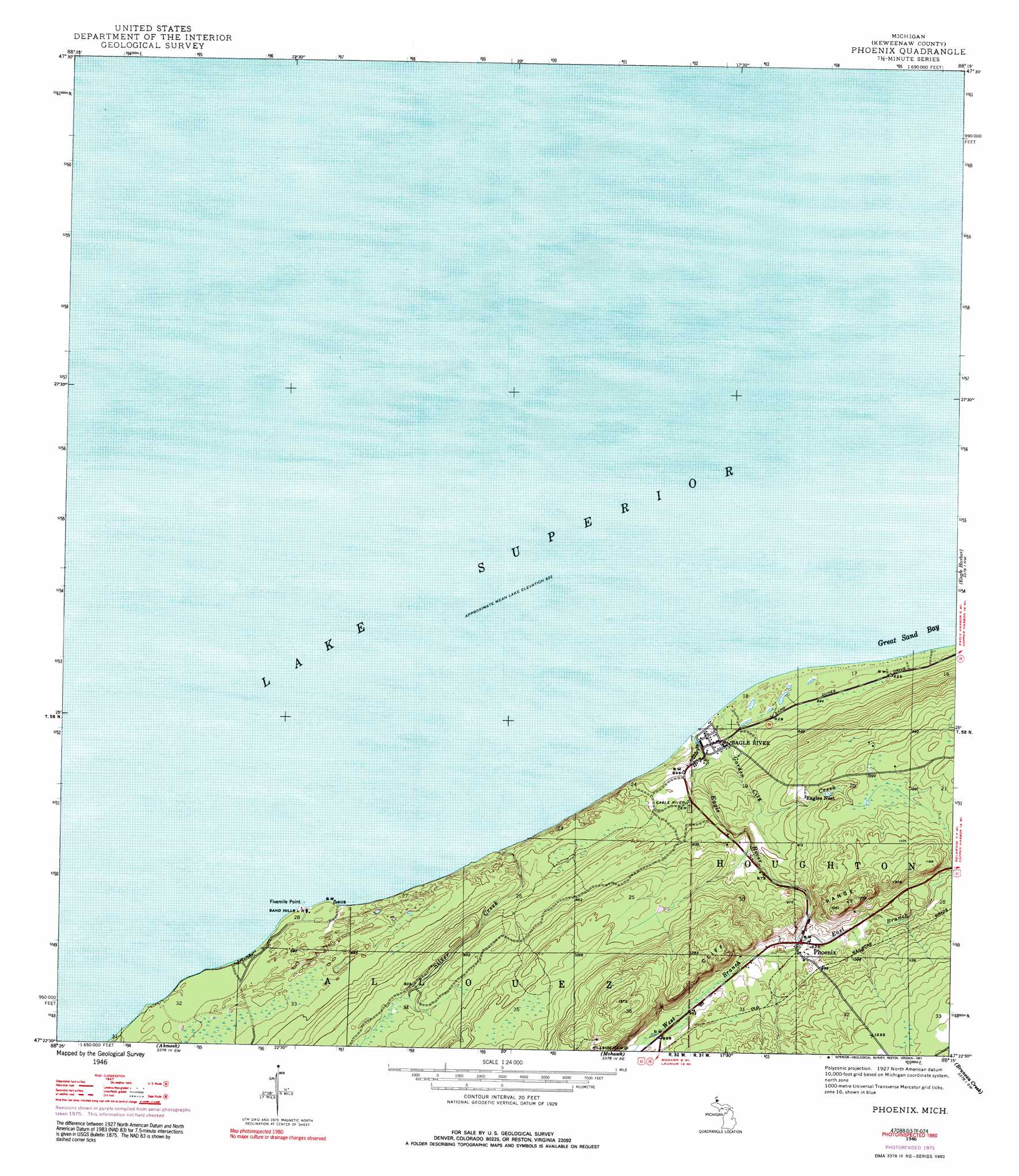
USGS Topo Quad 47088d3 - 1:24,000 scale
| Topo Map Name: | Phoenix |
| USGS Topo Quad ID: | 47088d3 |
| Print Size: | ca. 21 1/4" wide x 27" high |
| Southeast Coordinates: | 47.375° N latitude / 88.25° W longitude |
| Map Center Coordinates: | 47.4375° N latitude / 88.3125° W longitude |
| U.S. State: | MI |
| Filename: | o47088d3.jpg |
| Download Map JPG Image: | Phoenix topo map 1:24,000 scale |
| Map Type: | Topographic |
| Topo Series: | 7.5´ |
| Map Scale: | 1:24,000 |
| Source of Map Images: | United States Geological Survey (USGS) |
| Alternate Map Versions: |
Phoenix MI 1946, updated 1965 Download PDF Buy paper map Phoenix MI 1946, updated 1975 Download PDF Buy paper map Phoenix MI 1946, updated 1976 Download PDF Buy paper map Phoenix MI 1946, updated 1991 Download PDF Buy paper map Phoenix MI 1947 Download PDF Buy paper map Phoenix MI 2011 Download PDF Buy paper map Phoenix MI 2014 Download PDF Buy paper map Phoenix MI 2017 Download PDF Buy paper map |
1:24,000 Topo Quads surrounding Phoenix
Phoenix |
Eagle Harbor |
Delaware |
||
Muggun Creek |
Ahmeek |
Mohawk |
Bruneau Creek |
Deer Lake |
Hancock |
Laurium |
Rice Lake |
Gay |
> Back to 47088a1 at 1:100,000 scale
> Back to 47088a1 at 1:250,000 scale
> Back to U.S. Topo Maps home
Phoenix topo map: Gazetteer
Phoenix: Bars
Eagle River Shoals elevation 183m 600′Phoenix: Capes
Five Mile Point elevation 183m 600′Phoenix: Falls
Eagle River Falls elevation 195m 639′Phoenix: Parks
Eagle River Historical Marker elevation 194m 636′Lake Shore Drive Bridge Historical Marker elevation 194m 636′
Phoenix: Populated Places
Eagle Nest elevation 287m 941′Eagle River elevation 198m 649′
Phoenix elevation 281m 921′
Vaughsville elevation 290m 951′
Phoenix: Post Offices
Clifton Post Office (historical) elevation 298m 977′Eagle River Post Office elevation 197m 646′
Phoenix Post Office (historical) elevation 281m 921′
Phoenix: Ridges
Cliff Range elevation 399m 1309′Phoenix: Streams
Eagle River elevation 185m 606′East Branch Eagle River elevation 280m 918′
Garden City Creek elevation 187m 613′
Silver Creek elevation 192m 629′
West Branch Eagle River elevation 280m 918′
Phoenix digital topo map on disk
Buy this Phoenix topo map showing relief, roads, GPS coordinates and other geographical features, as a high-resolution digital map file on DVD: