Dry Blood Creek East Topo Map Montana
To zoom in, hover over the map of Dry Blood Creek East
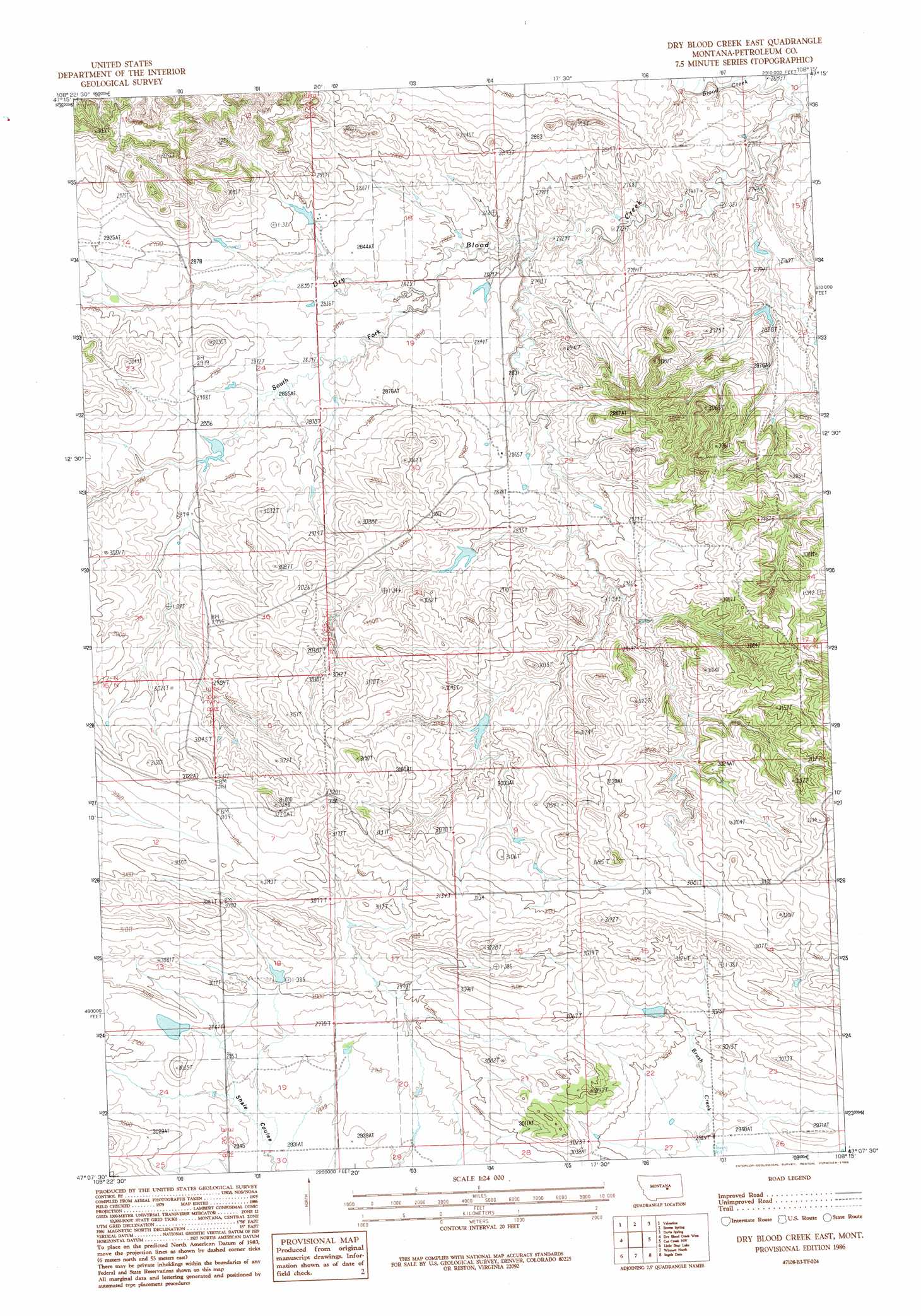
USGS Topo Quad 47108b3 - 1:24,000 scale
| Topo Map Name: | Dry Blood Creek East |
| USGS Topo Quad ID: | 47108b3 |
| Print Size: | ca. 21 1/4" wide x 27" high |
| Southeast Coordinates: | 47.125° N latitude / 108.25° W longitude |
| Map Center Coordinates: | 47.1875° N latitude / 108.3125° W longitude |
| U.S. State: | MT |
| Filename: | o47108b3.jpg |
| Download Map JPG Image: | Dry Blood Creek East topo map 1:24,000 scale |
| Map Type: | Topographic |
| Topo Series: | 7.5´ |
| Map Scale: | 1:24,000 |
| Source of Map Images: | United States Geological Survey (USGS) |
| Alternate Map Versions: |
Dry Blood Creek East MT 1986 Download PDF Buy paper map Dry Blood Creek East MT 2011 Download PDF Buy paper map Dry Blood Creek East MT 2014 Download PDF Buy paper map |
1:24,000 Topo Quads surrounding Dry Blood Creek East
Kachia Reservoir |
Pipes Coulee |
Dovetail Butte |
Weingart Place Nw |
Weingart Place |
Bear Creek Reservoir Se |
Valentine |
Brown Spring |
Davis Spring |
Kirkendal Flat |
Wild Horse Lake |
Dry Blood Creek West |
Dry Blood Creek East |
Cat Creek Nw |
Tin Can Hill |
Teigen |
Little Bear Lake |
Winnett North |
Ingals Dam |
Cat Creek |
Snoose Creek |
Yellow Water Res. |
Winnett South |
Petrolia Lake |
Breed Spring |
> Back to 47108a1 at 1:100,000 scale
> Back to 47108a1 at 1:250,000 scale
> Back to U.S. Topo Maps home
Dry Blood Creek East topo map: Gazetteer
Dry Blood Creek East: Dams
Brady Number 2 Dam elevation 921m 3021′Brady Number 4 Dam elevation 879m 2883′
Dry Blood Dam elevation 886m 2906′
Resettlement FSA Number 3 Dam elevation 917m 3008′
South Fork Dry Blood Creek Dam elevation 876m 2874′
Weingart Lane and Livestock Number 1 Dam elevation 880m 2887′
Dry Blood Creek East: Streams
Dry Blood Creek elevation 815m 2673′South Fork Dry Blood Creek elevation 855m 2805′
Dry Blood Creek East: Wells
17N27E30CAC_01 Well elevation 869m 2851′17N27E34AAD_01 Well elevation 855m 2805′
Dry Blood Creek East digital topo map on disk
Buy this Dry Blood Creek East topo map showing relief, roads, GPS coordinates and other geographical features, as a high-resolution digital map file on DVD: