Breed Spring Topo Map Montana
To zoom in, hover over the map of Breed Spring
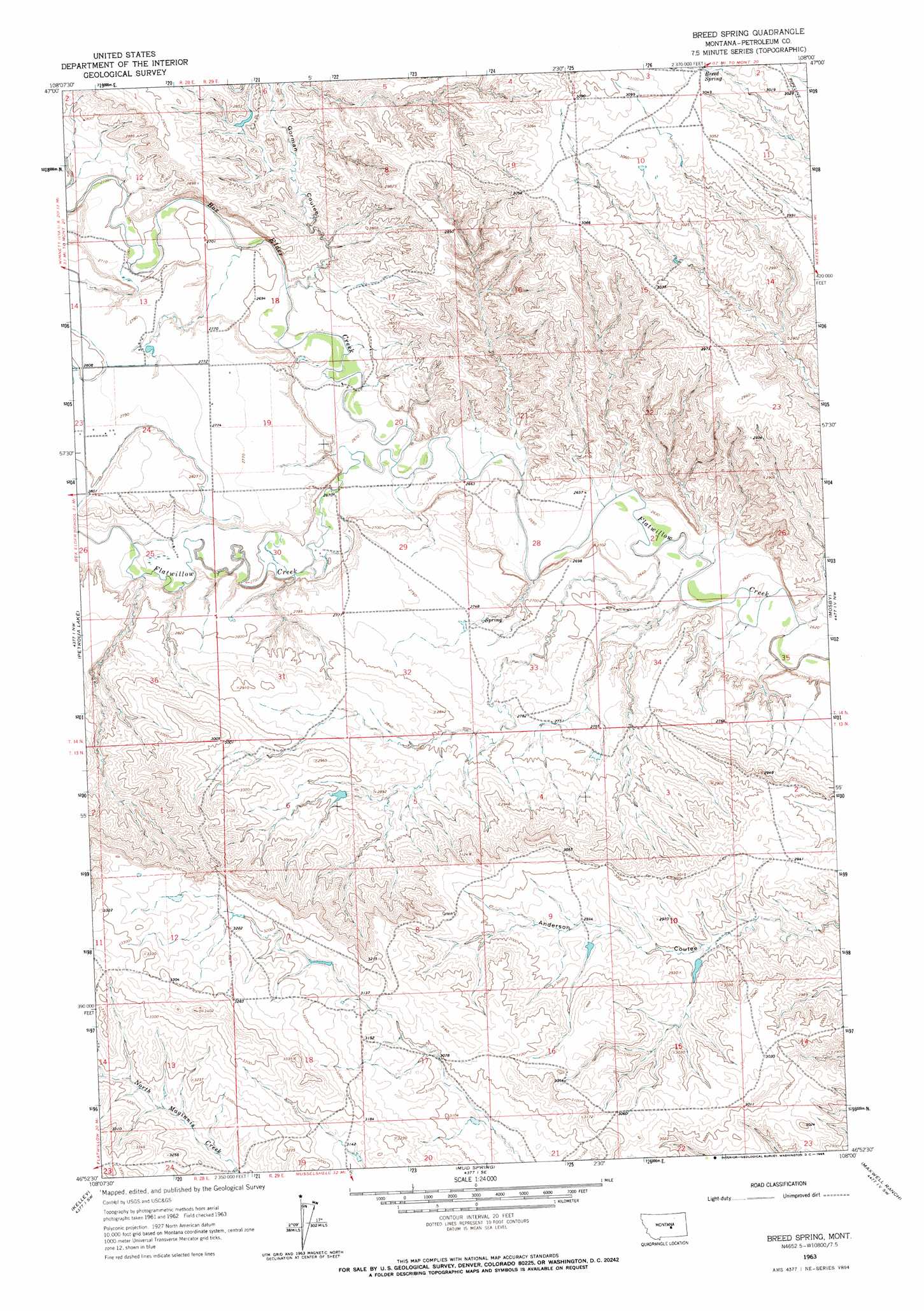
USGS Topo Quad 46108h1 - 1:24,000 scale
| Topo Map Name: | Breed Spring |
| USGS Topo Quad ID: | 46108h1 |
| Print Size: | ca. 21 1/4" wide x 27" high |
| Southeast Coordinates: | 46.875° N latitude / 108° W longitude |
| Map Center Coordinates: | 46.9375° N latitude / 108.0625° W longitude |
| U.S. State: | MT |
| Filename: | o46108h1.jpg |
| Download Map JPG Image: | Breed Spring topo map 1:24,000 scale |
| Map Type: | Topographic |
| Topo Series: | 7.5´ |
| Map Scale: | 1:24,000 |
| Source of Map Images: | United States Geological Survey (USGS) |
| Alternate Map Versions: |
Breed Spring MT 1963, updated 1966 Download PDF Buy paper map Breed Spring MT 2011 Download PDF Buy paper map Breed Spring MT 2014 Download PDF Buy paper map |
1:24,000 Topo Quads surrounding Breed Spring
Dry Blood Creek East |
Cat Creek Nw |
Tin Can Hill |
Bridge Coulee |
Lelig Coulee |
Winnett North |
Ingals Dam |
Cat Creek |
Fail Ranch |
Barney Pinnacle |
Winnett South |
Petrolia Lake |
Breed Spring |
Mosby |
Hill Ranch |
Crowley Dam |
Kelley |
Mud Spring |
Maxwell Ranch |
Mosby Se |
Jim Coulee |
Musselshell Nw |
Akers Ranch |
Melstone Nw |
Melstone Ne |
> Back to 46108e1 at 1:100,000 scale
> Back to 46108a1 at 1:250,000 scale
> Back to U.S. Topo Maps home
Breed Spring topo map: Gazetteer
Breed Spring: Dams
Bethel Number 11 Dam elevation 886m 2906′Bethel Number 4 Dam elevation 912m 2992′
Damschen Number 2 Dam elevation 964m 3162′
H Stensvad Number 1 Dam elevation 885m 2903′
Breed Spring: Post Offices
Petrolia Post Office (historical) elevation 846m 2775′Breed Spring: Springs
Breed Spring elevation 928m 3044′Breed Spring: Streams
Box Elder Creek elevation 810m 2657′Breed Spring: Valleys
Gorman Coulee elevation 822m 2696′Breed Spring digital topo map on disk
Buy this Breed Spring topo map showing relief, roads, GPS coordinates and other geographical features, as a high-resolution digital map file on DVD: