Craig Topo Map Montana
To zoom in, hover over the map of Craig
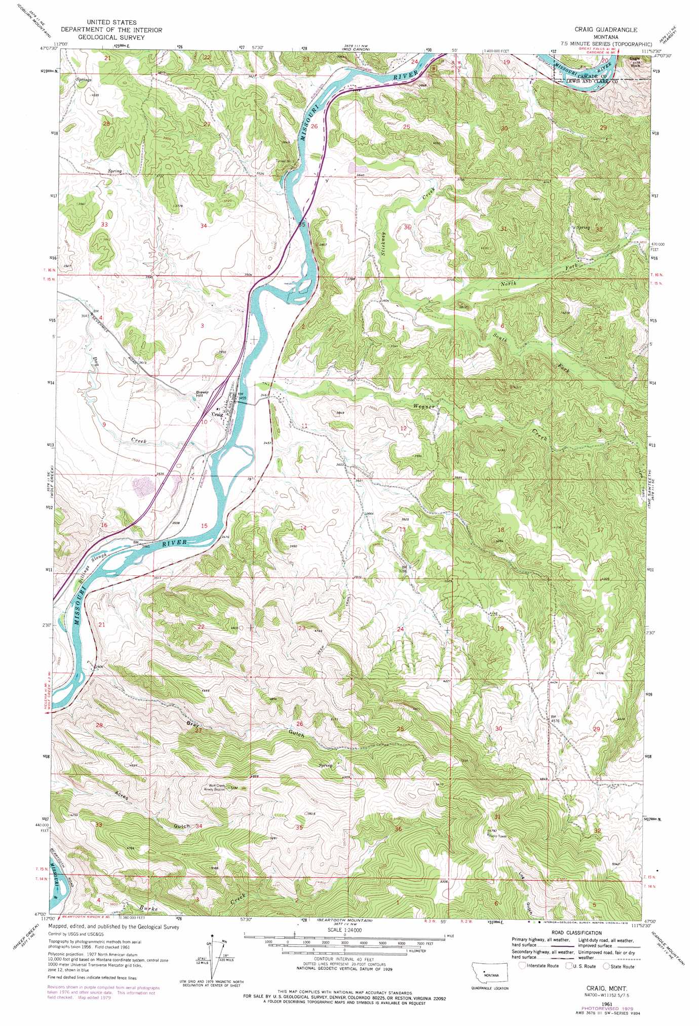
USGS Topo Quad 47111a8 - 1:24,000 scale
| Topo Map Name: | Craig |
| USGS Topo Quad ID: | 47111a8 |
| Print Size: | ca. 21 1/4" wide x 27" high |
| Southeast Coordinates: | 47° N latitude / 111.875° W longitude |
| Map Center Coordinates: | 47.0625° N latitude / 111.9375° W longitude |
| U.S. State: | MT |
| Filename: | o47111a8.jpg |
| Download Map JPG Image: | Craig topo map 1:24,000 scale |
| Map Type: | Topographic |
| Topo Series: | 7.5´ |
| Map Scale: | 1:24,000 |
| Source of Map Images: | United States Geological Survey (USGS) |
| Alternate Map Versions: |
Craig MT 1961, updated 1964 Download PDF Buy paper map Craig MT 1961, updated 1979 Download PDF Buy paper map Craig MT 2011 Download PDF Buy paper map Craig MT 2014 Download PDF Buy paper map |
1:24,000 Topo Quads surrounding Craig
Bowmans Corners |
Henry Creek |
Telegraph Mountain |
Mount Cecelia |
Cascade |
Comb Rock |
Coburn Mountain |
Mid Canon |
Hardy |
Rocky Reef |
Roberts Mountain |
Wolf Creek |
Craig |
The Sawteeth |
Hound Creek Reservoir |
Mitchell Mountain |
Sheep Creek |
Beartooth Mountain |
Candle Mountain |
Middle Creek Lake |
Silver City |
Rattlesnake Mountain |
Upper Holter Lake |
Nelson |
Hogback Mountain |
> Back to 47111a1 at 1:100,000 scale
> Back to 47110a1 at 1:250,000 scale
> Back to U.S. Topo Maps home
Craig topo map: Gazetteer
Craig: Bridges
Craig Bridge elevation 1052m 3451′Wegner Creek Bridge elevation 1056m 3464′
Craig: Crossings
Interchange 234 elevation 1056m 3464′Craig: Populated Places
Craig elevation 1055m 3461′Craig: Post Offices
Craig Post Office (historical) elevation 1055m 3461′Craig: Streams
Billings Slough elevation 1054m 3458′Dog Creek elevation 1055m 3461′
North Fork Stickney Creek elevation 1093m 3585′
South Fork Stickney Creek elevation 1093m 3585′
Stickney Creek elevation 1049m 3441′
Wegner Creek elevation 1052m 3451′
Craig: Summits
Brewer Hill elevation 1072m 3517′Eagle Rock elevation 1350m 4429′
Craig: Tunnels
Tunnel Number 3 elevation 1095m 3592′Craig: Valleys
Bray Gulch elevation 1061m 3480′Craig digital topo map on disk
Buy this Craig topo map showing relief, roads, GPS coordinates and other geographical features, as a high-resolution digital map file on DVD: