Rock Lake Topo Map Washington
To zoom in, hover over the map of Rock Lake
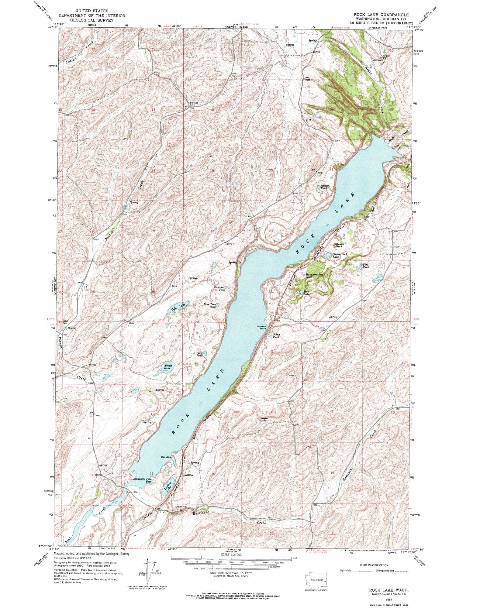
USGS Topo Quad 47117b6 - 1:24,000 scale
| Topo Map Name: | Rock Lake |
| USGS Topo Quad ID: | 47117b6 |
| Print Size: | ca. 21 1/4" wide x 27" high |
| Southeast Coordinates: | 47.125° N latitude / 117.625° W longitude |
| Map Center Coordinates: | 47.1875° N latitude / 117.6875° W longitude |
| U.S. State: | WA |
| Filename: | o47117b6.jpg |
| Download Map JPG Image: | Rock Lake topo map 1:24,000 scale |
| Map Type: | Topographic |
| Topo Series: | 7.5´ |
| Map Scale: | 1:24,000 |
| Source of Map Images: | United States Geological Survey (USGS) |
| Alternate Map Versions: |
Rock Lake WA 1964, updated 1965 Download PDF Buy paper map Rock Lake WA 2011 Download PDF Buy paper map Rock Lake WA 2014 Download PDF Buy paper map |
1:24,000 Topo Quads surrounding Rock Lake
Sassin |
Tyler |
Lance Hills |
Cheney |
Spangle West |
Sprague |
Fishtrap Lake |
Amber |
Chapman Lake |
Plaza |
Lamont |
Lamont Ne |
Rock Lake |
Pine City |
Malden |
Revere |
Texas Lake |
Ewan |
Saint John |
Thornton |
Honn Lakes |
Winona |
Endicott |
Thera |
Diamond |
> Back to 47117a1 at 1:100,000 scale
> Back to 47116a1 at 1:250,000 scale
> Back to U.S. Topo Maps home
Rock Lake topo map: Gazetteer
Rock Lake: Bays
Slaughter Pen Bay elevation 527m 1729′The Arm elevation 527m 1729′
Rock Lake: Beaches
Johnsons Beach elevation 528m 1732′Rock Lake: Lakes
Alkali Lake elevation 570m 1870′Campbell Pond elevation 599m 1965′
Castle Rock Lake elevation 588m 1929′
Egg Pond elevation 567m 1860′
Fire Pond elevation 631m 2070′
Johns Pond elevation 614m 2014′
Lavista Lake elevation 527m 1729′
Miller Pond elevation 608m 1994′
Mud Lake elevation 581m 1906′
Pine Tree Pond elevation 596m 1955′
Rock Lake elevation 527m 1729′
Slaughter Pen Pond elevation 600m 1968′
Tule Lake elevation 582m 1909′
Rock Lake: Pillars
Castle Rock elevation 643m 2109′Rock Lake: Populated Places
Lavista elevation 552m 1811′Rock Lake: Streams
Negro Creek elevation 533m 1748′Rock Lake digital topo map on disk
Buy this Rock Lake topo map showing relief, roads, GPS coordinates and other geographical features, as a high-resolution digital map file on DVD: