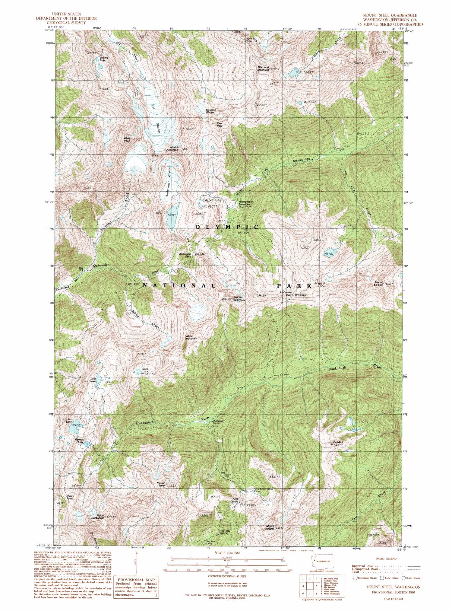
Mount Steel Topo Map Washington
To zoom in, hover over the map of Mount Steel
USGS Topo Quad 47123f3 - 1:24,000 scale
| Topo Map Name: | Mount Steel |
| USGS Topo Quad ID: | 47123f3 |
| Print Size: | ca. 21 1/4" wide x 27" high |
| Southeast Coordinates: | 47.625° N latitude / 123.25° W longitude |
| Map Center Coordinates: | 47.6875° N latitude / 123.3125° W longitude |
| U.S. State: | WA |
| Filename: | o47123f3.jpg |
| Download Map JPG Image: | Mount Steel topo map 1:24,000 scale |
| Map Type: | Topographic |
| Topo Series: | 7.5´ |
| Map Scale: | 1:24,000 |
| Source of Map Images: | United States Geological Survey (USGS) |
| Alternate Map Versions: |
Mount Steel WA 1990, updated 1990 Download PDF Buy paper map Mount Steel WA 1999, updated 2003 Download PDF Buy paper map Mount Steel WA 2011 Download PDF Buy paper map Mount Steel WA 2014 Download PDF Buy paper map |
1:24,000 Topo Quads surrounding Mount Steel
Hurricane Hill |
Mount Angeles |
Maiden Peak |
Tyler Peak |
Mount Zion |
Mount Queets |
Mccartney Peak |
Wellesley Peak |
Mount Deception |
Mount Townsend |
Mount Christie |
Chimney Peak |
Mount Steel |
The Brothers |
Mount Jupiter |
Mount Hoquiam |
Mount Olsen |
Mount Skokomish |
Mount Washington |
Eldon |
Wynoochee Lake |
Mount Tebo |
Lightning Peak |
Hoodsport |
Lilliwaup |
> Back to 47123e1 at 1:100,000 scale
> Back to 47122a1 at 1:250,000 scale
> Back to U.S. Topo Maps home
Mount Steel topo map: Gazetteer
Mount Steel: Flats
Honeymoon Meadows elevation 1080m 3543′Mount Steel: Gaps
Anderson Pass elevation 1365m 4478′First Divide elevation 1405m 4609′
La Crosse Pass elevation 1553m 5095′
O'Neil Pass elevation 1518m 4980′
Mount Steel: Glaciers
Anderson Glacier elevation 1595m 5232′Eel Glacier elevation 1687m 5534′
Hanging Glacier elevation 1595m 5232′
Mount Steel: Lakes
Buck Lake elevation 1555m 5101′Hart Lake elevation 1488m 4881′
Iceberg Lake elevation 1850m 6069′
Lake LaCrosse elevation 1455m 4773′
Mount Steel: Streams
Anderson Creek elevation 734m 2408′Elk Lick Creek elevation 811m 2660′
White Creek elevation 854m 2801′
White Creek elevation 852m 2795′
Mount Steel: Summits
Diamond Mountain elevation 2039m 6689′East Peak elevation 1826m 5990′
Mount Anderson elevation 2228m 7309′
Mount Duckabush elevation 1751m 5744′
Mount Elk Lick elevation 1974m 6476′
Mount Hopper elevation 1761m 5777′
Mount LaCrosse elevation 1843m 6046′
Mount Steel elevation 1866m 6122′
West Peak elevation 2169m 7116′
White Mountain elevation 1925m 6315′
Mount Steel digital topo map on disk
Buy this Mount Steel topo map showing relief, roads, GPS coordinates and other geographical features, as a high-resolution digital map file on DVD: