Bennett Lake Nw Topo Map Montana
To zoom in, hover over the map of Bennett Lake Nw
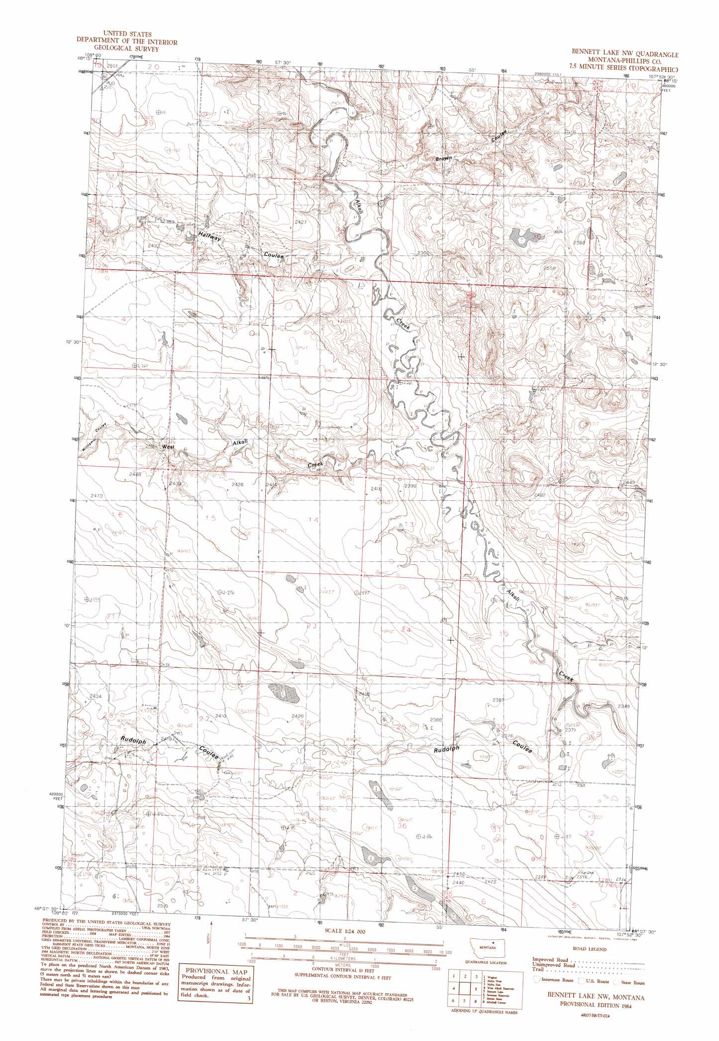
USGS Topo Quad 48107b8 - 1:24,000 scale
| Topo Map Name: | Bennett Lake Nw |
| USGS Topo Quad ID: | 48107b8 |
| Print Size: | ca. 21 1/4" wide x 27" high |
| Southeast Coordinates: | 48.125° N latitude / 107.875° W longitude |
| Map Center Coordinates: | 48.1875° N latitude / 107.9375° W longitude |
| U.S. State: | MT |
| Filename: | o48107b8.jpg |
| Download Map JPG Image: | Bennett Lake Nw topo map 1:24,000 scale |
| Map Type: | Topographic |
| Topo Series: | 7.5´ |
| Map Scale: | 1:24,000 |
| Source of Map Images: | United States Geological Survey (USGS) |
| Alternate Map Versions: |
Bennett Lake NW MT 1984, updated 1984 Download PDF Buy paper map Bennett Lake NW MT 2011 Download PDF Buy paper map Bennett Lake NW MT 2014 Download PDF Buy paper map |
1:24,000 Topo Quads surrounding Bennett Lake Nw
Dodson |
Dodson Ne |
Malta Nw |
Malta Ne |
Lake Bowdoin |
Cow Creek |
Wagner |
Malta West |
Malta East |
Clanton Coulee |
Wild Horse Reservoir |
West Alkali Reservoir |
Bennett Lake Nw |
Bennett Lake |
Content Nw |
Phillips |
Seymour Reservoir |
Button Butte |
Mitchell Corner |
Horse Pasture Coulee |
Veseth Reservoir |
Holzhey Reservoir |
Emond Ranch |
Whitcomb Lake |
Sheep Coulee |
> Back to 48107a1 at 1:100,000 scale
> Back to 48106a1 at 1:250,000 scale
> Back to U.S. Topo Maps home
Bennett Lake Nw topo map: Gazetteer
Bennett Lake Nw: Basins
Rudolph Valley elevation 738m 2421′Bennett Lake Nw: Dams
Slim Dam elevation 757m 2483′Bennett Lake Nw: Streams
West Alkali Creek elevation 714m 2342′Bennett Lake Nw: Valleys
Brown Coulee elevation 705m 2312′Halfway Coulee elevation 720m 2362′
Rudolph Coulee elevation 727m 2385′
Williams Coulee elevation 748m 2454′
Bennett Lake Nw digital topo map on disk
Buy this Bennett Lake Nw topo map showing relief, roads, GPS coordinates and other geographical features, as a high-resolution digital map file on DVD:
Eastern Montana & Western North Dakota
Buy digital topo maps: Eastern Montana & Western North Dakota