Tule Lake Topo Map Montana
To zoom in, hover over the map of Tule Lake
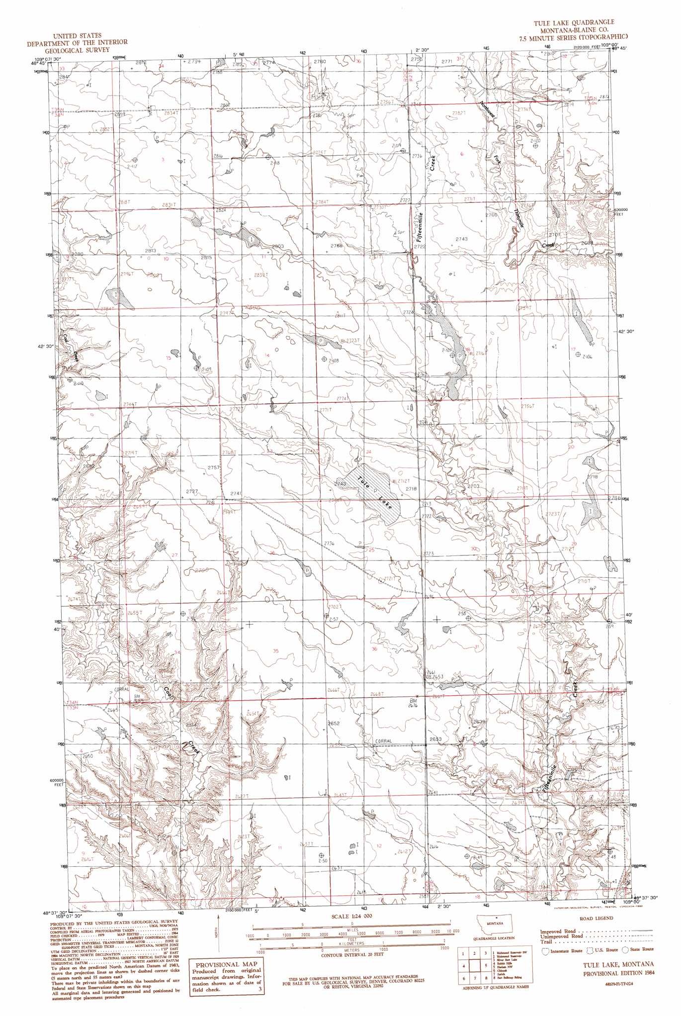
USGS Topo Quad 48109f1 - 1:24,000 scale
| Topo Map Name: | Tule Lake |
| USGS Topo Quad ID: | 48109f1 |
| Print Size: | ca. 21 1/4" wide x 27" high |
| Southeast Coordinates: | 48.625° N latitude / 109° W longitude |
| Map Center Coordinates: | 48.6875° N latitude / 109.0625° W longitude |
| U.S. State: | MT |
| Filename: | o48109f1.jpg |
| Download Map JPG Image: | Tule Lake topo map 1:24,000 scale |
| Map Type: | Topographic |
| Topo Series: | 7.5´ |
| Map Scale: | 1:24,000 |
| Source of Map Images: | United States Geological Survey (USGS) |
| Alternate Map Versions: |
Tule Lake MT 1984, updated 1984 Download PDF Buy paper map Tule Lake MT 1984, updated 1992 Download PDF Buy paper map Tule Lake MT 2011 Download PDF Buy paper map Tule Lake MT 2014 Download PDF Buy paper map |
1:24,000 Topo Quads surrounding Tule Lake
North Chinook Reservoir Ne |
Richmond Reservoir Nw |
Richmond Reservoir Ne |
Irvins Coulee |
Aubrey Dam |
North Chinook Res. |
Richmond Reservoir Sw |
Richmond Reservoir |
Silver Bow Lake |
Silver Bow Spring |
Telescope Coulee |
Rabbit Hills |
Tule Lake |
Harlem Nw |
East Butte |
Lohman Se |
Chinook |
Zurich |
Fort Belknap Siding |
Harlem |
Sayer Butte |
Cleveland Nw |
Cleveland Ne |
Big Coulee |
Fort Belknap Agency |
> Back to 48109e1 at 1:100,000 scale
> Back to 48108a1 at 1:250,000 scale
> Back to U.S. Topo Maps home
Tule Lake topo map: Gazetteer
Tule Lake: Dams
BR-12 Dam elevation 832m 2729′Jasper Dam elevation 829m 2719′
Lost Again Dam elevation 814m 2670′
Tule Lake: Lakes
Fifteen Mile Lake elevation 829m 2719′Tule Lake: Reservoirs
Tule Lake elevation 828m 2716′Tule Lake digital topo map on disk
Buy this Tule Lake topo map showing relief, roads, GPS coordinates and other geographical features, as a high-resolution digital map file on DVD: