North Chinook Reservoir Ne Topo Map Montana
To zoom in, hover over the map of North Chinook Reservoir Ne
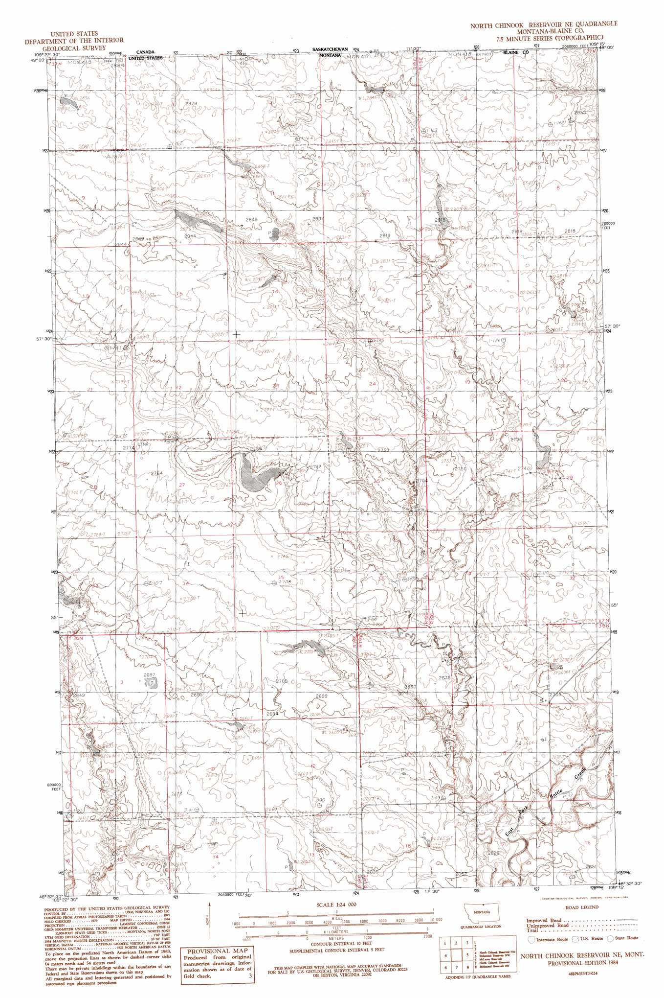
USGS Topo Quad 48109h3 - 1:24,000 scale
| Topo Map Name: | North Chinook Reservoir Ne |
| USGS Topo Quad ID: | 48109h3 |
| Print Size: | ca. 21 1/4" wide x 27" high |
| Southeast Coordinates: | 48.875° N latitude / 109.25° W longitude |
| Map Center Coordinates: | 48.9375° N latitude / 109.3125° W longitude |
| U.S. State: | MT |
| Filename: | o48109h3.jpg |
| Download Map JPG Image: | North Chinook Reservoir Ne topo map 1:24,000 scale |
| Map Type: | Topographic |
| Topo Series: | 7.5´ |
| Map Scale: | 1:24,000 |
| Source of Map Images: | United States Geological Survey (USGS) |
| Alternate Map Versions: |
North Chinook Reservoir NE MT 1984, updated 1984 Download PDF Buy paper map North Chinook Reservoir NE MT 2011 Download PDF Buy paper map North Chinook Reservoir NE MT 2014 Download PDF Buy paper map |
1:24,000 Topo Quads surrounding North Chinook Reservoir Ne
Lake Thibadeau Ne |
North Chinook Reservoir Nw |
North Chinook Reservoir Ne |
Richmond Reservoir Nw |
Richmond Reservoir Ne |
Lake Thibadeau |
Mclaren Reservoir |
North Chinook Res. |
Richmond Reservoir Sw |
Richmond Reservoir |
Havre Ne |
Reservoir Coulee |
Telescope Coulee |
Rabbit Hills |
Tule Lake |
> Back to 48109e1 at 1:100,000 scale
> Back to 48108a1 at 1:250,000 scale
> Back to U.S. Topo Maps home
North Chinook Reservoir Ne topo map: Gazetteer
North Chinook Reservoir Ne: Dams
BR-22 Dam elevation 859m 2818′BR-45 Dam elevation 841m 2759′
BR-55 Dam elevation 858m 2814′
Brave Warrior Dam elevation 820m 2690′
Thretening Times Dam elevation 839m 2752′
North Chinook Reservoir Ne: Populated Places
Norheim (historical) elevation 879m 2883′North Chinook Reservoir Ne: Post Offices
Norheim Post Office (historical) elevation 879m 2883′North Chinook Reservoir Ne digital topo map on disk
Buy this North Chinook Reservoir Ne topo map showing relief, roads, GPS coordinates and other geographical features, as a high-resolution digital map file on DVD: