Beaupre Coulee Topo Map Montana
To zoom in, hover over the map of Beaupre Coulee
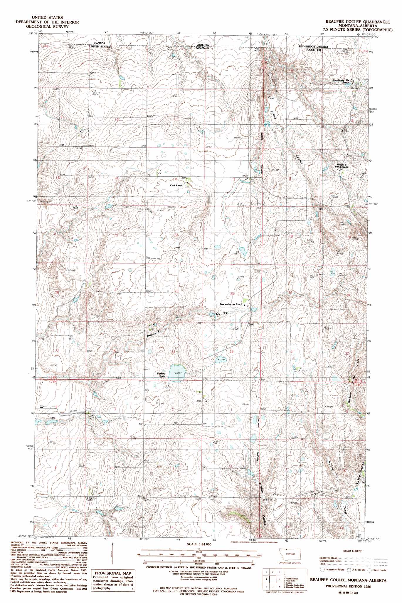
USGS Topo Quad 48111h6 - 1:24,000 scale
| Topo Map Name: | Beaupre Coulee |
| USGS Topo Quad ID: | 48111h6 |
| Print Size: | ca. 21 1/4" wide x 27" high |
| Southeast Coordinates: | 48.875° N latitude / 111.625° W longitude |
| Map Center Coordinates: | 48.9375° N latitude / 111.6875° W longitude |
| U.S. State: | MT |
| Filename: | o48111h6.jpg |
| Download Map JPG Image: | Beaupre Coulee topo map 1:24,000 scale |
| Map Type: | Topographic |
| Topo Series: | 7.5´ |
| Map Scale: | 1:24,000 |
| Source of Map Images: | United States Geological Survey (USGS) |
| Alternate Map Versions: |
Beaupre Coulee MT 1986, updated 1986 Download PDF Buy paper map Beaupre Coulee MT 2011 Download PDF Buy paper map Beaupre Coulee MT 2014 Download PDF Buy paper map |
1:24,000 Topo Quads surrounding Beaupre Coulee
Sunburst |
Willshaw Flats |
Beaupre Coulee |
West Butte |
Fey Lakes |
Kevin North |
Ferdig |
Fivemile Coulee West |
Fivemile Coulee East |
Cameron Lake |
Kevin South |
Oilmont |
Antelope Coulee Nw |
Johannson Coulee |
Hawthorne School |
> Back to 48111e1 at 1:100,000 scale
> Back to 48110a1 at 1:250,000 scale
> Back to U.S. Topo Maps home
Beaupre Coulee topo map: Gazetteer
Beaupre Coulee: Dams
Ha-Choo Dam elevation 1146m 3759′Iverson Dam elevation 1194m 3917′
Kimmett - Kleinert Dam elevation 1194m 3917′
O'Haire Dam elevation 1062m 3484′
Beaupre Coulee: Lakes
Perkins Lake elevation 1134m 3720′Beaupre Coulee: Streams
Kicking Horse Creek elevation 1122m 3681′Beaupre Coulee: Valleys
Certain Coulee elevation 1150m 3772′O'Laughlin Coulee elevation 1110m 3641′
Police Coulee elevation 1091m 3579′
Beaupre Coulee digital topo map on disk
Buy this Beaupre Coulee topo map showing relief, roads, GPS coordinates and other geographical features, as a high-resolution digital map file on DVD: