Kevin South Topo Map Montana
To zoom in, hover over the map of Kevin South
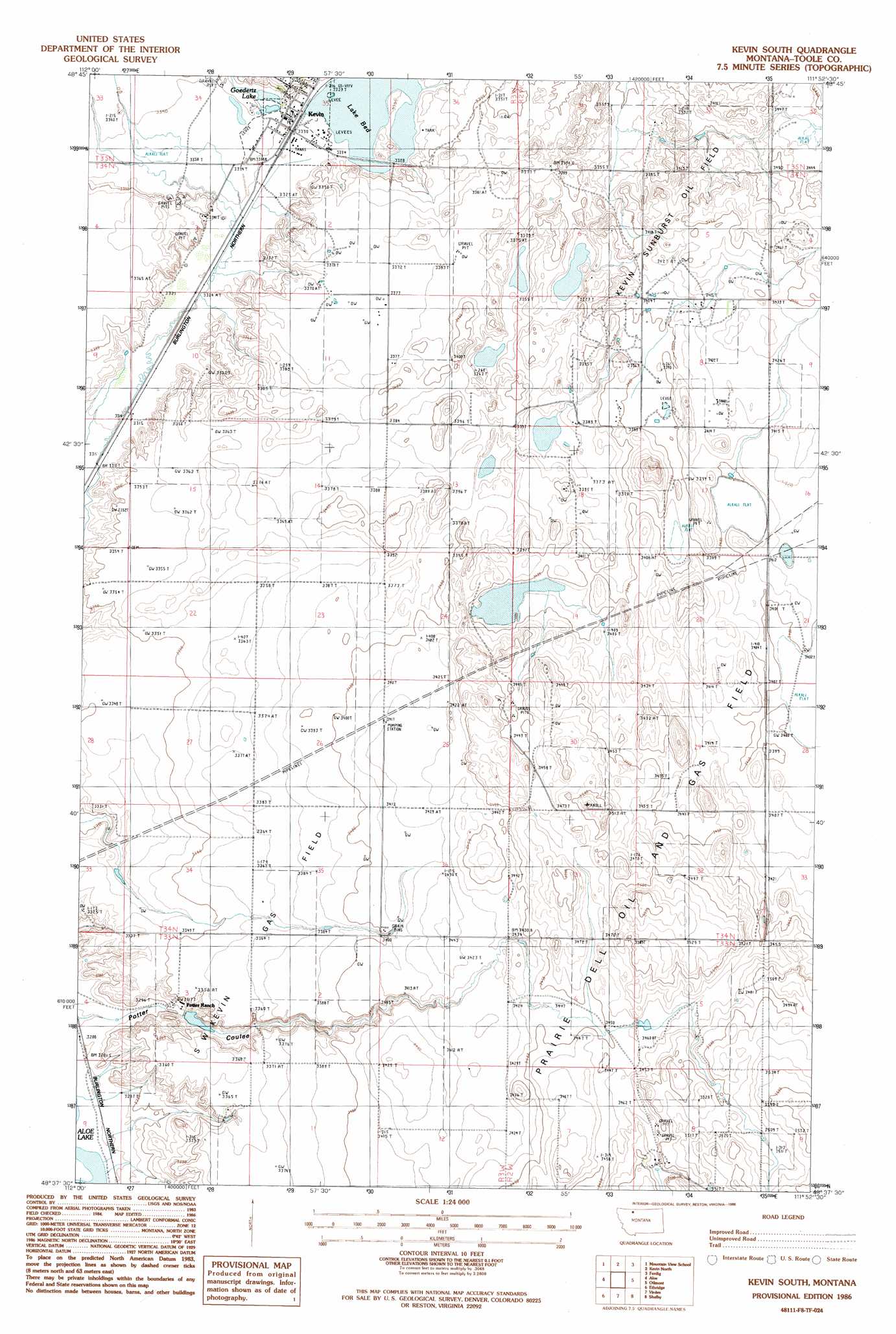
USGS Topo Quad 48111f8 - 1:24,000 scale
| Topo Map Name: | Kevin South |
| USGS Topo Quad ID: | 48111f8 |
| Print Size: | ca. 21 1/4" wide x 27" high |
| Southeast Coordinates: | 48.625° N latitude / 111.875° W longitude |
| Map Center Coordinates: | 48.6875° N latitude / 111.9375° W longitude |
| U.S. State: | MT |
| Filename: | o48111f8.jpg |
| Download Map JPG Image: | Kevin South topo map 1:24,000 scale |
| Map Type: | Topographic |
| Topo Series: | 7.5´ |
| Map Scale: | 1:24,000 |
| Source of Map Images: | United States Geological Survey (USGS) |
| Alternate Map Versions: |
Kevin South MT 1986, updated 1986 Download PDF Buy paper map Kevin South MT 2011 Download PDF Buy paper map Kevin South MT 2014 Download PDF Buy paper map |
1:24,000 Topo Quads surrounding Kevin South
Fitzpatrick Lake |
Hillside Colony |
Sunburst |
Willshaw Flats |
Beaupre Coulee |
Glacier Colony |
Mountain View School |
Kevin North |
Ferdig |
Fivemile Coulee West |
Ethridge Nw |
Aloe |
Kevin South |
Oilmont |
Antelope Coulee Nw |
Boru Spring |
Ethridge |
Virden |
Shelby |
Antelope Coulee Sw |
Abbott Lake |
Cactus Flat |
Ledger Nw |
Naismith |
Dunkirk |
> Back to 48111e1 at 1:100,000 scale
> Back to 48110a1 at 1:250,000 scale
> Back to U.S. Topo Maps home
Kevin South topo map: Gazetteer
Kevin South: Dams
Goeddertz Dam elevation 1015m 3330′Potter Dam elevation 1025m 3362′
Kevin South: Lakes
Goedertz Lake elevation 1018m 3339′Kevin South: Oilfields
Prairie Dell Oil and Gas Field elevation 1072m 3517′S W Kevin Gas Field elevation 1028m 3372′
Kevin South: Populated Places
Kevin elevation 1015m 3330′Kevin South: Post Offices
Kevin Post Office elevation 1015m 3330′Kevin South: Reservoirs
Goeddertz Reservoir elevation 1015m 3330′Kevin South: Valleys
Alkali Flat Coulee elevation 1015m 3330′Kevin South: Wells
35N03W35CD__01 Well elevation 1015m 3330′35N03W35CD__02 Well elevation 1015m 3330′
Kevin South digital topo map on disk
Buy this Kevin South topo map showing relief, roads, GPS coordinates and other geographical features, as a high-resolution digital map file on DVD: