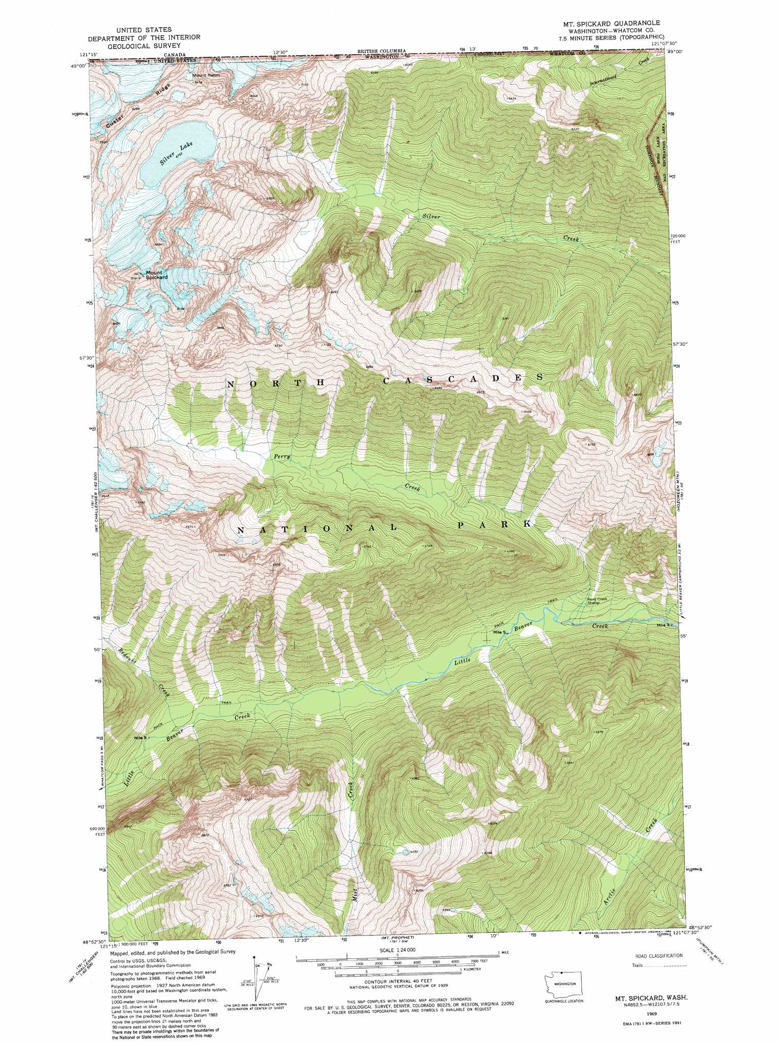
Mount Spickard Topo Map Washington
To zoom in, hover over the map of Mount Spickard
USGS Topo Quad 48121h2 - 1:24,000 scale
| Topo Map Name: | Mount Spickard |
| USGS Topo Quad ID: | 48121h2 |
| Print Size: | ca. 21 1/4" wide x 27" high |
| Southeast Coordinates: | 48.875° N latitude / 121.125° W longitude |
| Map Center Coordinates: | 48.9375° N latitude / 121.1875° W longitude |
| U.S. State: | WA |
| Filename: | o48121h2.jpg |
| Download Map JPG Image: | Mount Spickard topo map 1:24,000 scale |
| Map Type: | Topographic |
| Topo Series: | 7.5´ |
| Map Scale: | 1:24,000 |
| Source of Map Images: | United States Geological Survey (USGS) |
| Alternate Map Versions: |
Mt Spickard WA 1969, updated 1973 Download PDF Buy paper map Mt Spickard WA 1969, updated 1984 Download PDF Buy paper map Mt Spickard WA 1969, updated 1984 Download PDF Buy paper map Mount Spickard WA 2011 Download PDF Buy paper map Mount Spickard WA 2014 Download PDF Buy paper map |
1:24,000 Topo Quads surrounding Mount Spickard
Copper Mountain |
Mount Redoubt |
Mount Spickard |
Hozomeen Mountain |
Skagit Peak |
Mount Blum |
Mount Challenger |
Mount Prophet |
Pumpkin Mountain |
Jack Mountain |
Damnation Peak |
Mount Triumph |
Diablo Dam |
Ross Dam |
Crater Mountain |
> Back to 48121e1 at 1:100,000 scale
> Back to 48120a1 at 1:250,000 scale
> Back to U.S. Topo Maps home
Mount Spickard topo map: Gazetteer
Mount Spickard: Lakes
Silver Lake elevation 2063m 6768′Mount Spickard: Ridges
Custer Ridge elevation 2511m 8238′Mount Spickard: Streams
Mist Creek elevation 638m 2093′Perry Creek elevation 606m 1988′
Redoubt Creek elevation 671m 2201′
Mount Spickard: Summits
Mount Rahm elevation 2580m 8464′Mount Spickard elevation 2734m 8969′
Mount Spickard digital topo map on disk
Buy this Mount Spickard topo map showing relief, roads, GPS coordinates and other geographical features, as a high-resolution digital map file on DVD: