Mount Redoubt Topo Map Washington
To zoom in, hover over the map of Mount Redoubt
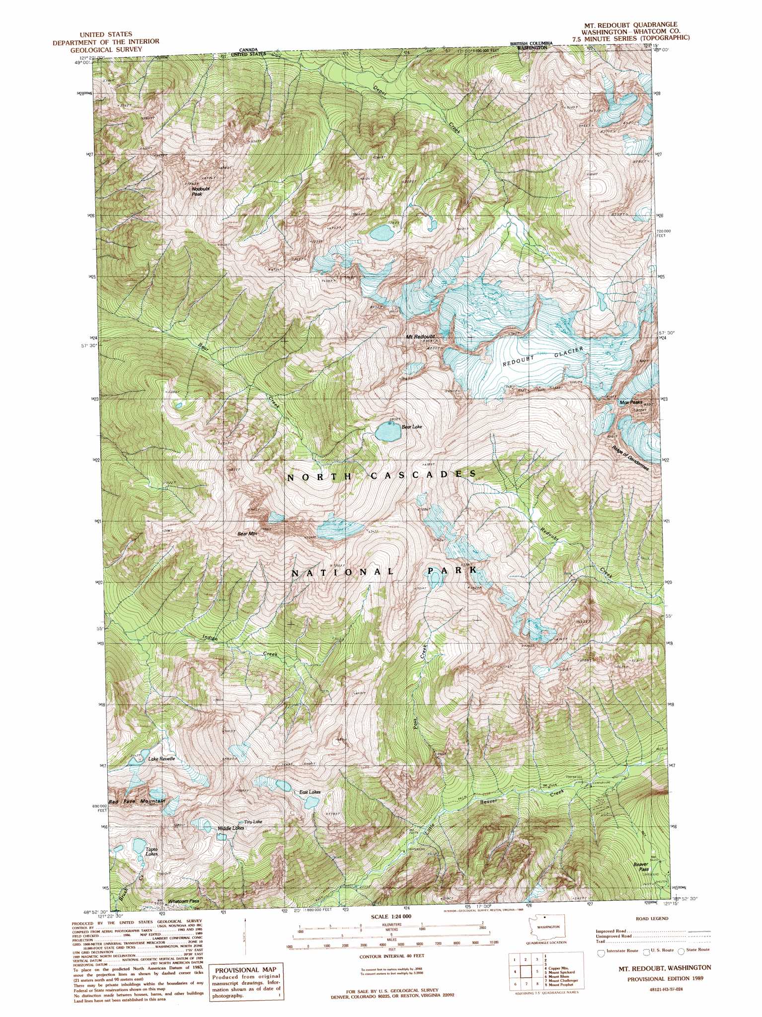
USGS Topo Quad 48121h3 - 1:24,000 scale
| Topo Map Name: | Mount Redoubt |
| USGS Topo Quad ID: | 48121h3 |
| Print Size: | ca. 21 1/4" wide x 27" high |
| Southeast Coordinates: | 48.875° N latitude / 121.25° W longitude |
| Map Center Coordinates: | 48.9375° N latitude / 121.3125° W longitude |
| U.S. State: | WA |
| Filename: | o48121h3.jpg |
| Download Map JPG Image: | Mount Redoubt topo map 1:24,000 scale |
| Map Type: | Topographic |
| Topo Series: | 7.5´ |
| Map Scale: | 1:24,000 |
| Source of Map Images: | United States Geological Survey (USGS) |
| Alternate Map Versions: |
Mt Redoubt WA 1989, updated 1989 Download PDF Buy paper map Mount Redoubt WA 2011 Download PDF Buy paper map Mount Redoubt WA 2014 Download PDF Buy paper map |
1:24,000 Topo Quads surrounding Mount Redoubt
Mount Sefrit |
Copper Mountain |
Mount Redoubt |
Mount Spickard |
Hozomeen Mountain |
Mount Shuksan |
Mount Blum |
Mount Challenger |
Mount Prophet |
Pumpkin Mountain |
Bacon Peak |
Damnation Peak |
Mount Triumph |
Diablo Dam |
Ross Dam |
> Back to 48121e1 at 1:100,000 scale
> Back to 48120a1 at 1:250,000 scale
> Back to U.S. Topo Maps home
Mount Redoubt topo map: Gazetteer
Mount Redoubt: Gaps
Beaver Pass elevation 1108m 3635′Whatcom Pass elevation 1589m 5213′
Mount Redoubt: Glaciers
Redoubt Glacier elevation 2218m 7276′Mount Redoubt: Lakes
Bear Lake elevation 1766m 5793′East Lakes elevation 1701m 5580′
Lake Reveille elevation 1525m 5003′
Middle Lakes elevation 1747m 5731′
Tapto Lakes elevation 1755m 5757′
Tiny Lake elevation 1860m 6102′
Mount Redoubt: Ridges
Ridge of Gendarmes elevation 2456m 8057′Mount Redoubt: Streams
Pass Creek elevation 800m 2624′Mount Redoubt: Summits
Bear Mountain elevation 2401m 7877′Mount Redoubt elevation 2689m 8822′
Mox Peaks elevation 2496m 8188′
Nodoubt Peak elevation 2171m 7122′
Red Face Mountain elevation 2149m 7050′
Mount Redoubt digital topo map on disk
Buy this Mount Redoubt topo map showing relief, roads, GPS coordinates and other geographical features, as a high-resolution digital map file on DVD: