Pensacola Topo Map Florida
To zoom in, hover over the map of Pensacola
USGS Topo Map 30087a1 - 1:100,000 scale
| Topo Map Name: | Pensacola |
| USGS Topo Quad ID: | 30087a1 |
| Print Size: | ca. 39" wide x 24" high |
| Southeast Coordinates: | 30° N latitude / 87° W longitude |
| Map Center Coordinates: | 30.25° N latitude / 87.5° W longitude |
| U.S. States: | FL, AL |
| Filename: | 30087a1.jpg |
| Download Map JPG Image: | Pensacola topo map 1:100,000 scale |
| Map Type: | Topographic |
| Topo Series: | 30´x60´ |
| Map Scale: | 1:100,000 |
| Source of Map Images: | United States Geological Survey (USGS) |
| Alternate Map Versions: |
Pensacola FL 1978, updated 1980 Download PDF Buy paper map Pensacola FL 1978, updated 1986 Download PDF Buy paper map Pensacola FL 1978, updated 1986 Download PDF Buy paper map |
1:100,000 Topos surrounding Pensacola
Mobile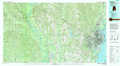 |
Bay Minette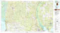 |
Crestview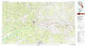 |
Biloxi |
Pensacola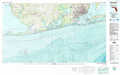 |
Fort Walton Beach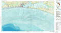 |
North Islands |
> Back to 30086a1 at 1:250,000 scale
> Back to U.S. Topo Maps home
1:24,000 Topo Quads covered by the spatial extent of this 100k map (Pensacola)
|
Point Clear 
|
Magnolia Springs 
|
Foley 
|
Elberta 
|
Lillian 
|
West Pensacola 
|
Pensacola 
|
Garcon Point 
|
|
Little Point Clear 
|
Bon Secour Bay 
|
Gulf Shores 
|
Orange Beach 
|
Perdido Bay 
|
Fort Barrancas 
|
Gulf Breeze 
|
Oriole Beach 
|
|
Saint Andrews Bay 
|
Pine Beach 
|
||||||
