Corkscrew Sw Topo Map Florida
To zoom in, hover over the map of Corkscrew Sw
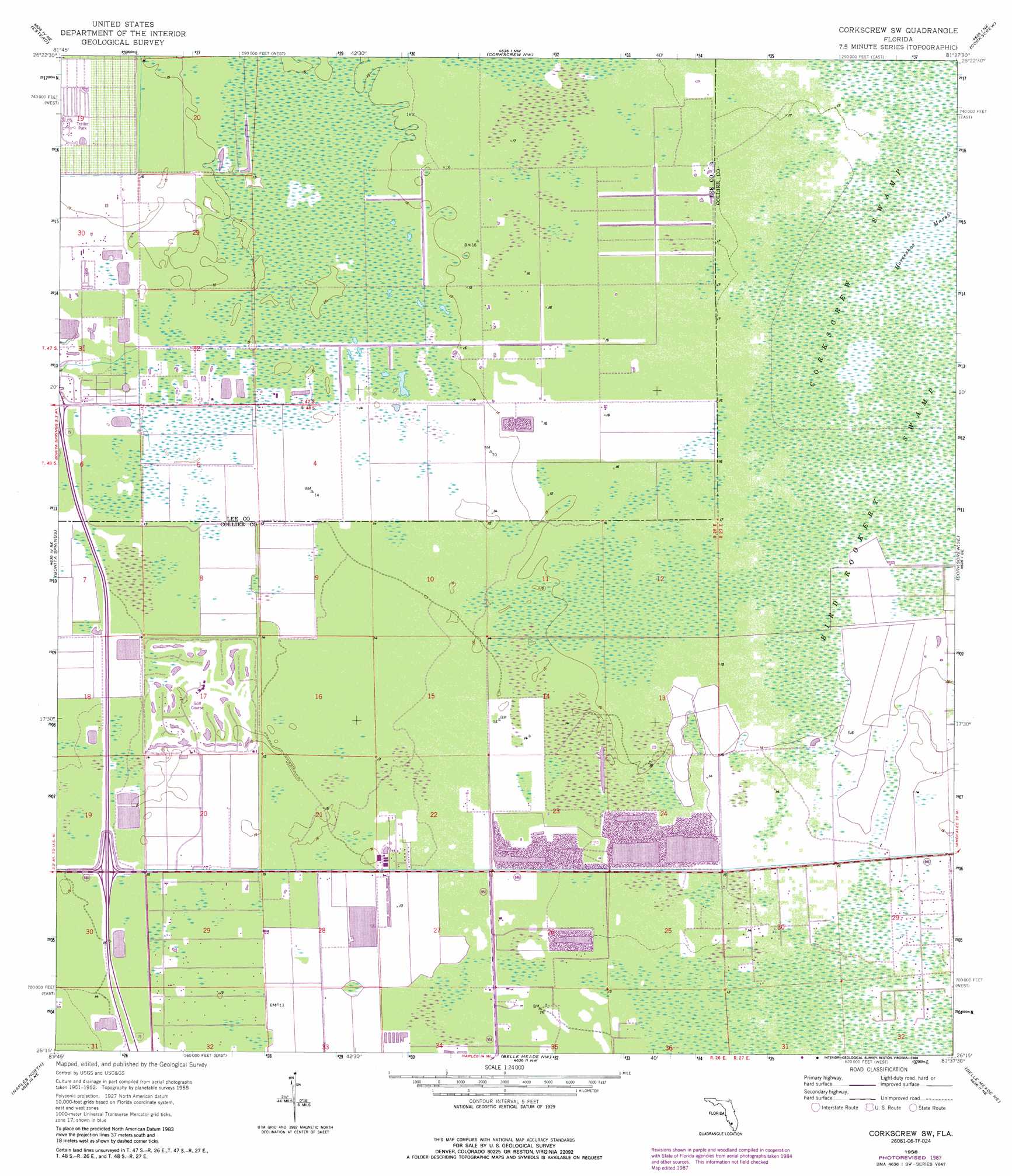
USGS Topo Quad 26081c6 - 1:24,000 scale
| Topo Map Name: | Corkscrew Sw |
| USGS Topo Quad ID: | 26081c6 |
| Print Size: | ca. 21 1/4" wide x 27" high |
| Southeast Coordinates: | 26.25° N latitude / 81.625° W longitude |
| Map Center Coordinates: | 26.3125° N latitude / 81.6875° W longitude |
| U.S. State: | FL |
| Filename: | O26081C6.jpg |
| Download Map JPG Image: | Corkscrew Sw topo map 1:24,000 scale |
| Map Type: | Topographic |
| Topo Series: | 7.5´ |
| Map Scale: | 1:24,000 |
| Source of Map Images: | United States Geological Survey (USGS) |
| Alternate Map Versions: |
Corkscrew SW FL 1958, updated 1959 Download PDF Buy paper map Corkscrew SW FL 1958, updated 1966 Download PDF Buy paper map Corkscrew SW FL 1958, updated 1974 Download PDF Buy paper map Corkscrew SW FL 1958, updated 1988 Download PDF Buy paper map Corkscrew SW FL 2012 Download PDF Buy paper map Corkscrew SW FL 2015 Download PDF Buy paper map |
1:24,000 Topo Quads surrounding Corkscrew Sw
Fort Myers Sw |
Fort Myers Se |
Alva Sw |
Alva Se |
Felda |
Fort Myers Beach |
Estero |
Corkscrew Nw |
Corkscrew |
Immokalee |
Bonita Springs |
Corkscrew Sw |
Corkscrew Se |
Immokalee Sw |
|
Naples North |
Belle Meade Nw |
Belle Meade Ne |
Catherine Island |
|
Naples South |
Belle Meade |
Belle Meade Se |
Deep Lake Sw |
> Back to 26081a1 at 1:100,000 scale
> Back to 26080a1 at 1:250,000 scale
> Back to U.S. Topo Maps home
Corkscrew Sw topo map: Gazetteer
Corkscrew Sw: Populated Places
Citrus Park Mobile Home Village elevation 4m 13′Glade Haven Mobile Home Park elevation 3m 9′
Corkscrew Sw: Swamps
Bird Rookery Swamp elevation 5m 16′Corkscrew Sw digital topo map on disk
Buy this Corkscrew Sw topo map showing relief, roads, GPS coordinates and other geographical features, as a high-resolution digital map file on DVD: