Beckwith Arm Topo Map Texas
To zoom in, hover over the map of Beckwith Arm
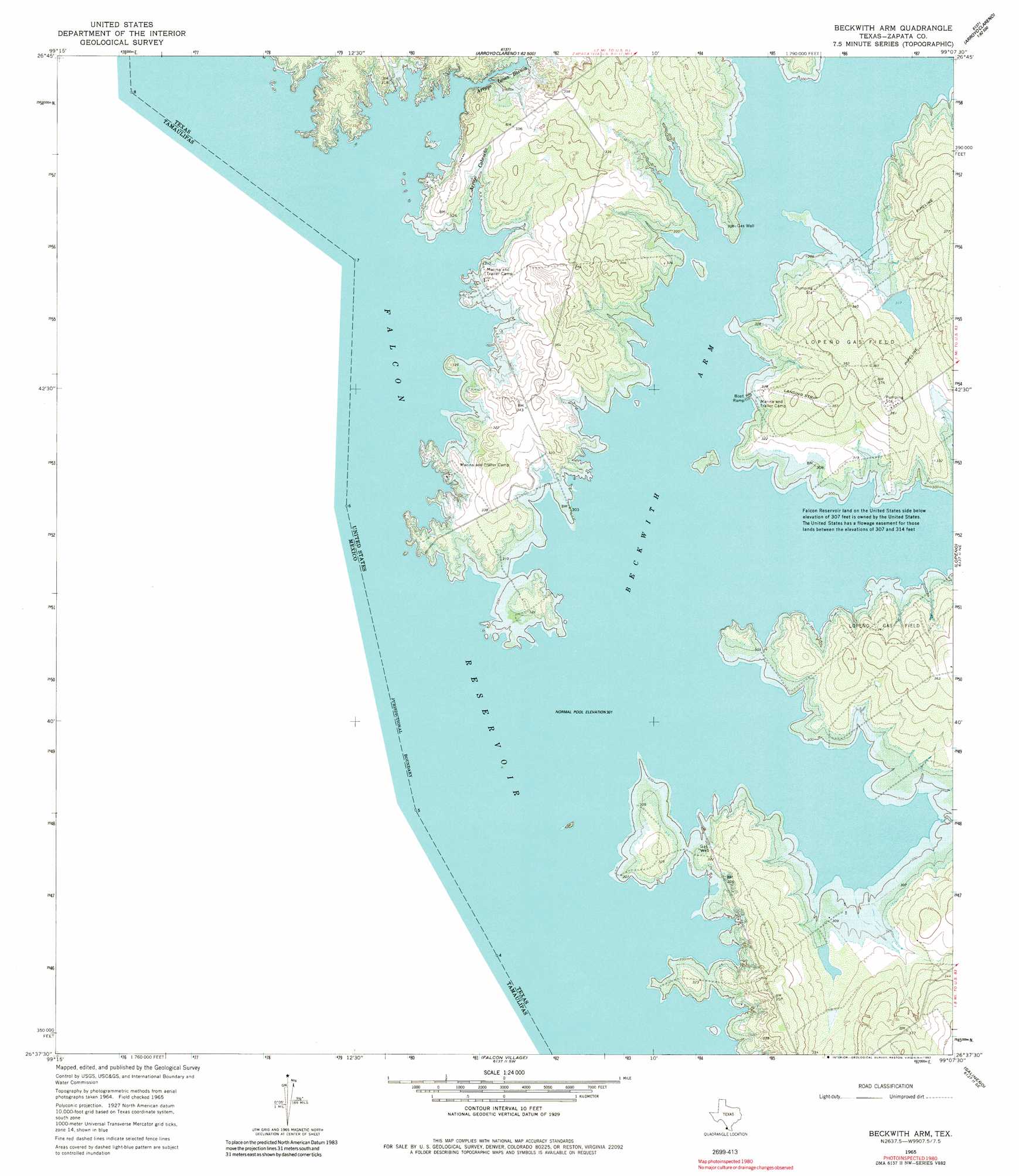
USGS Topo Quad 26099f2 - 1:24,000 scale
| Topo Map Name: | Beckwith Arm |
| USGS Topo Quad ID: | 26099f2 |
| Print Size: | ca. 21 1/4" wide x 27" high |
| Southeast Coordinates: | 26.625° N latitude / 99.125° W longitude |
| Map Center Coordinates: | 26.6875° N latitude / 99.1875° W longitude |
| U.S. State: | TX |
| Filename: | o26099f2.jpg |
| Download Map JPG Image: | Beckwith Arm topo map 1:24,000 scale |
| Map Type: | Topographic |
| Topo Series: | 7.5´ |
| Map Scale: | 1:24,000 |
| Source of Map Images: | United States Geological Survey (USGS) |
| Alternate Map Versions: |
Beckwith Arm TX 1965, updated 1968 Download PDF Buy paper map Beckwith Arm TX 1965, updated 1982 Download PDF Buy paper map Beckwith Arm TX 2010 Download PDF Buy paper map Beckwith Arm TX 2012 Download PDF Buy paper map Beckwith Arm TX 2016 Download PDF Buy paper map |
1:24,000 Topo Quads surrounding Beckwith Arm
Zapata Nw |
Zapata |
Arroyo Veleno |
Arroyo Huisache |
Guerra |
Zapata Se |
Arroyo Clareno |
Arroyo Miguel |
Cuevitas Sw |
|
Beckwith Arm |
Lopeno |
Las Escobas Ranch |
||
Falcon Village |
Salineno |
El Chapote Creek |
||
Roma-Los Saenz West |
Roma-Los Saenz East |
> Back to 26099e1 at 1:100,000 scale
> Back to 26098a1 at 1:250,000 scale
> Back to U.S. Topo Maps home
Beckwith Arm topo map: Gazetteer
Beckwith Arm: Bays
Beckwith Arm elevation 92m 301′Beckwith Arm: Dams
Juan Vela Lake Dam elevation 97m 318′Beckwith Arm: Reservoirs
Juan Vela Lake elevation 97m 318′Beckwith Arm: Streams
Arroyo Cabaseña elevation 92m 301′Arroyo Loma Blanca elevation 92m 301′
Arroyo Tinajas elevation 92m 301′
Beckwith Arm: Valleys
Bronco Canyon elevation 92m 301′Beckwith Arm digital topo map on disk
Buy this Beckwith Arm topo map showing relief, roads, GPS coordinates and other geographical features, as a high-resolution digital map file on DVD: