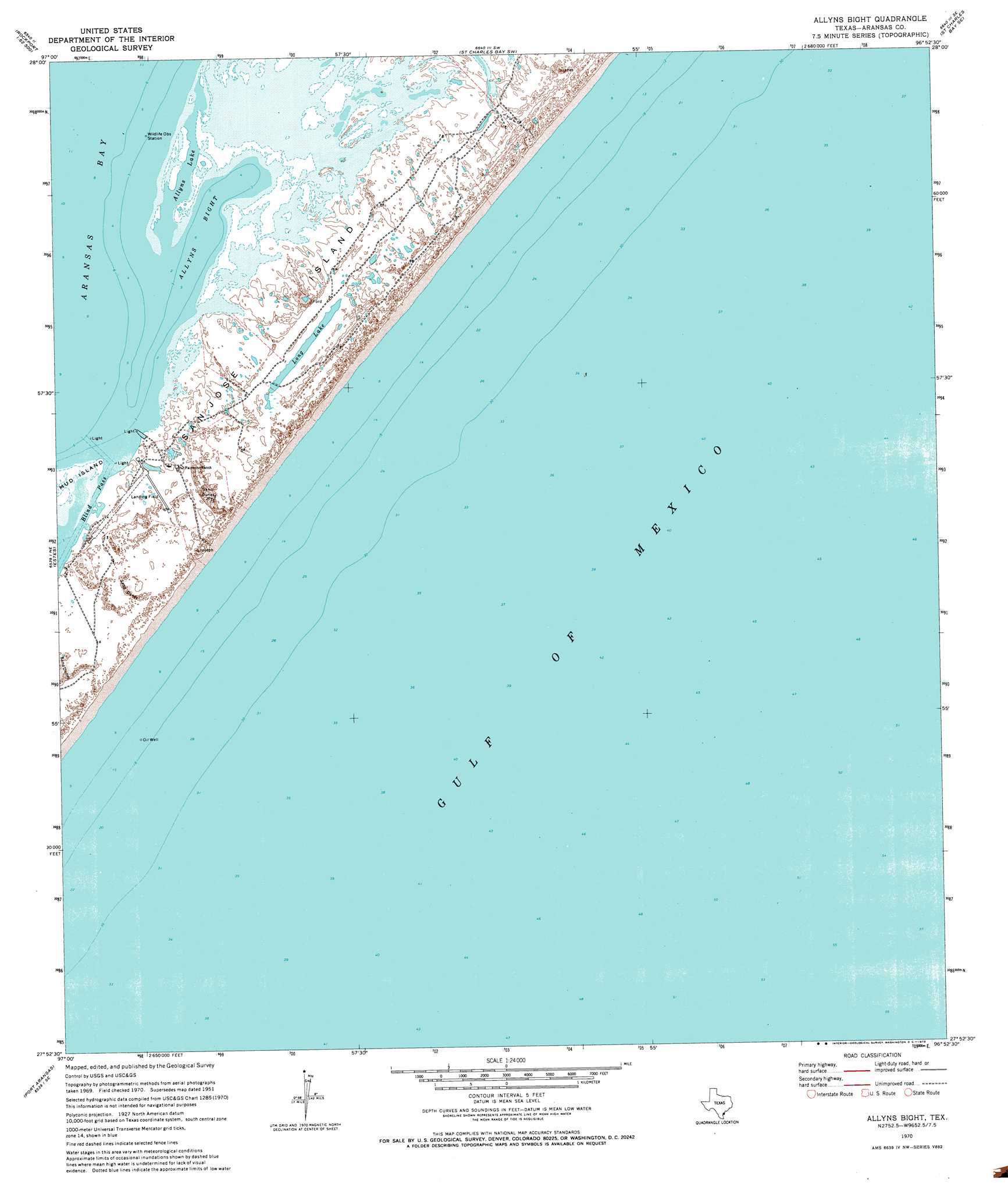
Allyns Bight Topo Map Texas
To zoom in, hover over the map of Allyns Bight
USGS Topo Quad 27096h8 - 1:24,000 scale
| Topo Map Name: | Allyns Bight |
| USGS Topo Quad ID: | 27096h8 |
| Print Size: | ca. 21 1/4" wide x 27" high |
| Southeast Coordinates: | 27.875° N latitude / 96.875° W longitude |
| Map Center Coordinates: | 27.9375° N latitude / 96.9375° W longitude |
| U.S. State: | TX |
| Filename: | o27096h8.jpg |
| Download Map JPG Image: | Allyns Bight topo map 1:24,000 scale |
| Map Type: | Topographic |
| Topo Series: | 7.5´ |
| Map Scale: | 1:24,000 |
| Source of Map Images: | United States Geological Survey (USGS) |
| Alternate Map Versions: |
Allyns Bight TX 1951, updated 1953 Download PDF Buy paper map Allyns Bight TX 1970, updated 1973 Download PDF Buy paper map Allyns Bight TX 2010 Download PDF Buy paper map Allyns Bight TX 2012 Download PDF Buy paper map Allyns Bight TX 2016 Download PDF Buy paper map |
1:24,000 Topo Quads surrounding Allyns Bight
Mission Bay |
Lamar |
Saint Charles Bay |
Mesquite Bay |
Panther Point |
Bayside |
Rockport |
Saint Charles Bay Sw |
Saint Charles Bay Se |
|
Aransas Pass |
Estes |
Allyns Bight |
||
Port Ingleside |
Port Aransas |
|||
Crane Islands Nw |
> Back to 27096e1 at 1:100,000 scale
> Back to 27096a1 at 1:250,000 scale
> Back to U.S. Topo Maps home
Allyns Bight topo map: Gazetteer
Allyns Bight: Airports
San Jose Island Airport elevation 3m 9′Allyns Bight: Bays
Allyns Bight elevation 0m 0′Allyns Lake elevation 0m 0′
Allyns Bight: Channels
Blind Pass elevation 0m 0′Allyns Bight: Lakes
Long Lake elevation 2m 6′Allyns Bight digital topo map on disk
Buy this Allyns Bight topo map showing relief, roads, GPS coordinates and other geographical features, as a high-resolution digital map file on DVD: