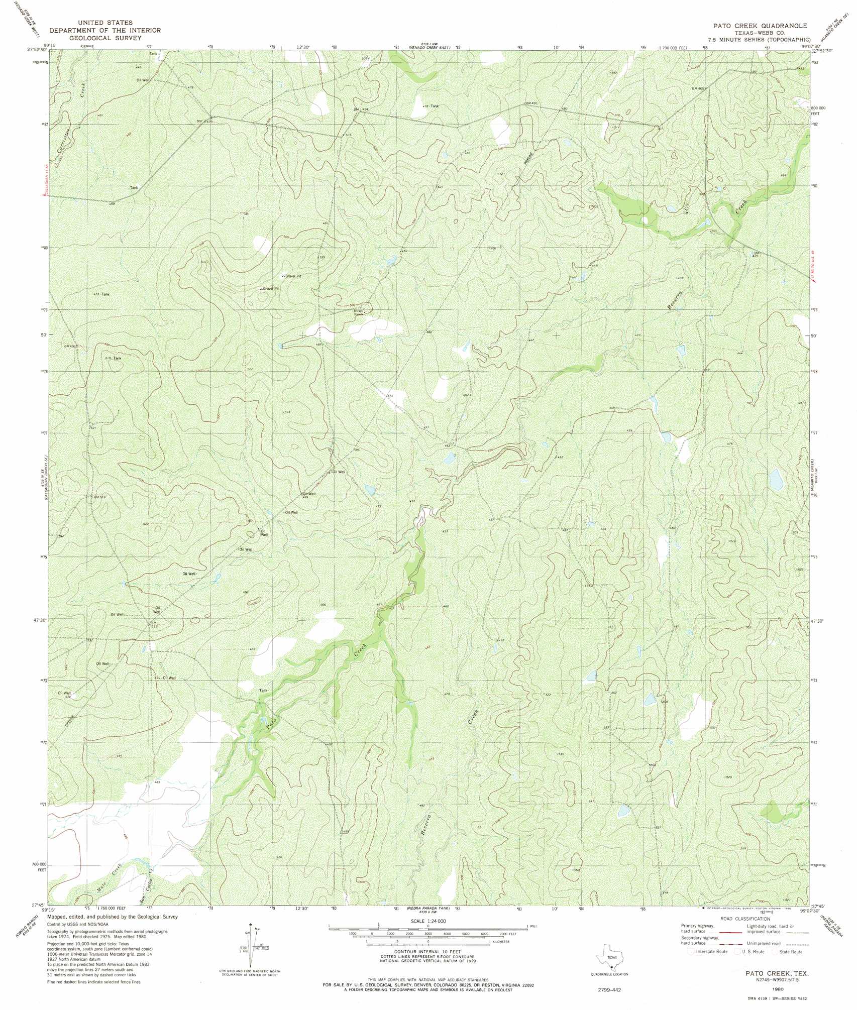
Pato Creek Topo Map Texas
To zoom in, hover over the map of Pato Creek
USGS Topo Quad 27099g2 - 1:24,000 scale
| Topo Map Name: | Pato Creek |
| USGS Topo Quad ID: | 27099g2 |
| Print Size: | ca. 21 1/4" wide x 27" high |
| Southeast Coordinates: | 27.75° N latitude / 99.125° W longitude |
| Map Center Coordinates: | 27.8125° N latitude / 99.1875° W longitude |
| U.S. State: | TX |
| Filename: | o27099g2.jpg |
| Download Map JPG Image: | Pato Creek topo map 1:24,000 scale |
| Map Type: | Topographic |
| Topo Series: | 7.5´ |
| Map Scale: | 1:24,000 |
| Source of Map Images: | United States Geological Survey (USGS) |
| Alternate Map Versions: |
Pato Creek TX 1980, updated 1980 Download PDF Buy paper map Pato Creek TX 2010 Download PDF Buy paper map Pato Creek TX 2013 Download PDF Buy paper map Pato Creek TX 2016 Download PDF Buy paper map |
1:24,000 Topo Quads surrounding Pato Creek
Mesteno Creek South |
Encinal |
Live Oak Creek |
Caiman Creek Se |
Piedra Creek Sw |
Callaghan Ranch North |
Venado Creek West |
Venado Creek East |
Alamito Creek Ne |
Biel Lake North |
Callaghan Ranch South |
Callaghan Ranch Se |
Pato Creek |
Alamito Creek |
Biel Lake South |
Orvil |
Cibolo Ranch |
Piedra Parada Tank |
Piedra Parada Ranch |
Mills Bennett Nw |
Laredo East |
Tios Creek |
Burrito Tank |
Shipp Ranch |
Mills Bennett Sw |
> Back to 27099e1 at 1:100,000 scale
> Back to 27098a1 at 1:250,000 scale
> Back to U.S. Topo Maps home
Pato Creek topo map: Gazetteer
Pato Creek: Streams
Mule Creek elevation 150m 492′Pato Creek elevation 137m 449′
San Carlos Creek elevation 150m 492′
Pato Creek digital topo map on disk
Buy this Pato Creek topo map showing relief, roads, GPS coordinates and other geographical features, as a high-resolution digital map file on DVD: