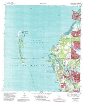
Tarpon Springs Topo Map Florida
To zoom in, hover over the map of Tarpon Springs
USGS Topo Quad 28082b7 - 1:24,000 scale
| Topo Map Name: | Tarpon Springs |
| USGS Topo Quad ID: | 28082b7 |
| Print Size: | ca. 21 1/4" wide x 27" high |
| Southeast Coordinates: | 28.125° N latitude / 82.75° W longitude |
| Map Center Coordinates: | 28.1875° N latitude / 82.8125° W longitude |
| U.S. State: | FL |
| Filename: | O28082B7.jpg |
| Download Map JPG Image: | Tarpon Springs topo map 1:24,000 scale |
| Map Type: | Topographic |
| Topo Series: | 7.5´ |
| Map Scale: | 1:24,000 |
| Source of Map Images: | United States Geological Survey (USGS) |
| Alternate Map Versions: |
Tarpon Springs FL 1943, updated 1961 Download PDF Buy paper map Tarpon Springs FL 1943, updated 1961 Download PDF Buy paper map Tarpon Springs FL 1973, updated 1975 Download PDF Buy paper map Tarpon Springs FL 1973, updated 1980 Download PDF Buy paper map Tarpon Springs FL 1973, updated 1988 Download PDF Buy paper map Tarpon Springs FL 1973, updated 1988 Download PDF Buy paper map Tarpon Springs FL 1995, updated 1998 Download PDF Buy paper map Tarpon Springs FL 2012 Download PDF Buy paper map Tarpon Springs FL 2015 Download PDF Buy paper map |
1:24,000 Topo Quads surrounding Tarpon Springs
Aripeka |
Port Richey Ne |
|||
Port Richey |
Fivay Junction |
|||
Tarpon Springs |
Elfers |
Odessa |
||
Dunedin |
Oldsmar |
Citrus Park |
||
Clearwater |
Safety Harbor |
Gandy Bridge |
> Back to 28082a1 at 1:100,000 scale
> Back to 28082a1 at 1:250,000 scale
> Back to U.S. Topo Maps home
Tarpon Springs topo map: Gazetteer
Tarpon Springs: Bays
Anclote Anchorage elevation 0m 0′Holiday Cove elevation 0m 0′
Marshy Bayou elevation 0m 0′
Meyers Cove elevation 0m 0′
Sand Bay elevation 0m 0′
Spring Bayou elevation 0m 0′
Sting Ray Cove elevation 0m 0′
Whitcomb Bayou elevation 0m 0′
Tarpon Springs: Beaches
Sunset Beach elevation 1m 3′Tarpon Springs: Bridges
Anclote Bridge elevation 2m 6′Tarpon Springs: Capes
Baileys Bluff elevation 1m 3′Ben Pilot Point elevation 0m 0′
Big Bayou Point elevation 0m 0′
Chesapeake Point elevation 1m 3′
Hickory Point elevation 1m 3′
North River Point elevation 0m 0′
Piney Point elevation 0m 0′
Round Point elevation 0m 0′
Sand Point elevation 1m 3′
Sponge Harbor Point elevation 1m 3′
The Cabbage elevation 3m 9′
Tarpon Springs: Guts
Ben Pilot Creek elevation 0m 0′Fillmans Creek elevation 0m 0′
Kreamer Bayou elevation 0m 0′
Lake Avoca elevation 0m 0′
Minetta Branch elevation 0m 0′
Rocky Creek elevation 0m 0′
Sawyers Basin elevation 0m 0′
Sheads Creek elevation 0m 0′
Spring Branch elevation 0m 0′
Sunset Lagoon elevation 0m 0′
Tarpon Bayou elevation 0m 0′
The Canal elevation 0m 0′
Trouble Creek elevation 0m 0′
Whitecomb Bayou elevation 0m 0′
Tarpon Springs: Harbors
Port Tarpon elevation 0m 0′Tarpon Springs: Islands
Anclote Keys elevation 0m 0′Bird Key elevation 0m 0′
Brady Island elevation 0m 0′
Coquina Key elevation 2m 6′
Dutchman Key elevation 1m 3′
Firnell Island elevation 2m 6′
North Anclote Key elevation 0m 0′
North Keys elevation 0m 0′
Rabbit Key elevation 0m 0′
Sunset Key elevation 2m 6′
Tarpon Springs: Lakes
Hidden Lake elevation 1m 3′Lake Avaco elevation 0m 0′
Lake Conley elevation 0m 0′
Tarpon Springs: Parks
Anclote Key Preserve State Park elevation 1m 3′Anclote National Wildlife Refuge elevation 0m 0′
Coburn Park elevation 2m 6′
Cocoris Park elevation 1m 3′
Craig Park elevation 2m 6′
Howard Park elevation 1m 3′
North Anclote Nature Park elevation 1m 3′
Riverside Park elevation 2m 6′
Rotary Field elevation 2m 6′
Sisler Field elevation 2m 6′
Sunset Beach elevation 2m 6′
Trentwood Playground elevation 6m 19′
Tarpon Springs: Populated Places
Anclote elevation 3m 9′Beacon Square elevation 2m 6′
Gulf Harbors elevation 2m 6′
Tarpon Springs elevation 7m 22′
Victor elevation 3m 9′
Tarpon Springs: Streams
Anclote River elevation 0m 0′Snead Creek elevation 0m 0′
Tarpon Springs: Summits
Sunset Hills elevation 5m 16′The Union elevation 1m 3′
Tarpon Springs: Swamps
The Sawgrasses elevation 0m 0′Tarpon Springs digital topo map on disk
Buy this Tarpon Springs topo map showing relief, roads, GPS coordinates and other geographical features, as a high-resolution digital map file on DVD:


