Grand Bayou Topo Map Louisiana
To zoom in, hover over the map of Grand Bayou
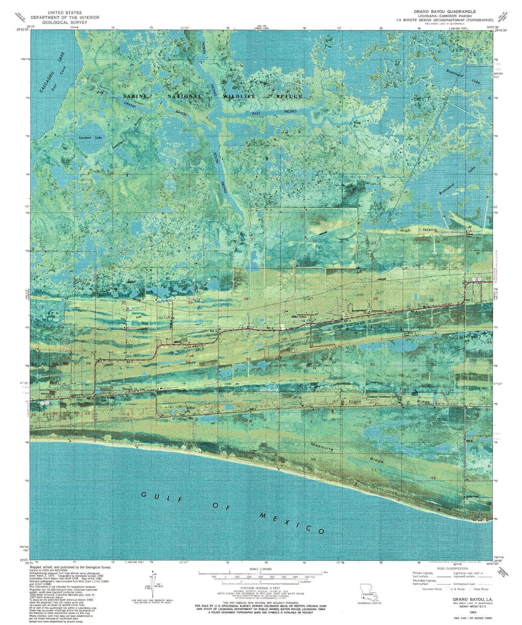
USGS Topo Quad 29093g2 - 1:24,000 scale
| Topo Map Name: | Grand Bayou |
| USGS Topo Quad ID: | 29093g2 |
| Print Size: | ca. 21 1/4" wide x 27" high |
| Southeast Coordinates: | 29.75° N latitude / 93.125° W longitude |
| Map Center Coordinates: | 29.8125° N latitude / 93.1875° W longitude |
| U.S. State: | LA |
| Filename: | p29093g2.jpg |
| Download Map JPG Image: | Grand Bayou topo map 1:24,000 scale |
| Map Type: | Orthophoto |
| Topo Series: | 7.5´ |
| Map Scale: | 1:24,000 |
| Source of Map Images: | United States Geological Survey (USGS) |
| Alternate Map Versions: |
Grand Bayou LA 1934, updated 1961 Download PDF Buy paper map Grand Bayou LA 1975, updated 1976 Download PDF Buy paper map Grand Bayou LA 1982, updated 1982 Download PDF Buy paper map Grand Bayou LA 1998, updated 2003 Download PDF Buy paper map Grand Bayou LA 2012 Download PDF Buy paper map Grand Bayou LA 2015 Download PDF Buy paper map |
1:24,000 Topo Quads surrounding Grand Bayou
Black Lake |
Moss Lake |
Lake Charles Sw |
Lake Charles Se |
Hayes |
Browns Lake |
Hackberry |
Sweet Lake |
Boudreaux Lake |
Lake Misere |
Holly Beach |
Cameron |
Grand Bayou |
Creole |
Grand Cheniere |
Hackberry Beach |
Hog Bayou |
|||
> Back to 29093e1 at 1:100,000 scale
> Back to 29092a1 at 1:250,000 scale
> Back to U.S. Topo Maps home
Grand Bayou topo map: Gazetteer
Grand Bayou: Airports
Evergreen Heliport elevation 1m 3′Grand Bayou: Bays
East Cove elevation 0m 0′Grand Bayou: Canals
Creole Canal elevation 0m 0′Grand Bayou: Lakes
Broussard Lake elevation 0m 0′Lambert Lake elevation 0m 0′
Grand Bayou: Oilfields
North Creole Gas Field elevation 0m 0′West Creole Gas Field elevation 0m 0′
Grand Bayou: Ridges
Front Ridge elevation 1m 3′Mesquite Ridge elevation 0m 0′
Grand Bayou: Streams
East Prong of Grand Bayou elevation 0m 0′Grand Bayou elevation 0m 0′
Lambert Bayou elevation 0m 0′
North Prong of Grand Bayou elevation 0m 0′
South Prong of Grand Bayou elevation 0m 0′
Grand Bayou digital topo map on disk
Buy this Grand Bayou topo map showing relief, roads, GPS coordinates and other geographical features, as a high-resolution digital map file on DVD: