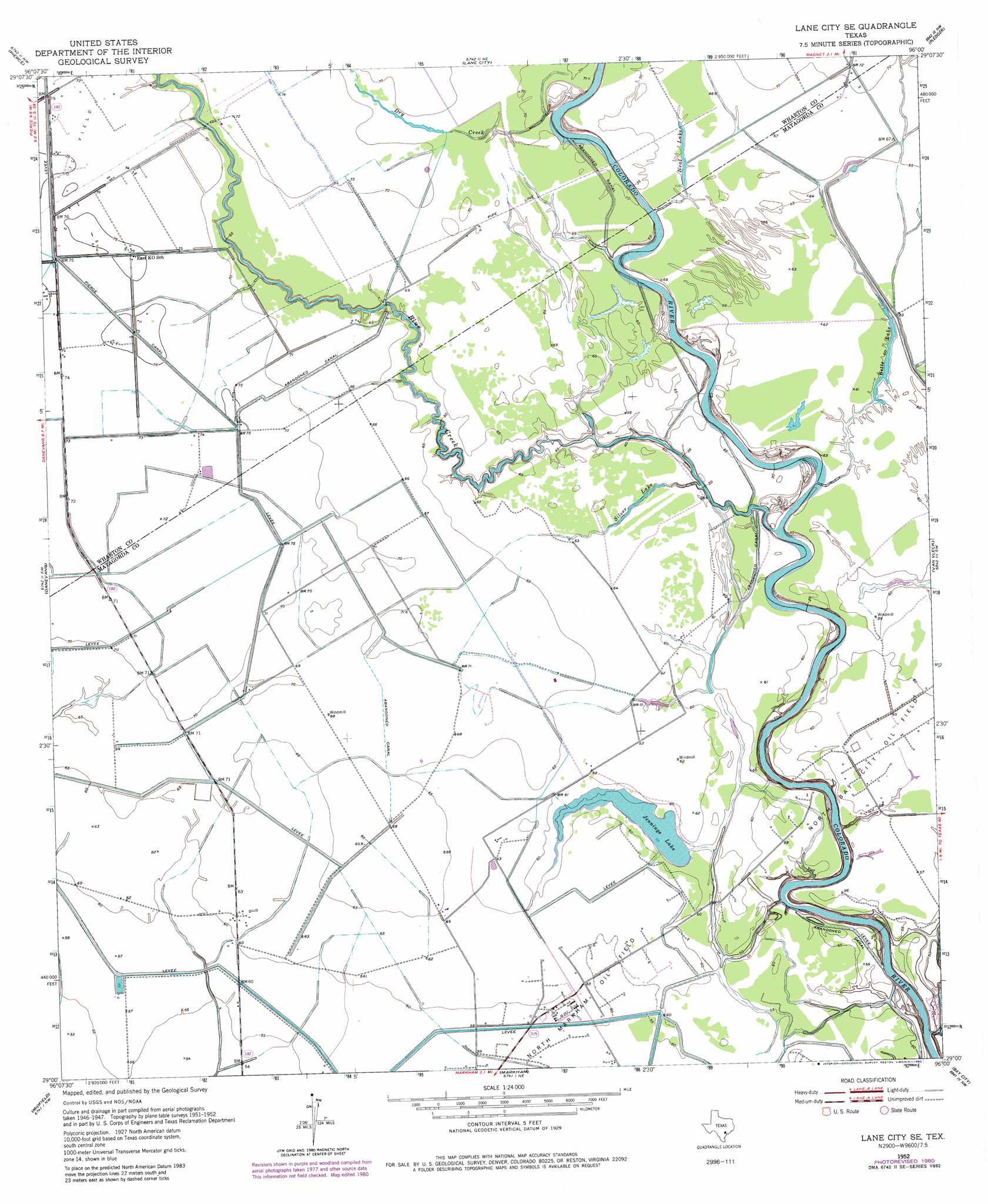
Lane City Se Topo Map Texas
To zoom in, hover over the map of Lane City Se
USGS Topo Quad 29096a1 - 1:24,000 scale
| Topo Map Name: | Lane City Se |
| USGS Topo Quad ID: | 29096a1 |
| Print Size: | ca. 21 1/4" wide x 27" high |
| Southeast Coordinates: | 29° N latitude / 96° W longitude |
| Map Center Coordinates: | 29.0625° N latitude / 96.0625° W longitude |
| U.S. State: | TX |
| Filename: | o29096a1.jpg |
| Download Map JPG Image: | Lane City Se topo map 1:24,000 scale |
| Map Type: | Topographic |
| Topo Series: | 7.5´ |
| Map Scale: | 1:24,000 |
| Source of Map Images: | United States Geological Survey (USGS) |
| Alternate Map Versions: |
Lane City SE TX 1952, updated 1953 Download PDF Buy paper map Lane City SE TX 1952, updated 1973 Download PDF Buy paper map Lane City SE TX 1952, updated 1980 Download PDF Buy paper map Lane City SE TX 2010 Download PDF Buy paper map Lane City SE TX 2013 Download PDF Buy paper map Lane City SE TX 2016 Download PDF Buy paper map |
1:24,000 Topo Quads surrounding Lane City Se
New Taiton |
Glen Flora |
Wharton |
Boling |
Guy |
El Campo |
Pierce |
Lane City |
Pledger |
Danciger |
El Campo Se |
Danevang |
Lane City Se |
Van Vleck |
Ashwood |
Francitas Ne |
Midfield |
Markham |
Bay City |
Bay City Ne |
Francitas |
Blessing |
Blessing Se |
Wadsworth |
Lake Austin |
> Back to 29096a1 at 1:100,000 scale
> Back to 29096a1 at 1:250,000 scale
> Back to U.S. Topo Maps home
Lane City Se topo map: Gazetteer
Lane City Se: Airports
Station 24 Heliport elevation 17m 55′Lane City Se: Lakes
Betts Lake elevation 18m 59′Jennings Lake elevation 16m 52′
Neal Lake elevation 20m 65′
Silver Lake elevation 18m 59′
Lane City Se: Oilfields
North Bay City Oil Field elevation 18m 59′North Markham Oil Field elevation 17m 55′
Lane City Se: Streams
Blue Creek elevation 13m 42′Dry Creek elevation 14m 45′
Lane City Se digital topo map on disk
Buy this Lane City Se topo map showing relief, roads, GPS coordinates and other geographical features, as a high-resolution digital map file on DVD: