New Taiton Topo Map Texas
To zoom in, hover over the map of New Taiton
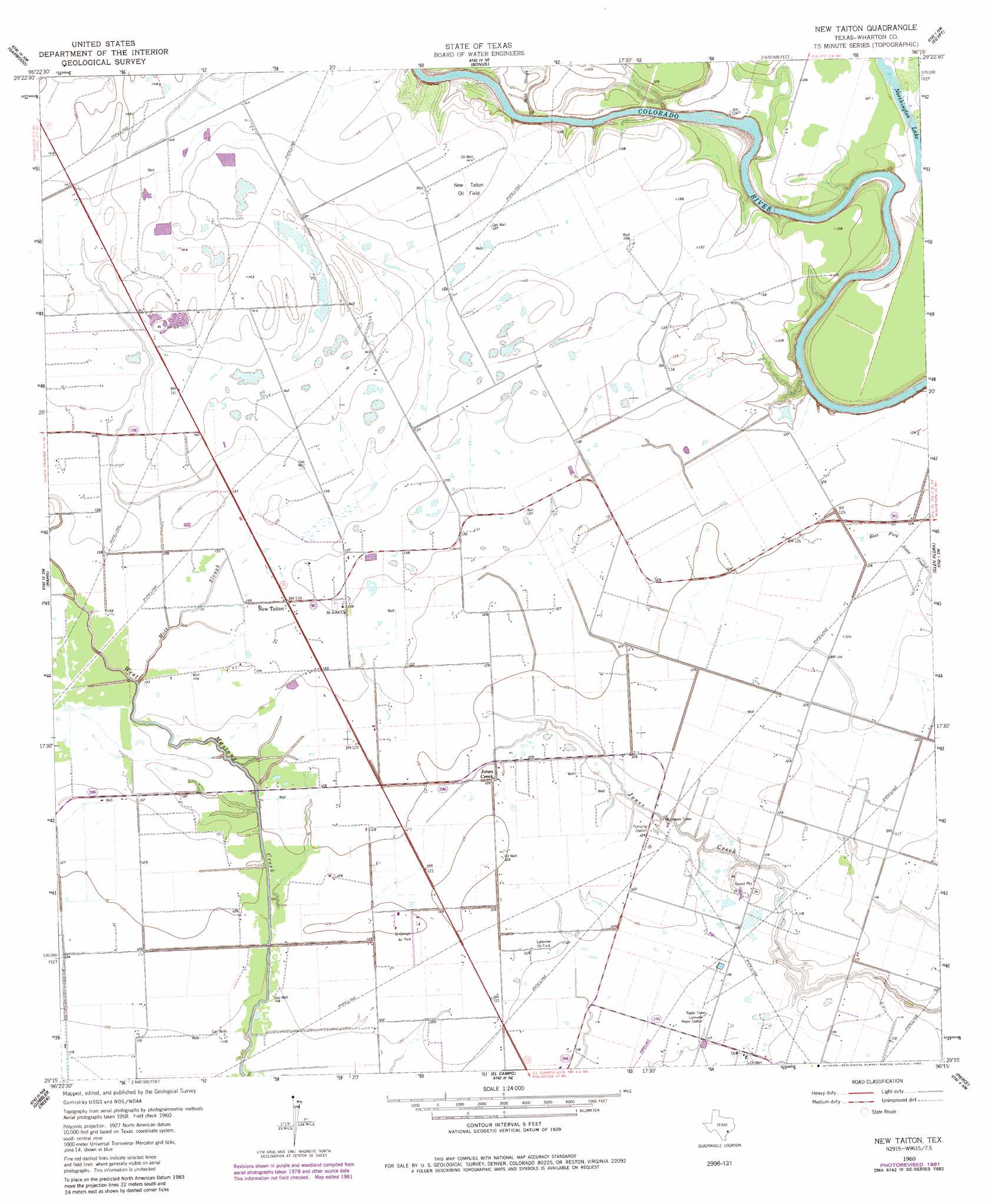
USGS Topo Quad 29096c3 - 1:24,000 scale
| Topo Map Name: | New Taiton |
| USGS Topo Quad ID: | 29096c3 |
| Print Size: | ca. 21 1/4" wide x 27" high |
| Southeast Coordinates: | 29.25° N latitude / 96.25° W longitude |
| Map Center Coordinates: | 29.3125° N latitude / 96.3125° W longitude |
| U.S. State: | TX |
| Filename: | o29096c3.jpg |
| Download Map JPG Image: | New Taiton topo map 1:24,000 scale |
| Map Type: | Topographic |
| Topo Series: | 7.5´ |
| Map Scale: | 1:24,000 |
| Source of Map Images: | United States Geological Survey (USGS) |
| Alternate Map Versions: |
New Taiton TX 1960, updated 1961 Download PDF Buy paper map New Taiton TX 1960, updated 1983 Download PDF Buy paper map New Taiton TX 2010 Download PDF Buy paper map New Taiton TX 2013 Download PDF Buy paper map New Taiton TX 2016 Download PDF Buy paper map |
1:24,000 Topo Quads surrounding New Taiton
Rock Island |
Altair |
Eagle Lake |
Lissie |
East Bernard |
Sheridan Ne |
Garwood |
Bonus |
Egypt |
Hungerford |
Sheridan Se |
Hahn |
New Taiton |
Glen Flora |
Wharton |
Ganado Ne |
Gobbler Creek |
El Campo |
Pierce |
Lane City |
Ganado |
Louise |
El Campo Se |
Danevang |
Lane City Se |
> Back to 29096a1 at 1:100,000 scale
> Back to 29096a1 at 1:250,000 scale
> Back to U.S. Topo Maps home
New Taiton topo map: Gazetteer
New Taiton: Airports
El Campo Airpark elevation 38m 124′Station 30 Heliport elevation 37m 121′
New Taiton: Lakes
Northington Lake elevation 37m 121′New Taiton: Oilfields
Lakeview Oil Field elevation 37m 121′New Taiton Oil Field elevation 43m 141′
New Taiton: Populated Places
Jones Creek elevation 38m 124′New Taiton elevation 41m 134′
New Taiton: Streams
Mott Slough elevation 39m 127′Robb Slough elevation 30m 98′
New Taiton digital topo map on disk
Buy this New Taiton topo map showing relief, roads, GPS coordinates and other geographical features, as a high-resolution digital map file on DVD: